the wandering chick
...Yosemite Natl Park
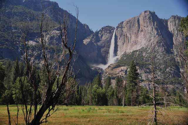
The year of the gushing falls. Oh, yeah.
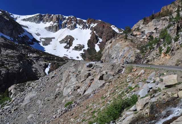
Because I was in the Eastern Sierra Nevadas when I visited Yosemite, I entered the grand park from the east side, via the Tioga Road. That may be considered the opposite side of the park from "all the action," but there is such incredible beauty along the Tioga Pass I would not have wanted to miss it.
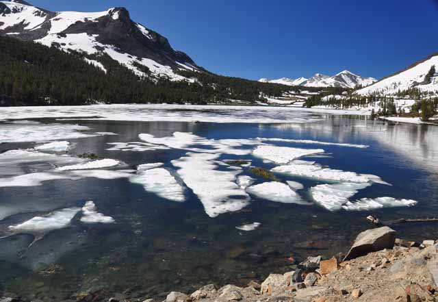
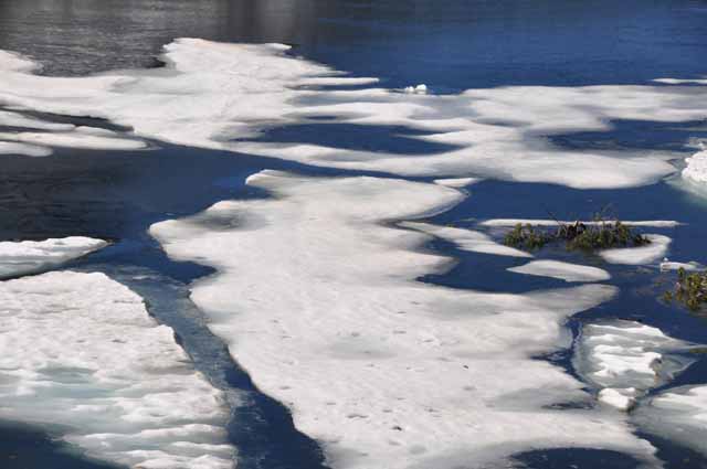
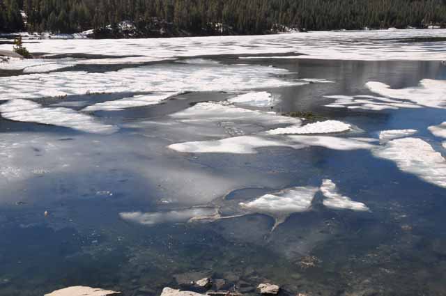
Because of the heavier-than-usual snowfall this year, there was still snow everywhere, even in Tioga Lake, where the ice had not yet melted...in July.
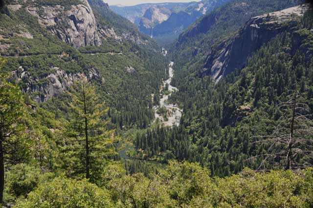
I visited the park on the 4th of July weekend....big mistake. It was so crowded, traffic was ridiculous with everyone wanting to see the waterfalls that were just simply out of control. HOWEVER, it was a beautiful visit, and I will go back hopefully in the fall when there are less people and cars. So...visit again later for a continuation of pictures.
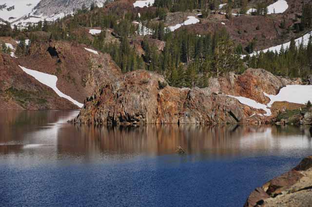
On the east side of the park, along Tioga Road
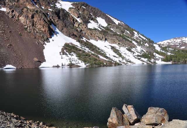
Ellery Lake on Tioga Road
Tioga Lake in July. Tioga Lake is very near the Tioga Pass (east side) entrance to the park.
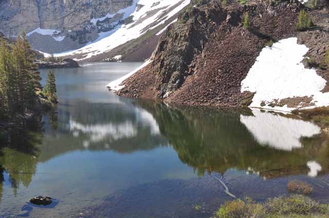
A view from Tioga Road
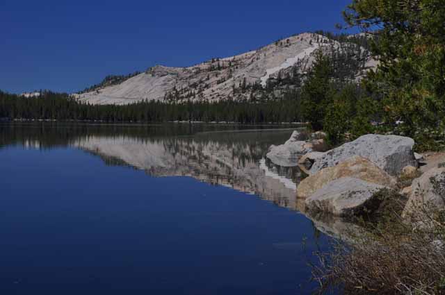
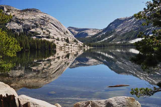
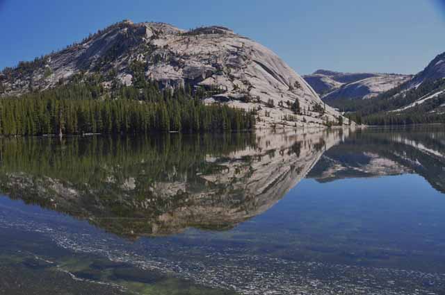
Tenaya Lake
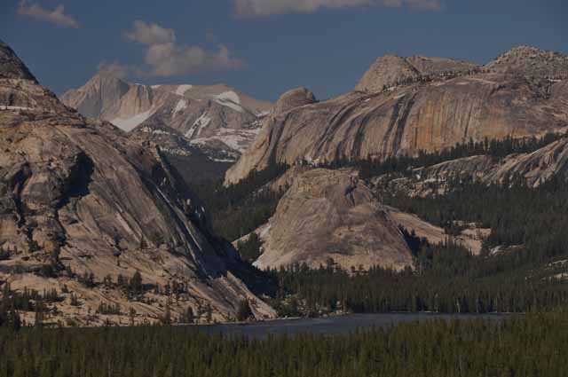
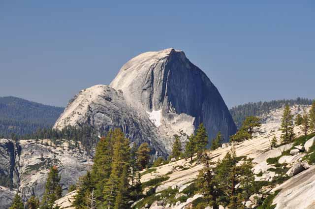
The view of Half Dome Rock from Olmsted Point
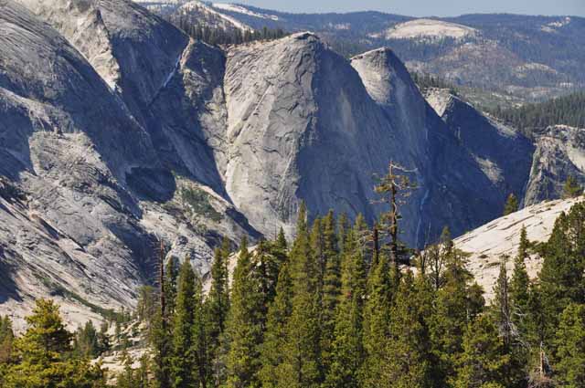
The rocks just to the left of Half Dome from Olmsted Point on Tioga Road
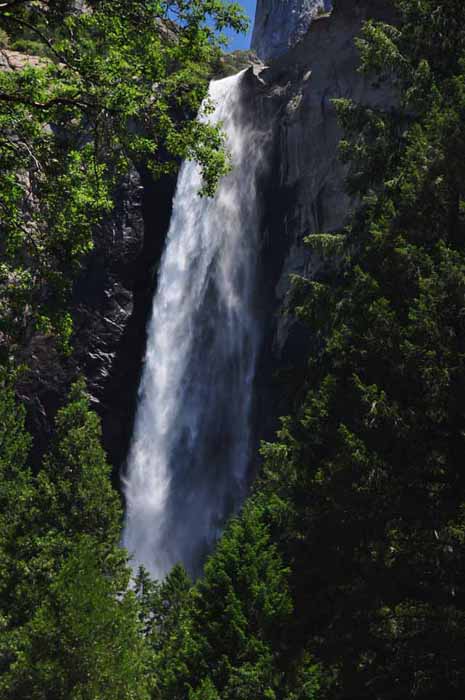
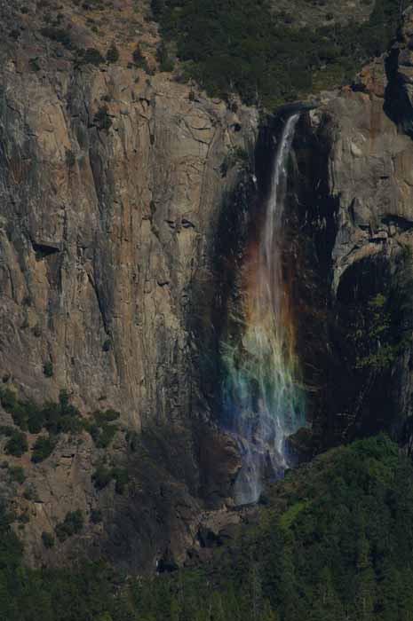
Another view of Bridalveil Fall
Bridalveil Fall was stunning this year due to the increased amount of snow melt. Visitors who ventured the complete trail to the fall came back soaked from the spray.
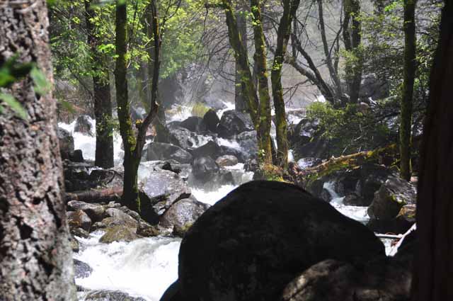
The water from Bridalveil Fall pounded over rock and trees to make its way to the creek.
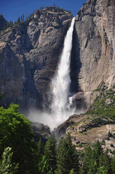
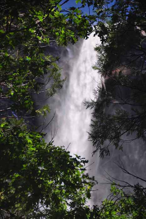
I got this shot and the one below right of Upper Yosemite Fall while stuck in traffic. A nice place to be stuck.
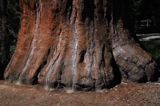
I have returned to Yosemite in early September. The picture above and the following pictures were taken then. Above is a giant sequoia tree trunk in the Mariposa Grove of Giant Sequoias near the south entrance to Yosemite.
Please visit some of my other travel locations. Feel free to email me if you have questions or comments.
BY CITY:Boston | Carson City | Coeur d'Alene, ID | Colorado Springs | Duluth, MN | Durango, CO | Fort Benton, MT | Galveston, TX | Independence, MO | Juliette, GA | Leadville, CO | Morro Bay, CA | New York City | Sacramento | San Diego | Savannah | Seattle | Sedona, AZ | St. Louis | Stillwater, MN | Tombstone| Tucson | Washington, D.C.
BY STATE:Alaska| Arizona | California | Colorado | Georgia | Idaho | Maine | Michigan | Minnesota | Montana | Nevada | New Mexico | North Carolina | Oregon | South Dakota| Texas | Utah | Washington | Wisconsin | Wyoming
BY REGIONS, LANDMARKS AND NATL PARKS, FORESTS AND MONUMENTS: the Ancient Bristlecone Pine Forest | Antelope Island on the Great Salt Lake | Arches NP | the Badlands | Big Sur | Bighorn Canyon | the Biltmore Estate | the Black Hills | Blue Ridge Parkway | Bodega Bay | Bridges of Madison County | Bryce Canyon | Canyon de Chelly | Canyonlands NP | Death Valley | Devils Tower| Garden of the Gods | Glacier NP | the Grand Canyon | the Grand Tetons | the Great Sand Dunes NP | Gulf Shores, AL | the Hearst Castle | Highway 287 | Hoover Dam | Hovenweep NM | In search of Barns and Bridges | Kure Beach | Lake Powell | Lake Tahoe | Little Bighorn Battlefield | Mackinac Island | Martha's Vineyard |
Medicine Bow NF | Mesa Verde NP | Monterey Bay | Monument Valley | Mount Rainier | Mount Rushmore | Mount St. Helens | Napa Valley | Natural Bridges NM | Niagara Falls | OK City (bombing) NM | the Olympic Peninsula | Organ Pipe Cactus NM | the Outer Banks | the Petrified Forest and Painted Desert | Pictured Rocks NL | Point Reyes Natl Seashore | Rocky Mtn NP | the Royal Gorge | Saguaro NP | Shenandoah Valley |
Sleeping Bear Dunes NL | the Sonoma Coast | Sunset Crater NM | Texas Hill Country | Tonto NM | Tonto Natural Bridge | Tybee Island | Valley of Fire | the Vermillion Cliffs | White Mountains NF | Yellowstone NP | Yosemite NP | Zion NP
OUTSIDE THE U.S.: Austria | Budapest, Hungary | Canada | Costa Rica | East Africa | Europe, here and there| France | Germany | Greece | Italy | Morocco | the Netherlands | Portugal | Puerto Peñasco, Mexico | Russia | Scotland | Spain | Switzerland | Tunisia | Turkey
OTHER: HOME |My Favorites | the Andreas family, Moab | Vilseck DoDDS teachers' reunions | Madi's Page
All images within 'The Wandering Chick' Web site are copyright protected. They may not be downloaded or otherwise copied.
Upper Yosemite Fall, taken in early July
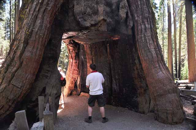
The California Tunnel Tree is a living tree.
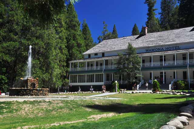
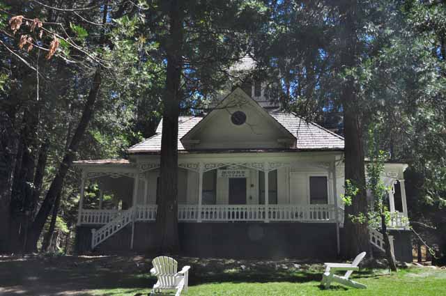
I was very impressed with the Wawona Hotel and the cottages behind it. The Wawona is located at Yosemite's south entrance. Below is the Moore Cottage.
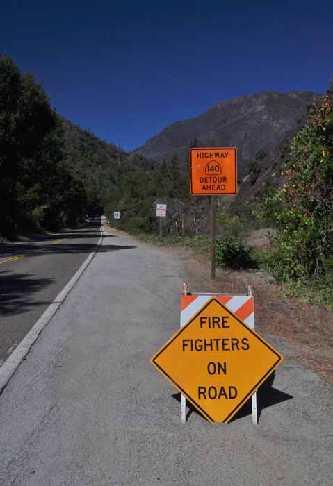
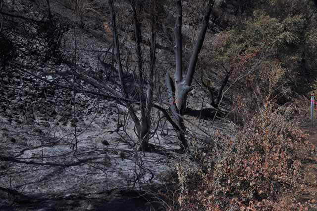
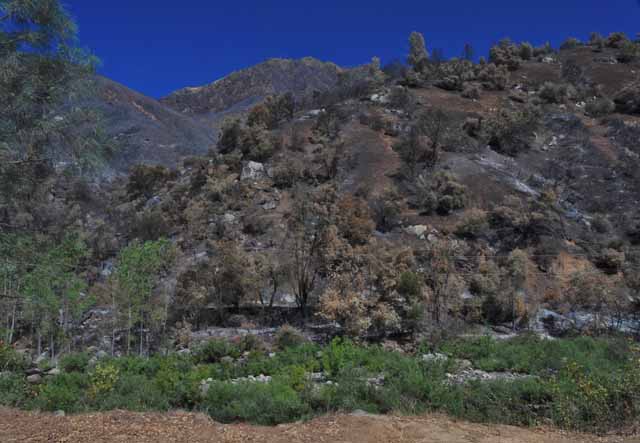
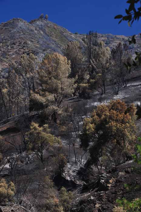
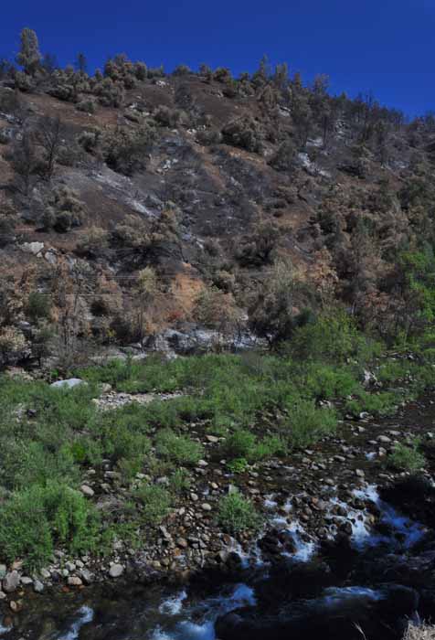
In August of 2011 there occurred a fire in Yosemite's El Portal section. This includes the west entrance from Mariposa and Midpines, the Route 140. As I passed through that section I was surprised at the vast amount of land that was damaged. The following pictures were taken within about a three-mile radius of each other.
The fire must have jumped the road. The photo above and the one below were taken on opposite sides of the Highway 140.
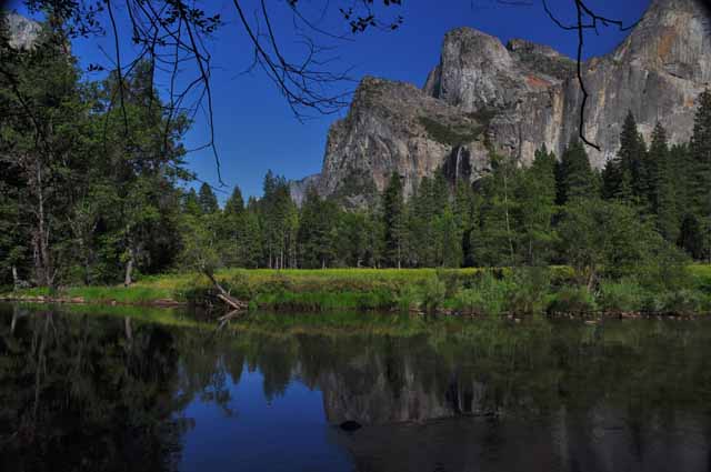
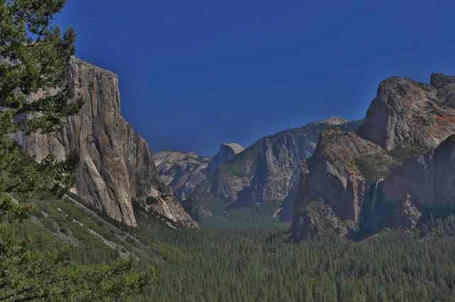
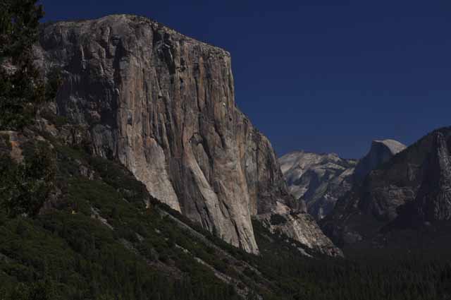
From Tunnel View, you see an impressive shot of El Capitan (left), Half Dome (in the background) and Bridal Veil Fall (in the shadow far right).
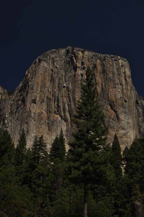
The massive El Capitan
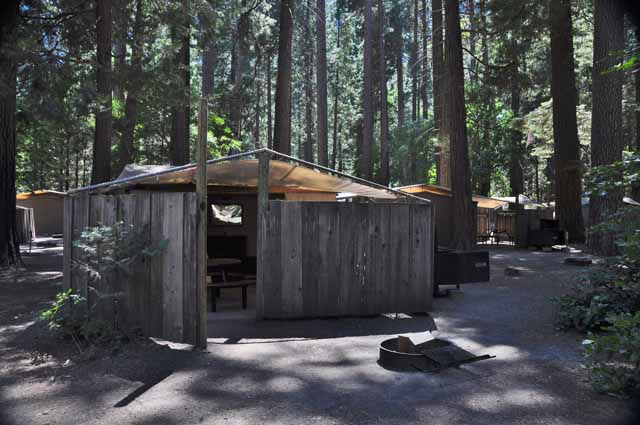
Housekeeping Camp are tent facilities provided in the Yosemite Valley. There is a double bed and two bunks in each tent, a light, and an electrical outlet. Outside there is a firepit, a picnic table and a bear-proof food storage cabinet. Linens, etc. can be rented. There are river and non-river units.
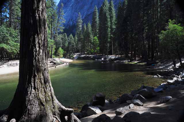
The Merced River runs through the Yosemite Valley. This shot was taken in Housekeeping Camp, near the river units.
A meadow in the Yosemite Valley
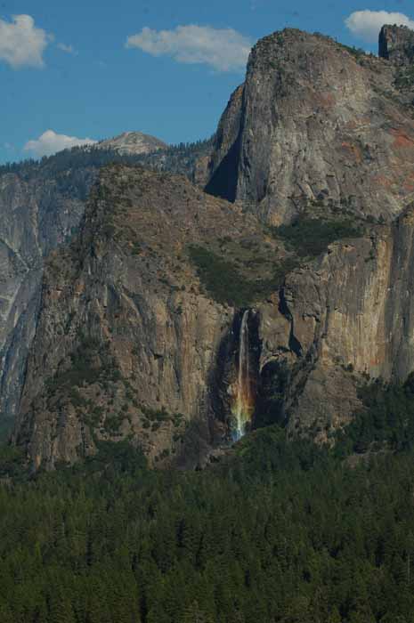
This view of Bridal Veil Fall was taken from Tunnel View Overlook. According to a ranger on site, this rainbow is not as good as it gets. As the sun travels lower in the sky later in the year, the colors get more intense and there is a more fully-formed rainbow. I was pretty satisfied with this gorgeous view.
Upper and Lower Yosemite Falls
A reflection of El Capitan from Cathedral Beach
Sentinel Dome off Glacier Point Road
From the top of Sentinel Dome one has a 360-degree view of the surrounding mountains and Yosemite park. Sentinel Dome can be reached from the Glacier Point Trail. The next several shots were taken from the top of Sentinel Dome.
Upper Yosemite Fall from Sentinel Dome
A grand view of Half Dome from the top of Sentinel Dome
Ansel Adams, whose images of Yosemite can be found everywhere, also photographed a lone Jennifer Pine Tree that sat prominently on Sentinel Dome. The tree has since died, but a piece of the trunk is still present.
One of the many highlights of Yosemite is Half Dome, seen here from Sentinel Dome.
Glacier Point is the highest spot in Yosemite, and from there one can get awesome views of parts of the valley, Half Dome and both Nevada and Vernal Falls. It's a must-see for any trip into Yosemite. This shot is of a ledge that juts out over the valley floor.
As the sun begins to set, a totally different light is cast on the rock formations, such as here on Half Dome.
The Merced River meanders through Yosemite's valley and out of the west side of the park toward El Portal.
Mirror Lake, in the early 1900s, was a thriving hot spot for Yosemite visitors, offering a very large lake with a perfect reflection of the mountains above. But the lake is gradually losing its water and today offers not much more than what is seen here. It sits at the foot of Half Dome, and there's an easy hiking trail to it.
The Ahwahnee Lodge has the most impressive - and expensive - accommodations and restaurant in the park.
The valley after a rain
Climbers on El Capitan point out an image of North America on the face of the massive rock. Looking closely with little imagination, one can see the outline of the continent, even with a clear view of Baja California.
Above Right: A climber makes his way to the top of El Capitan.

.jpg)
.jpg)
.jpg)
.jpg)
.jpg)
.jpg)
.jpg)
.jpg)
.jpg)
.jpg)
.jpg)
.jpg)
.jpg)
.jpg)
.jpg)
.jpg)
.jpg)
.jpg)
.jpg)
.jpg)
.jpg)
.jpg)
.jpg)
.jpg)
.jpg)
.jpg)