the wandering chick
...Arches National Park
rated right up there with Bryce
Arches is one those parks that you want to keep going back to.The size, the layout, the ease of getting around, the variety of types of rock and land formation and the absolute stark beauty all combine to make the perfect park.
It has more than 2000 arches, the most famous being Delicate Arch. Unfortunately, 43 arches have collapsed in the park since 1970, the latest being Wall Arch in 2008.
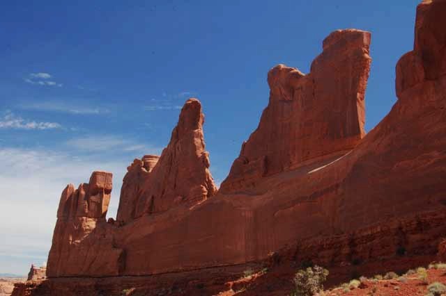
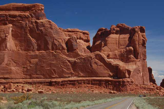
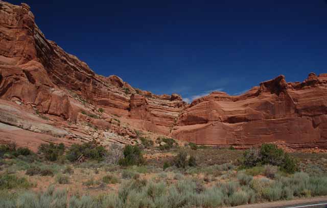
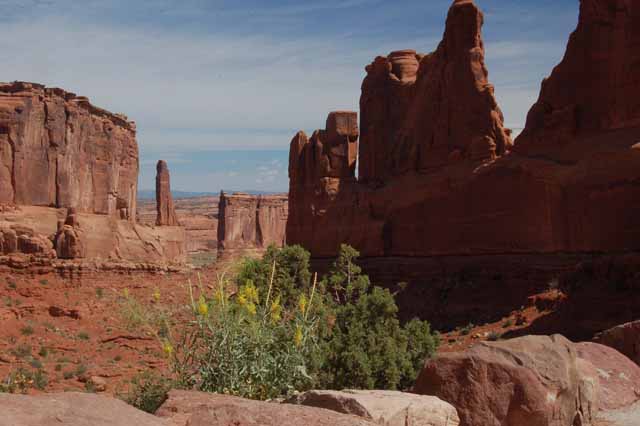
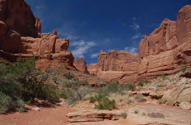
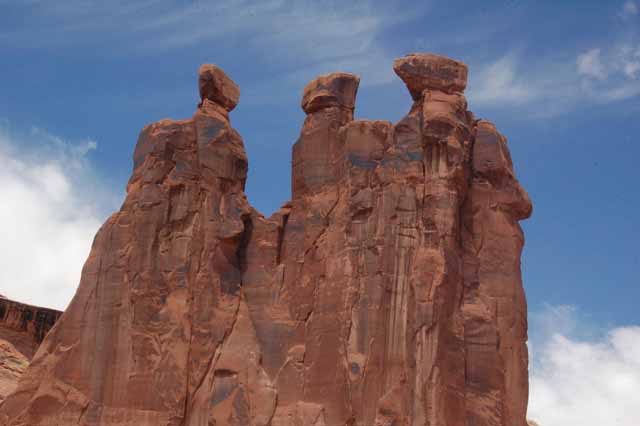
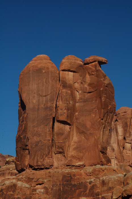
From the near beginning of the park you see the enormous Great Wall that travels miles within the park and concludes at the end of the Park Avenue Trail where you see rock forms named Nefertiti, The Three Gossips, Sheep Rock, the House of Babel and Courthouse Towers.
The park is named in sections, such as Devil's Garden, The Windows, Fiery Furnace and Garden of Eden, and at each section there will be well-marked hiking trails. Fiery Furnace is the only section of the park that requires a guide for hiking.
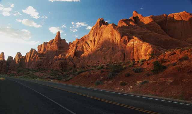
You enter the park by way of a series of switchbacks that rise from 4,000 feet at the visitor's center to more than 5600 feet at the height of the 119-square miles park, Elephant Butte.
The park is located less than 10 miles north of the city of Moab in southeastern Utah.
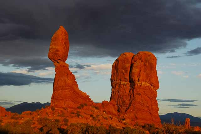
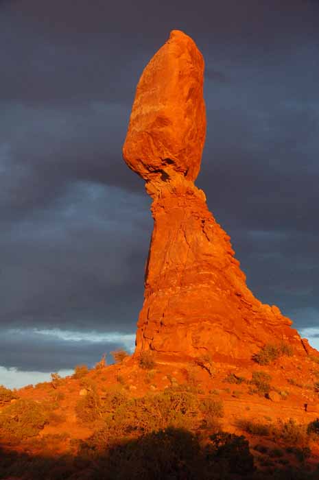
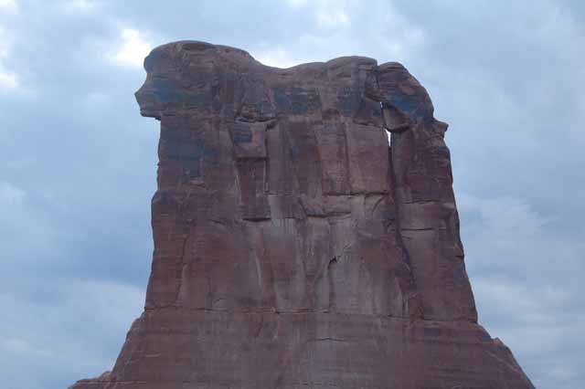
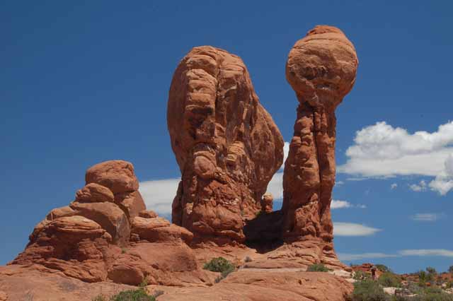
Balanced Rock is one of the more popular rock formations in Arches, especially near sunset when the sun shines directly on the face of the rock.
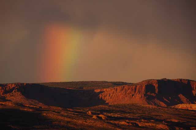
Though it never rained while I was at Balanced Rock, a part of a rainbow peaked behind a nearby rock form.
When the words, "There's a rainbow" resounded around the Balanced Rock area near sunset, everyone headed for the mountain top for a better view.
Sheep Rock is located in the Park Avenue Section of Arches. Below is Sheep Rock during the day.
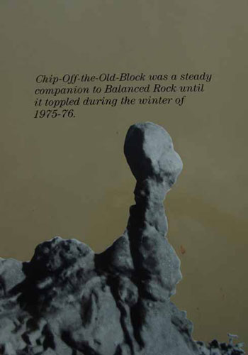
Rest in peace, Chip.
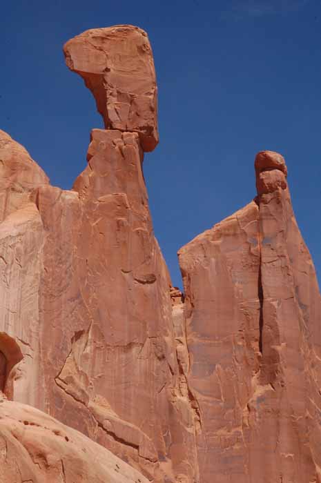
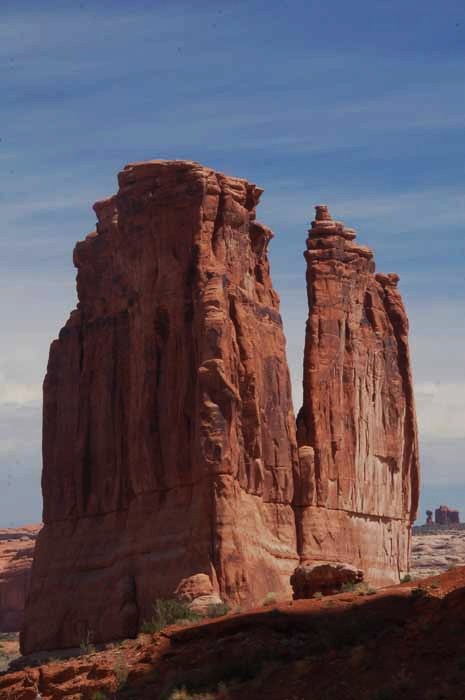
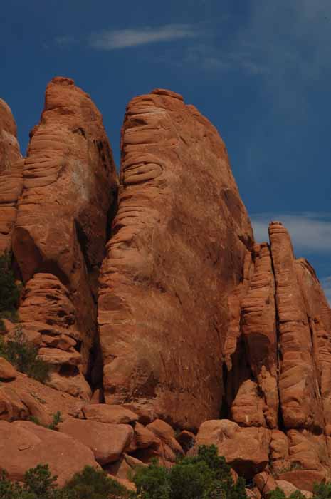
Meet Nefertiti. She's located in the Park Avenue Section of Arches. The stone is Entrada. It appears thick and massive as opposed to the more delicate Navajo sandstone. All of the rock forms along the Park Avenue Trail are Entrada. They are pictured in the next several shots.
The Park Avenue Trail was so named because of its likeness to a New York City street of tall buildings. The massive rock is called Entrada.
Above and Below: the Great Wall
The Park Avenue Trail is an easy one-mile walk that takes you down to the floor of the shallow canyon between the massive Great Wall on your left and the Park Avenue 'skyline' on your right.
Courthouse Towers, as seen from the Park Avenue Trail
The Three Gossips. You'll see them along the road in the Par Avenue Section.
You'll find The Penguins huddled together in the Entrada stone above one of the switchbacks as you leave the park. If you see them soon enough, you'll also spot a safe place to pull over for a picture. The form is harder to see on the way up into the park, especially if you're driving.
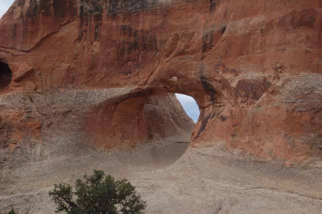
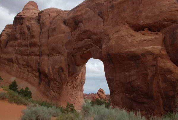
Tunnel Arch is located in the Devil's Garden section of Arches. On the same trail is the Pine Tree Arch, below.
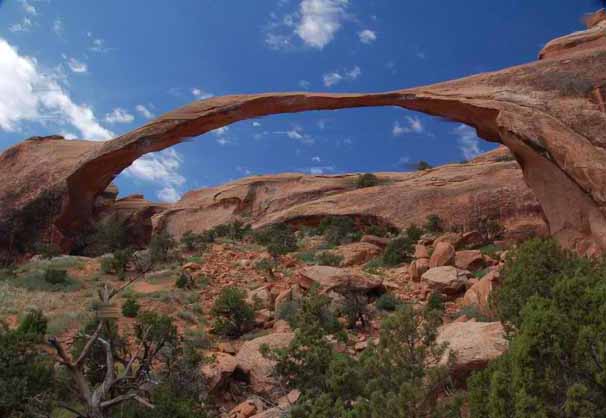
Landscape Arch is also in the Devil's Garden section, in the most northern part of Arches. In 2006, a large section of Landscape Arch fell, which is the pile of rocks under the arch on the right side.
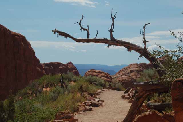
All of Arches' hiking trails are very well marked. This one is in Devil's Garden and leads to Landscape Arch.
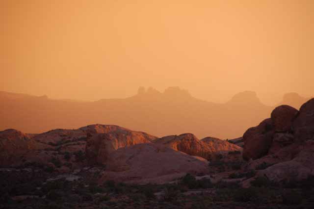
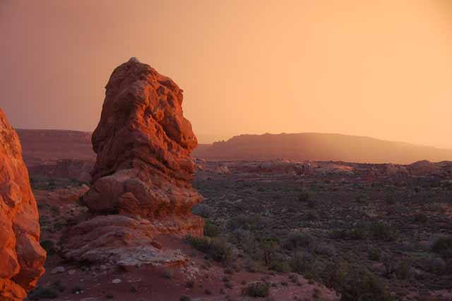
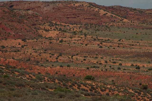
All the colors that can be found in Arches congregate here at Panorama Point.
Above and Right: The Garden of Eden section of Arches has an array of interesting rock formations, all of Navajo sandstone.
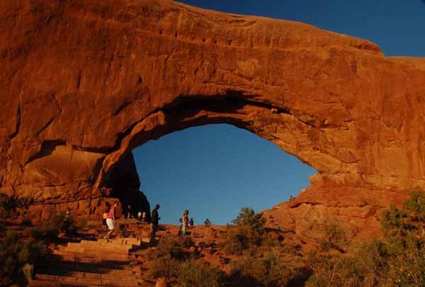
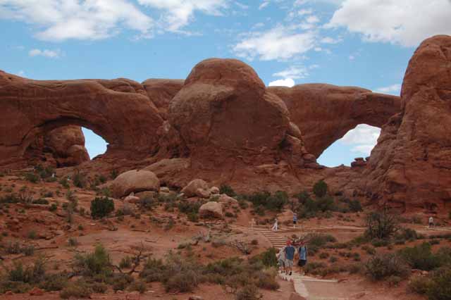
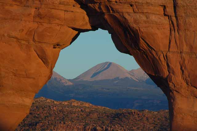
The Windows Section has the North Window (above) and the South Window. When viewed from a distance, you can see both, and it's called The Spectacles (right).
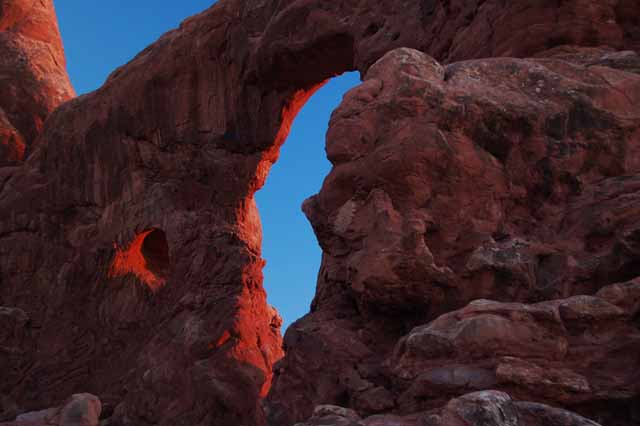
Turret Arch is also in the Windows Section. A nice loop trail takes you by all three sites. To the right is Turret Arch at sunset.
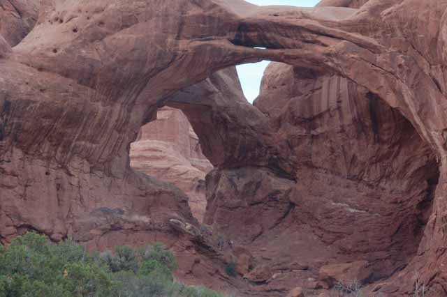
this is Double Arch. The size of the people, who you can barely see at the bottom of the arch, emphasizes how massive this formation is.
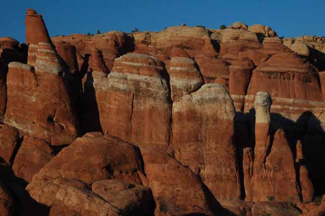
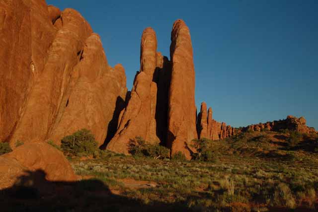
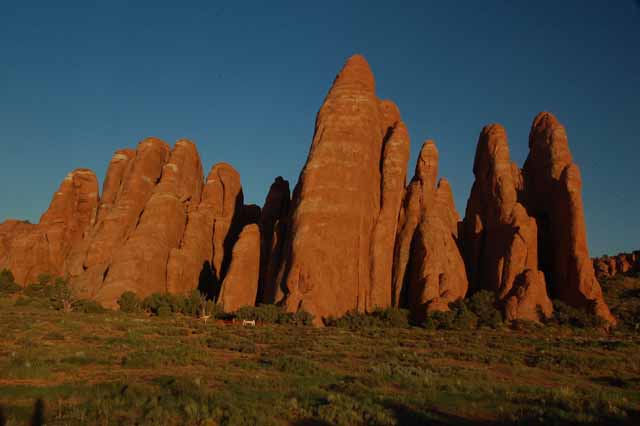
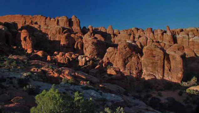
This and the next four pictures were taken in the Fiery Furnace section of Arches. Named for the fire-like light as the setting sun hits these formations, it's the only section of the park that requires a guide for hiking. The reason? It's a maze of twists and turns with no set trail. This section is also known for its fins, the formation of rock that has eroded in such a way that its likeness is that of a shark's fin.
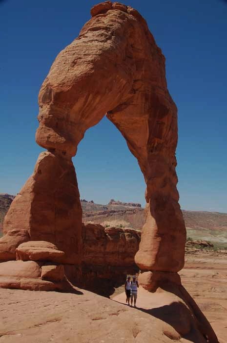
And last but not least: Delicate Arch, certainly the most famous in the park. And for good reason. First, its beauty, so perfectly shaped and, yes, delicate describes it perfectly.
But also because it sits so precariously on the brink of a cliff. In front is a large bowl-shaped area that gradually slants toward the arch. Behind it is, well, nothing. A drop. A canyon.
Delicate Arch has become the symbol of Arches Natl Park and is the one seen on Utah's license plates.
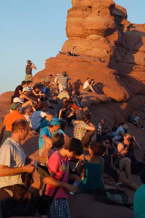
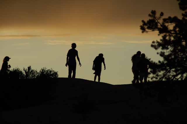
Seeing Delicate Arch as the sun sets on it is something tourists and photographers alike want to add to their 'Did it' list. Despite the tiring hike to the arch, hoards of people show up just before sunset to see the glow. Problem is: July is not the best time to do it. The sun sets behind a very large rock that blocks the full sun from the arch. Earlier in the year, the sun is positioned better. Still, the crowds showed up (left) to witness at sunset one of the park's favorite arches. Behind Delicate Arch is the La Sal Mountain Range.
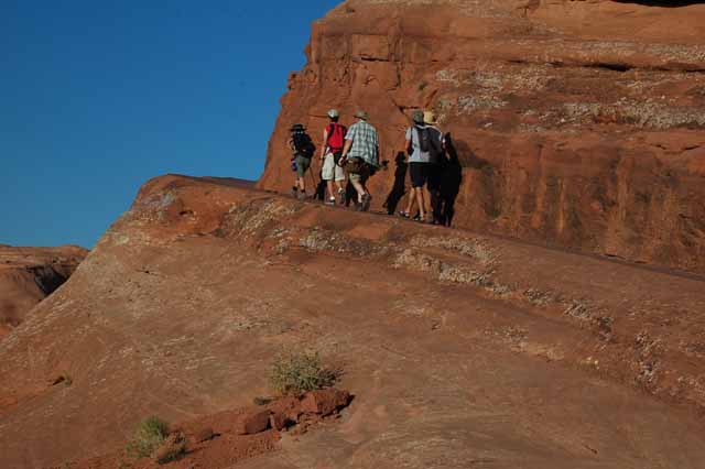
There are three ways to see Delicate Arch. But there's only one good way...the uphill climb from Wolf's Ranch.
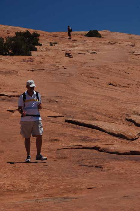
You start out on a gravel road that climbs gradually to a large slick rock area. Cairns (rock piles) guide you over the massive slab of slick rock. Then you get to "The Ledge." Now, I was forwarned of this ledge because it was known I can't do heights. But, I was told, it's only 200 yards "and not that bad," . So, with friends hiking with me, I decided to 'take the plunge." Well, not literally, I prayed.
And you know what? It really wasn't that bad. I did it. It's not a drop off, as you can see from the picture above. And that made all the difference in the world.
So, if you're worried about doing the hike, don't be. It's not an easy one, otherwise, cuz there's a lot of uphill to do. But keep your stick-it-ta-tootie because the reward at the end of the trail is well, well worth every uphill step.
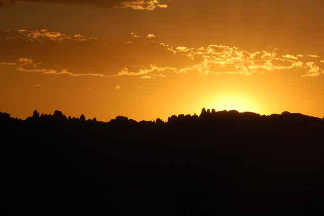
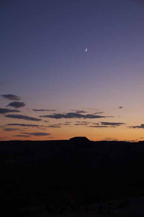
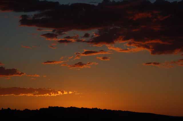
A few parting shots of the sunset from the Delicate Arch site. The picture on the left was taken from the trail back to the parking lot.
To see more of Utah's pages, please return to the Utah menu page by clicking here.
Thank you for visiting these photo pages.
If you're interested in seeing more, please return to the Main Menu at the bottom of my home page and make your selection.
All images within 'The Wandering Chick' Web site are copyright protected. They may not be downloaded or otherwise copied.
Please contact me if you think a particular photo or set of photos can be used in your publication.