the wandering chick
...Lake Powell
straddling the Arizona-Utah border
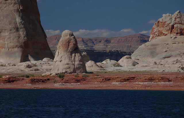
Lake Powell sits on the border between Arizona and Utah. The vast lake, the second largest man-made lake on our continent (the largest is Lake Mead), is a reservoir for the Colorado River and can be accessed from several different spots.
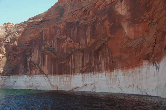
On the Arizona side, it's less than ten miles from the small town of Page. After crossing the Glen Canyon bridge and dam, spectacles themselves, you'll soon get sight of the brilliant blue lake that surrounds and enhances the white soft sandstone cliffs and buttes in this beautiful little part of our world.
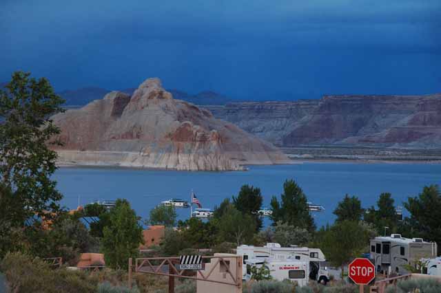
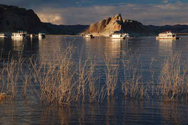
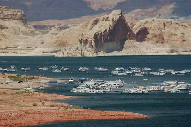
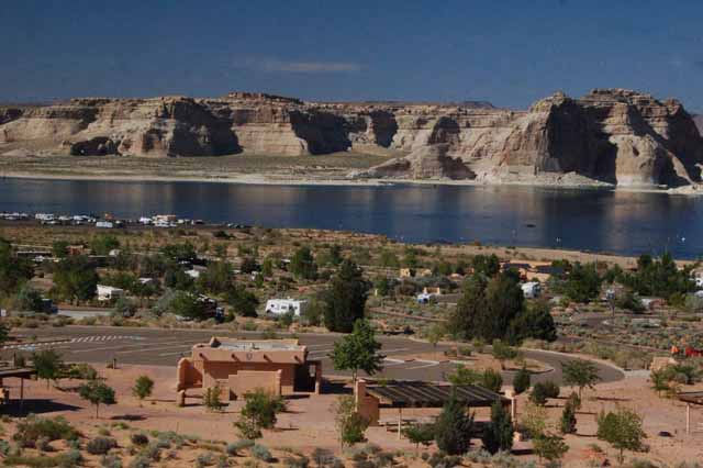
Lake Powell from the Wahweap Marina and Campground, north of Page, AZ.
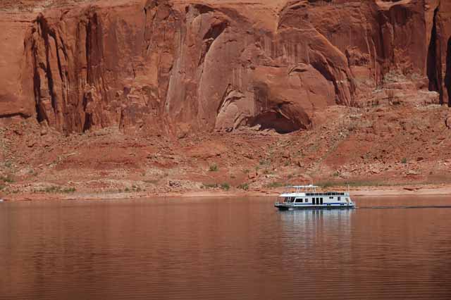
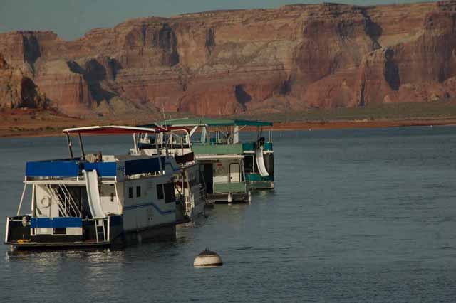
One of the most popular attractions on Lake Powell is houseboat rental...by the day, week or month.
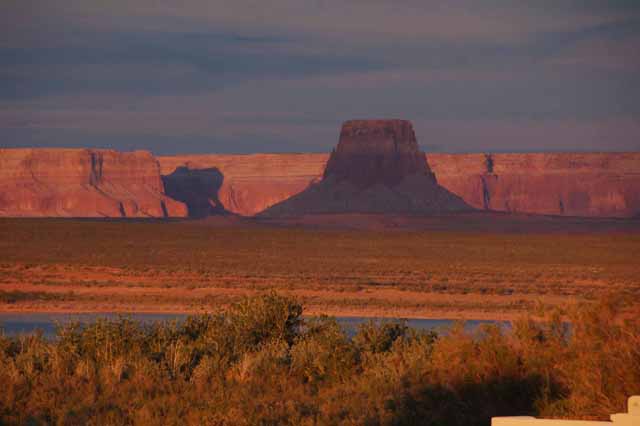
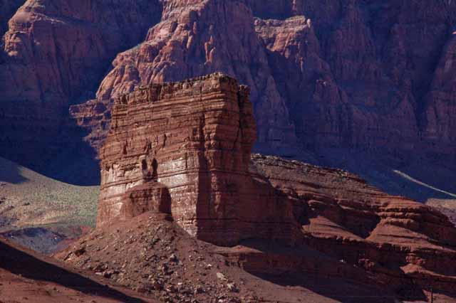
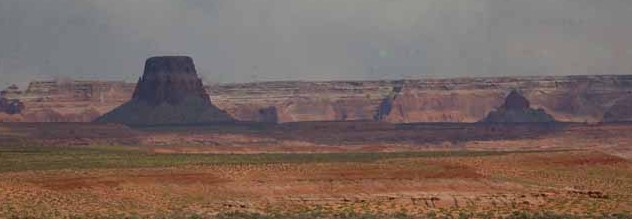
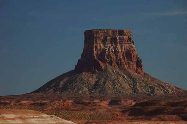
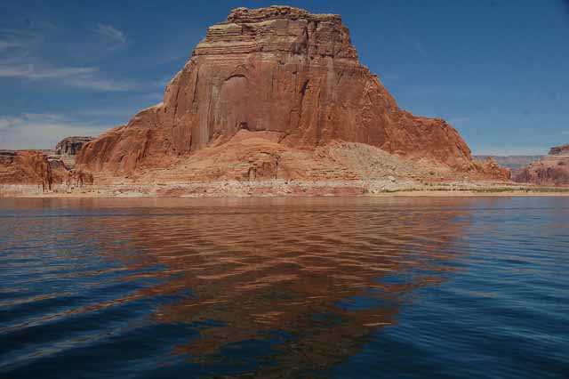
Tower Butte, like all the sandstone cliffs and formations on Lake Powell, takes on several different colors through the course of the day, depending on how the sun hits it.
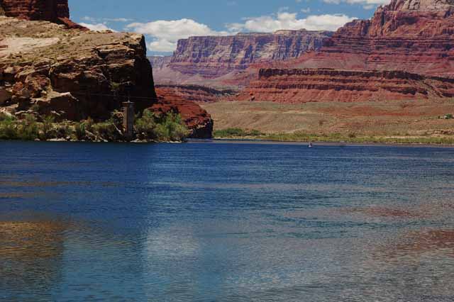
The Colorado River at Lees Ferry. Lees Ferry is south of Page and was, in the 1870s through 1910, a ferry crossing over the Colorado. Today the area is on the National Historic Register and is also a launch site for boaters and rafters. It is also the official starting point for the Grand Canyon on the Colorado River.
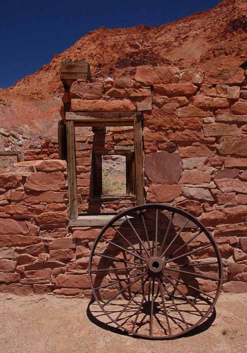
One of a couple of historic buildings at Lees Ferry.
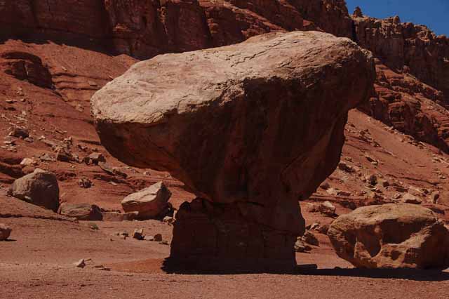
Balanced Rock is a natural formation and sits off the Highway 89a against the Vermilion Cliffs near Lees Ferry. Erosion of the softer sandstone under the harder rock will eventually cause the formation to collapse.
This rock formation is part of the Vermilion Cliffs at the Navajo Bridge and Interpretive Center at Marble Canyon. There's no end to the unique and breath-taking views of the Vermilion Cliffs, a range that parallels Highway 89 south of Page.
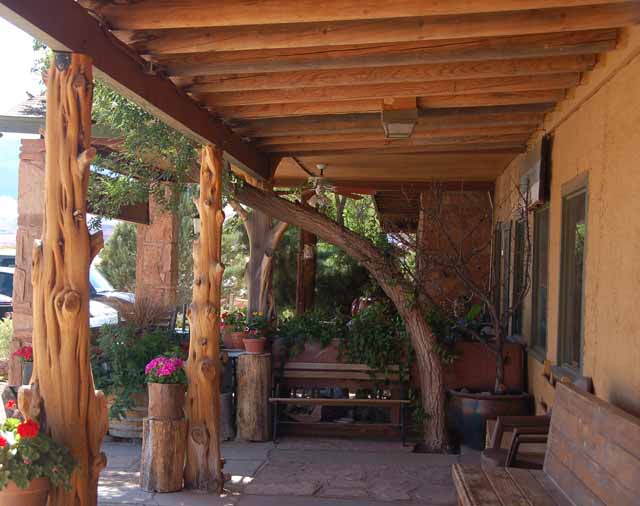
Half the fun of sightseeing is finding new places to eat lunch...such as this picturesque spot off Highway 89 at Marble Canyon.
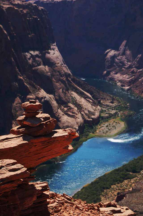
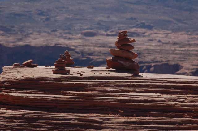
It took a very brave person (or a fool) to build this cairn on a ledge that sits a thousand feet above the Colorado River at Horseshoe Bend. But, whoever you are, thank you. Cairns always put a smile on my face.
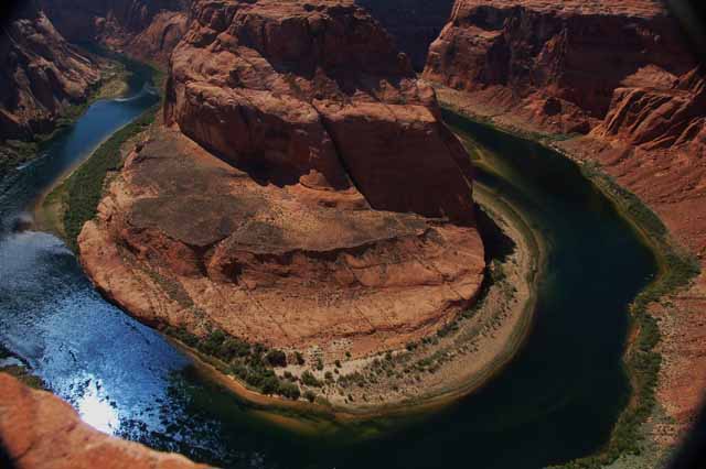
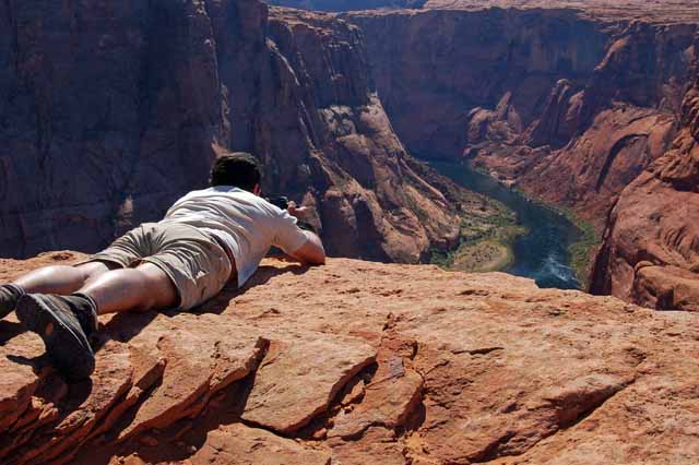
Horseshoe Bend is so named for the natural bend of the Colorado River south of Page, Arizona. This view is taken from 1,000 feet above, and there is no railing to block a fall. Yikes!
At Horseshoe Bend, you get the shot the best way you can.
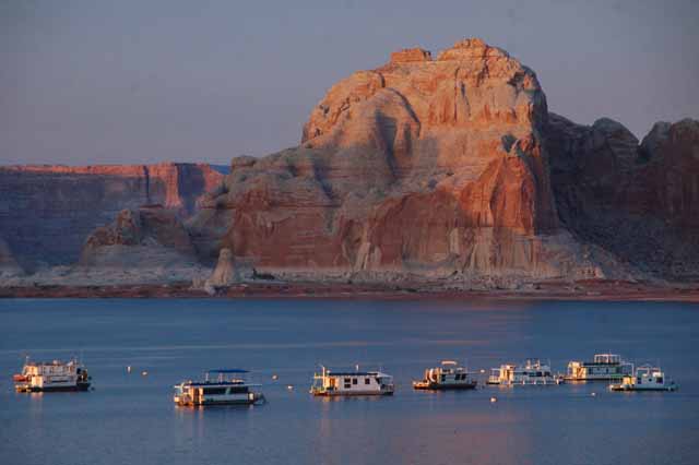
The Wahweap Marina on Lake Powell
Another shot of Tower Butte
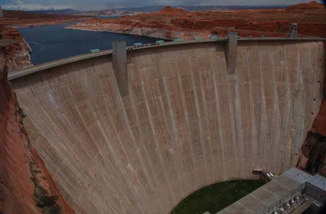
Glen Canyon Dam is one of several that helps control the raging Colorado River. It's located only a few miles south of Page, Arizona, and empties into Lake Powell.
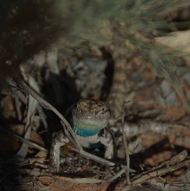
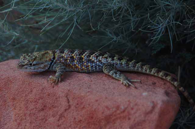
We've seen our share of spiny lizards around the campsite, but this male is the most colorful we've seen. The picture on the right is also of a spiny lizard, possibly a female.
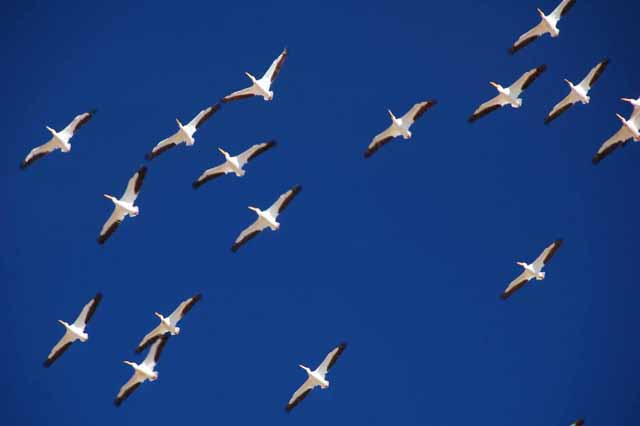
Above: White pelicans pass overhead at the Wahweap Campground.
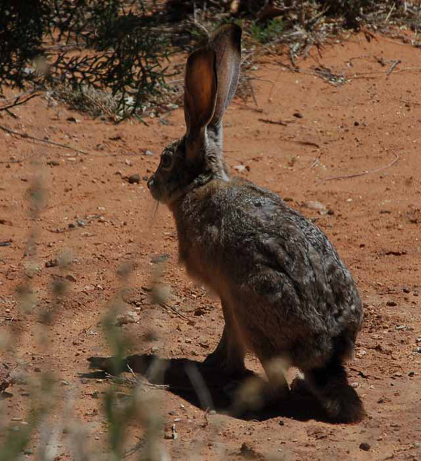
Right: The resident jack rabbit flits between the brush near the campground's Loop F.
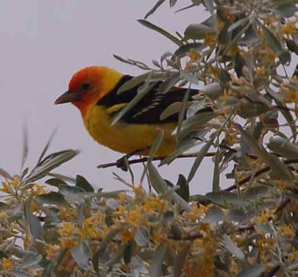
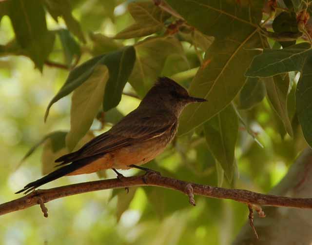
Several different species of birds can be found here at the Wahweap Campground. Among them is this western tanager, which may have only been passing through.
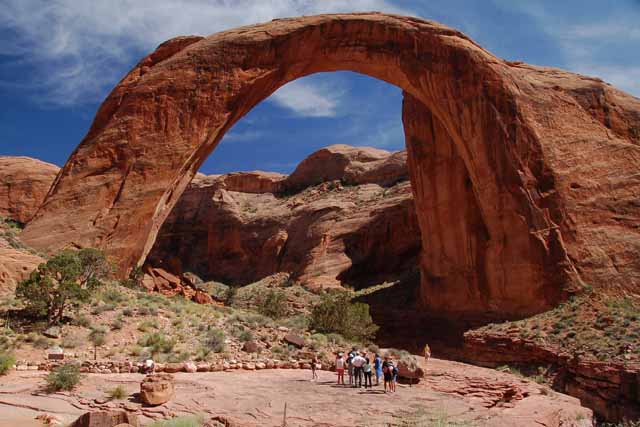
If you do nothing else while visiting Lake Powell, at least go see Rainbow Bridge. It's a 50-mile cruise in the direction of Navajo Mountain, taking 2.5 hours one way by boat. There are a couple of hiking trails starting at Navajo Mountain that will get you there, that are, I think, about seven miles one way.
The dimensions of Rainbow Bridge are astonishing. It is nearly as tall as the Statue of Liberty, 290 feet from its base. The top of the arch is 42 feet thick and 33 feet wide. The arch spans 275 feet from one side of the Colorado River to the other.
The bridge is of Navajo sandstone and was completely shaped by water, over millions of years, first boring a hole in the rock, then casually wearing it away. Bridges are different from arches that way. Arches are formed by wind, bridges by water.
Rainbow Bridge is considered sacred ground by the Navajo people, and therefore tourists are asked to not approach the base of it. The people above are standing at an allowed 200 feet away.
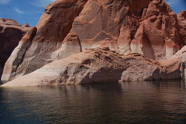
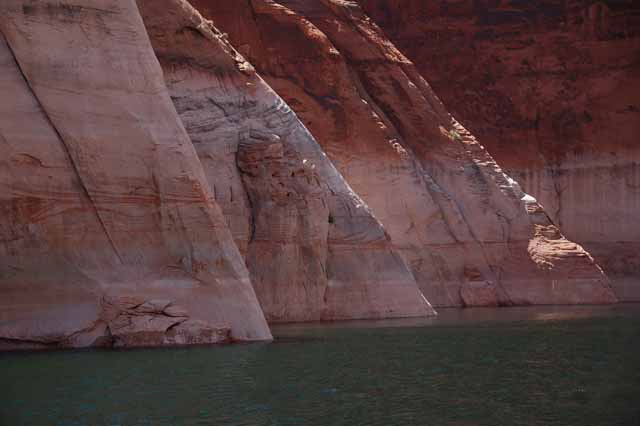
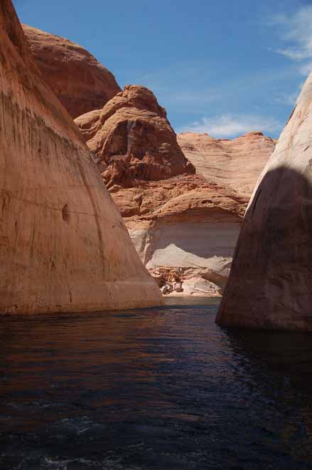
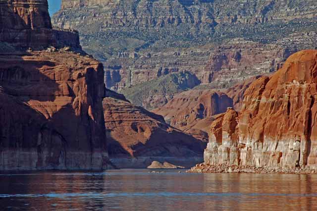
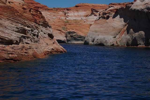
The 50-mile cruise fromWahweap Bay to Rainbow Bridge in and of itself was spectacular, passing enormous rock formations and slip rock, slinking through narrow canyons and gliding the smooth blue waters of Lake Powell. The next several pictures were taken along the route.
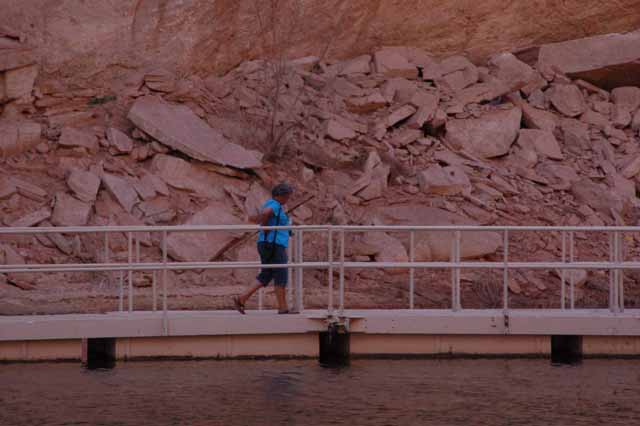
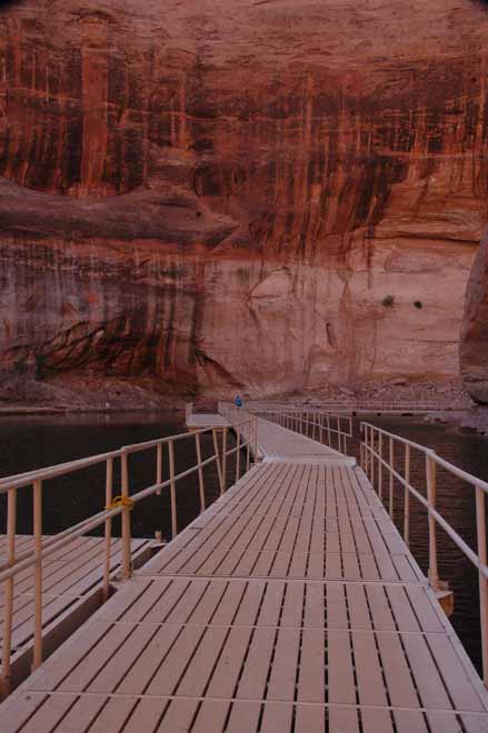
When the water is at a higher level, the cruise boat is able to get closer to the Rainbow Bridge. But at 75 feet below the norm, planks were installed to gap the distance between the boat and the land. From this point, there was about a 3/4-mile walk to the bridge.
Yet another shot of the impressive Tower Butte.
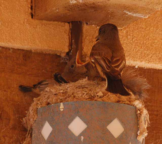
A mother Say's Phoebe (also left) feeds her young at the Wahweap Campground's Regisration building.
For more pictures of a winter trip to Lake Powell, click here.
And a second winter trip was made. To see those pictures, click here.
Or, feel free to visit my other Arizona pages by returning to the Arizona home page.
Thank you for visiting these photo pages.
If you're interested in seeing more, please return to the Main Menu at the bottom of my home page and make your selection.
All images within 'The Wandering Chick' Web site are copyright protected. They may not be downloaded or otherwise copied.
Please contact me if you think a particular photo or set of photos can be used in your publication.
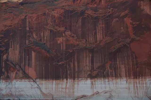
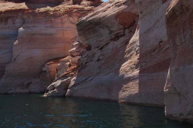
This (and below) is called The Tapestry, seen in the Navajo Canyon on Lake Powell. The natural dark desert varnish has created a work of art.
Incredible rock formations line the water's edge of Lake Powell's Antelope and Navajo Canyons, as seen from the Adventure Cruise Tour that leaves from the Wahweap Lodge.
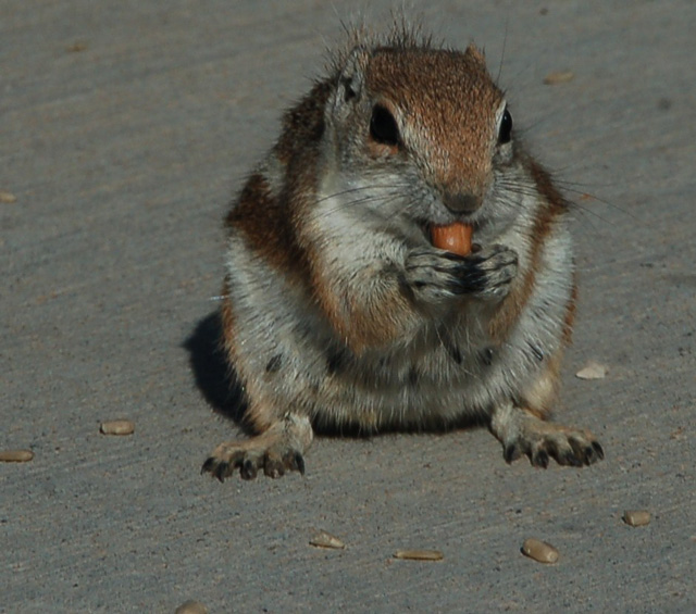
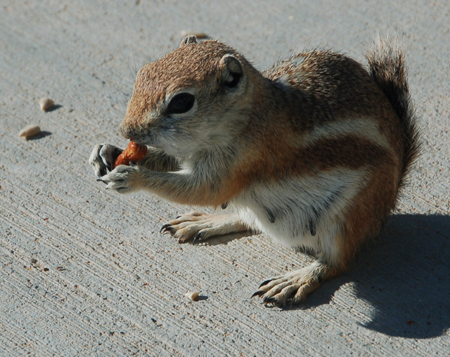
Another animal friend we have here at Wahweap Campground is the antelope squirrel, somewhat related to the chipmunk. It took us a few days to realize that at least one of the squirrels coming around is a female, as we can tell by its teets in the photo to the right.
The Wahweap Campgound and Wahweap Bay on Lake Powell, north of Page, AZ
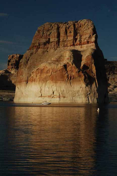
Lone Rock stands in Wahweap Bay on Lake Powell.
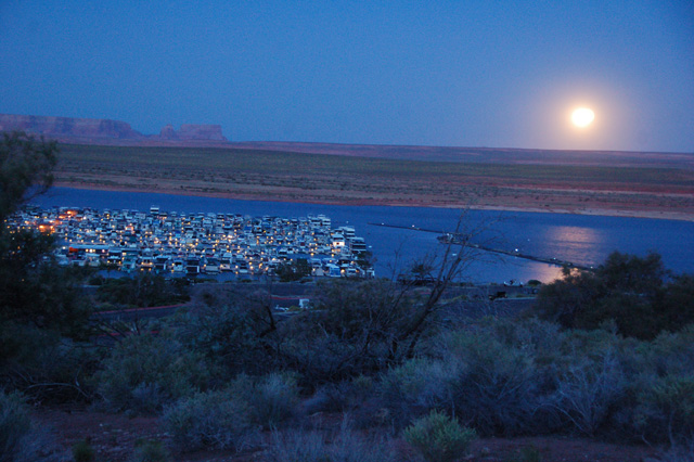
The moon rises over Wahweap Bay. In this area of the marina is the storage of some 500 personal houseboats. House-boating is a popular activity on Lake Powell.
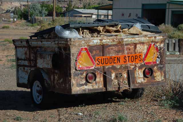
Yep, I'd say its days of sudden anything are long gone.
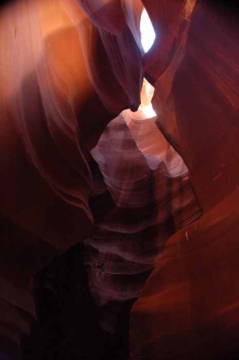
This area around Lake Powell has several slot canyons, but the most impressive is Antelope Canyon where this shot was taken. To understand slot canyons and see more pictures of this one, click
here. A link will bring you back to this page with the option of viewing the Toadstool Trail in Utah.
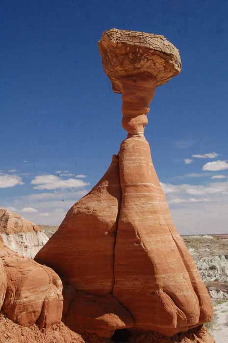
The Toadstool Trail is just over the state line into Utah on Highway 89 north of Page. It is a wonderful little hike which leads to a massive area of toadstool-shaped rocks formed by the softer sandstone on the bottom eroding away faster than the harder rock on top.
To see more of the Toadstool Trail, click here. A link will bring you back to this page, with the option of stopping by the Antelope Slot Canyon page.