the wandering chick
Nova Scotia's main attraction
...Cape Breton
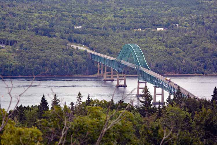
Nova Scotia is geographically (and unofficially) divided into two parts: That which IS Cape Breton, and that which is not. Cape Breton is an island that makes up the most northeastern section of Nova Scotia It is separated from the lower part by the Canso Bridge.
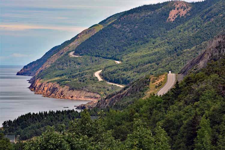
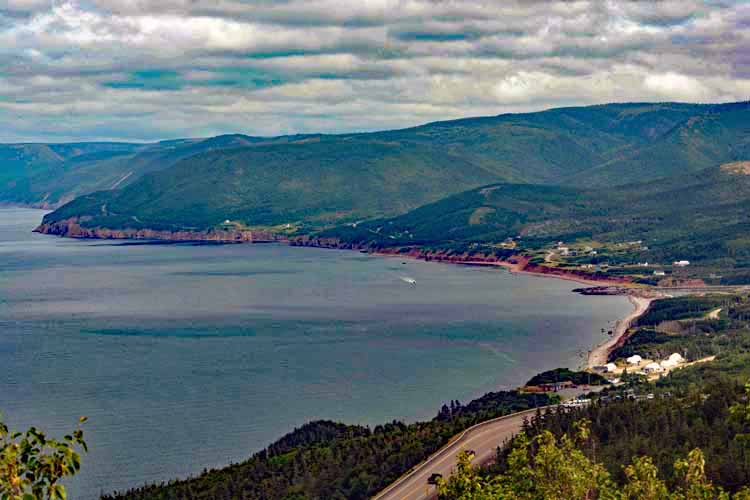
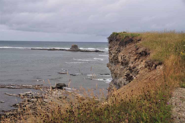
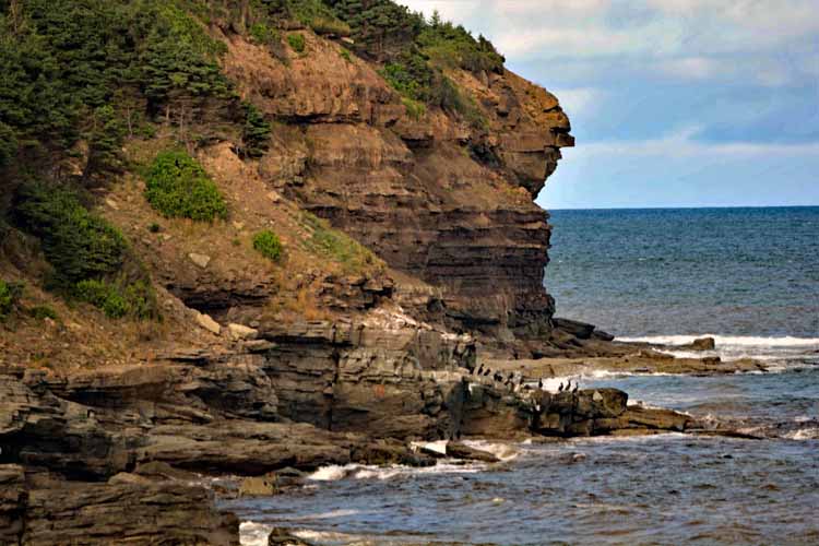
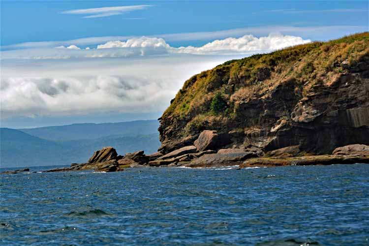
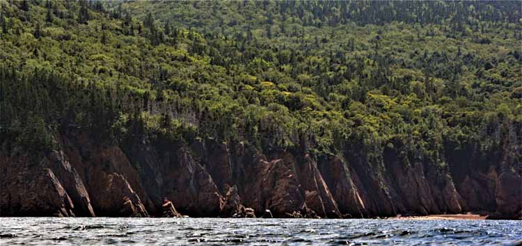
One hardly goes to Nova Scotia, at least for the first time, without visiting Cape Breton and its Cape Breton Highlands National Park. Canada's premier scenic drive called the Cabot Trail, 185 miles long, circles the park and its lush green forestry, offering dramatic coastline scenes of rocky red cliffs against the steel blue water. Hiking trails abound.
Cape Breton is also home to the expansive Bras d'Or Lake, a salt-water natural habitat, as well as several other places of interest and beauty, many of which are represented on this page.
-2022-08-10-can-ns-cabot trail to ingonish.jpg)
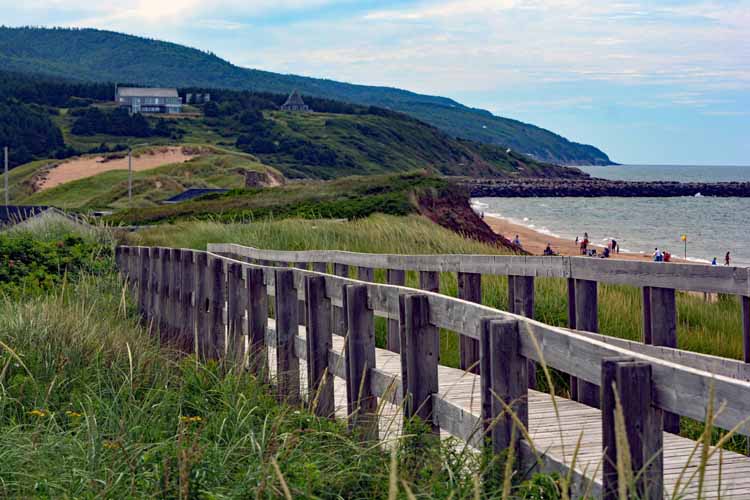
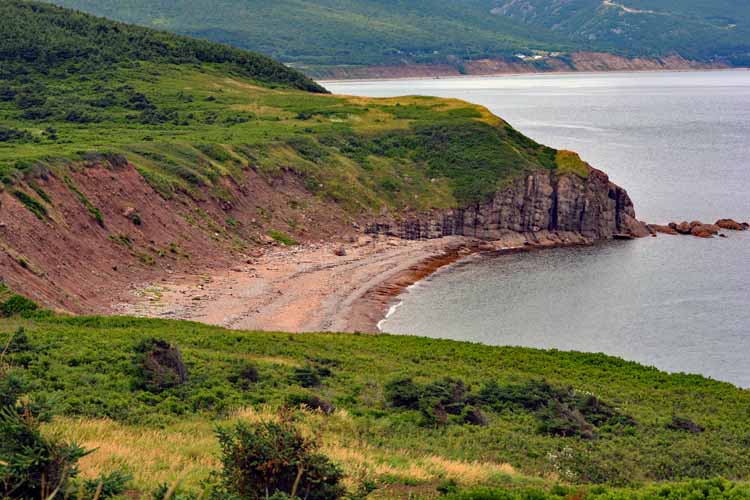
There's debate whether one should drive clockwise, starting on the west side of the Cabot Trail and traveling to the east side, or vice versa. Of course, there's no right or wrong. I started on the east side and traveled as far as Ingonish, then on a later day, started out on the west side. This picture was taken on the east side heading north, toward Ingonish where it looks out into the Atlantic Ocean. There are several pullouts for taking in the scenic views.
Even though I much prefer sunny days, I have to admit that the fog and overcast creates a slightly more dramatic picture.
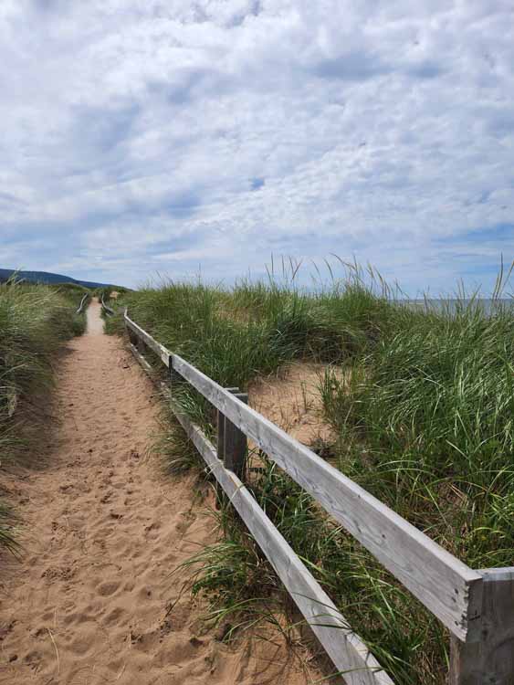
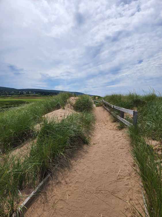
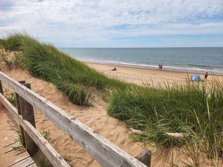
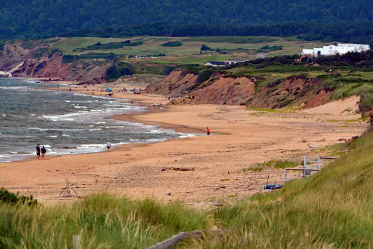
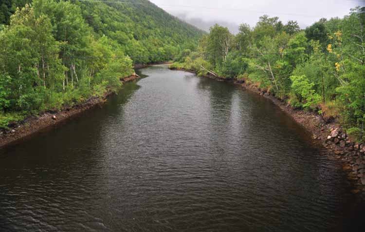
The Ingonish River
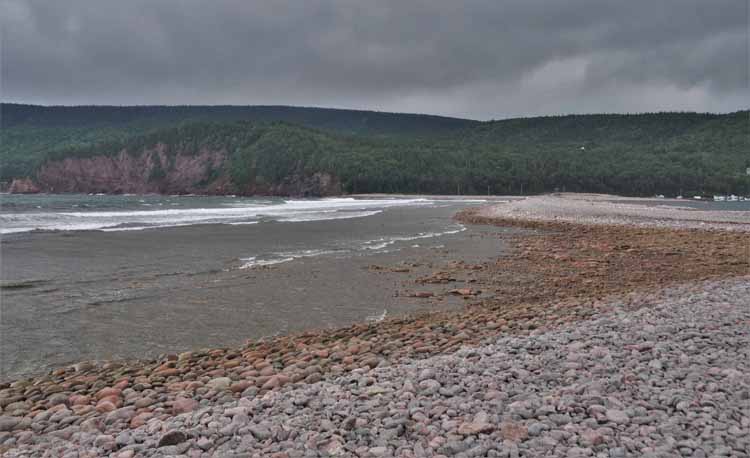
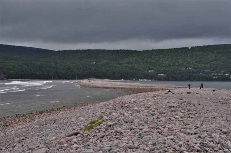
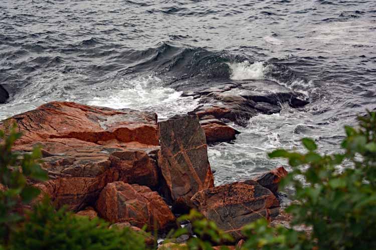
Ingonish beach with its wonderful rocks
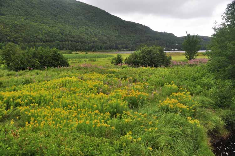
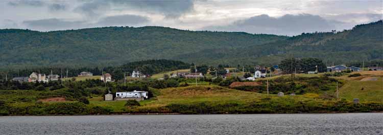
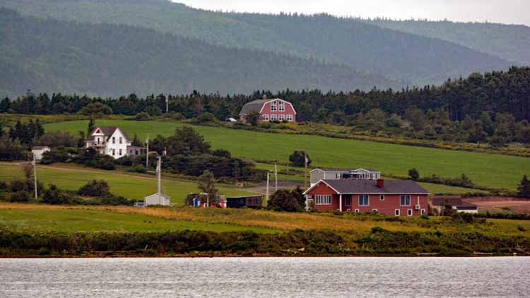
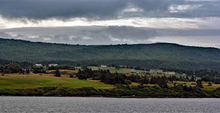
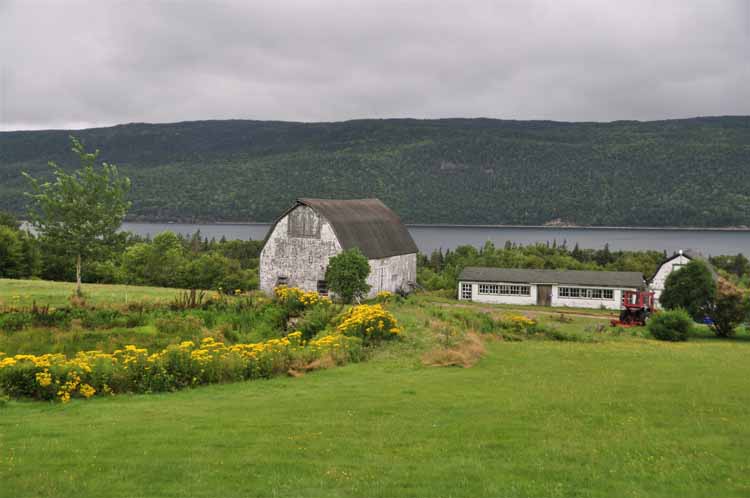
The area on the southwest side of the Cabot Trail called St. Margaree offers a calmer, tranquil feel as the farms and homes dot the rolling hills.
St. Margaree's harbor
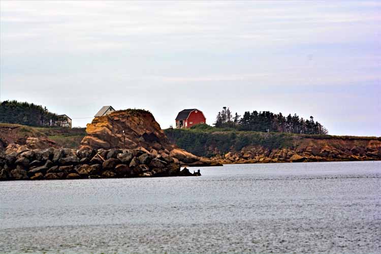
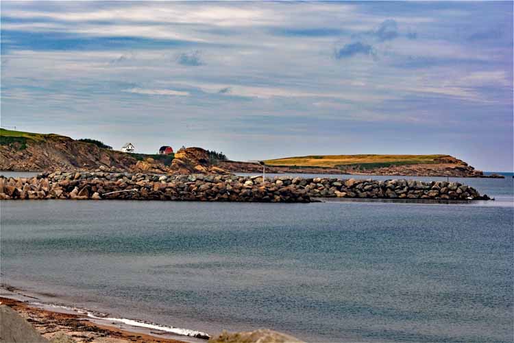
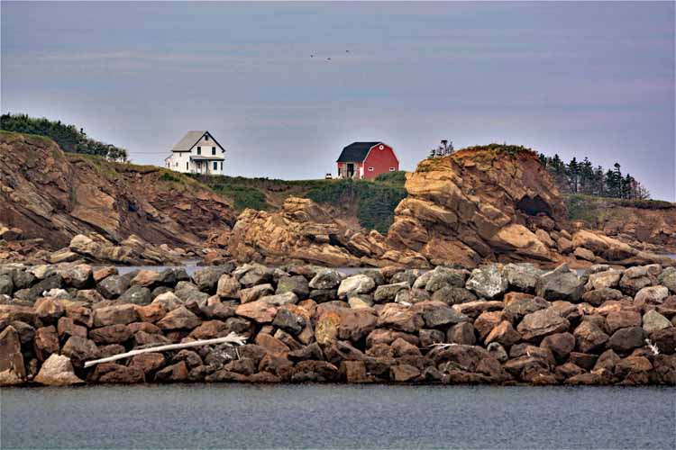
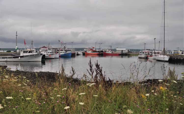
Grand Etang is a small community on the west side of the Cabot Trail just south of Cheticamp. A picture of its harbor is below.
The west side of the Cabot Trail faces the Gulf of St Lawrence.
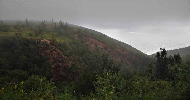
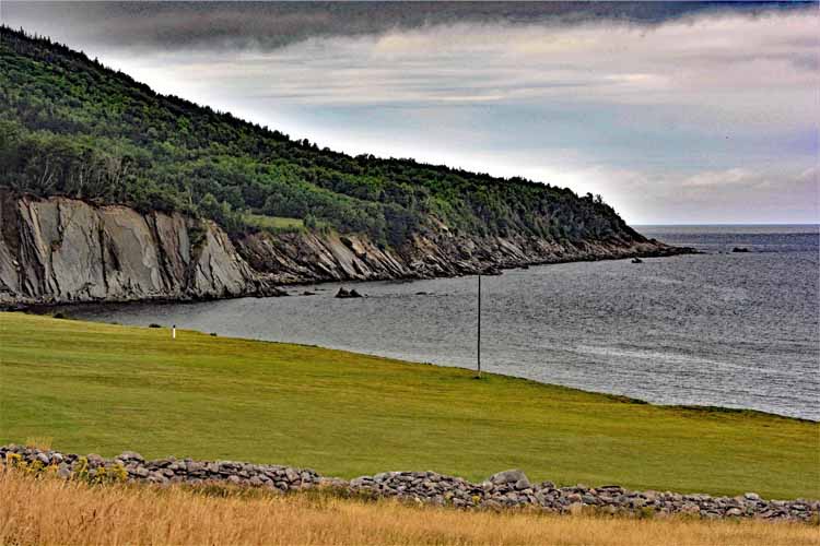
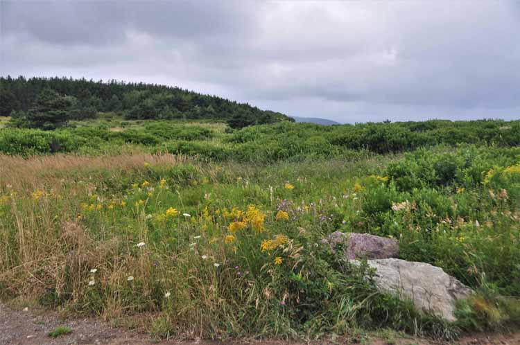
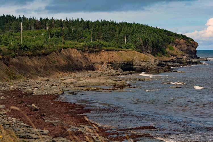
The Cabot Trail as it meanders through and over the hills, hugging a breath-taking coastline. These four shots were taken on the west side. To some, it may look quite daunting, but it was not. I, not one for heights, had no fear driving the road and felt perfectly safe.
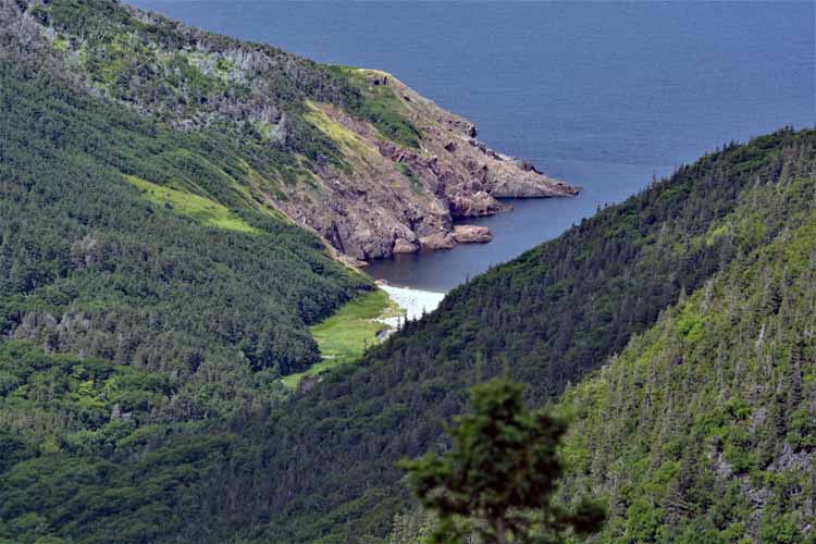
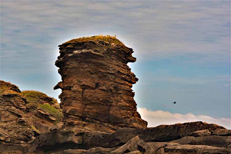
From an overlook, or a "lookoff," as the locals call it, one can look down to a tiny cove called Fishing Cove. An interpretive sign at the lookoff gives its history.
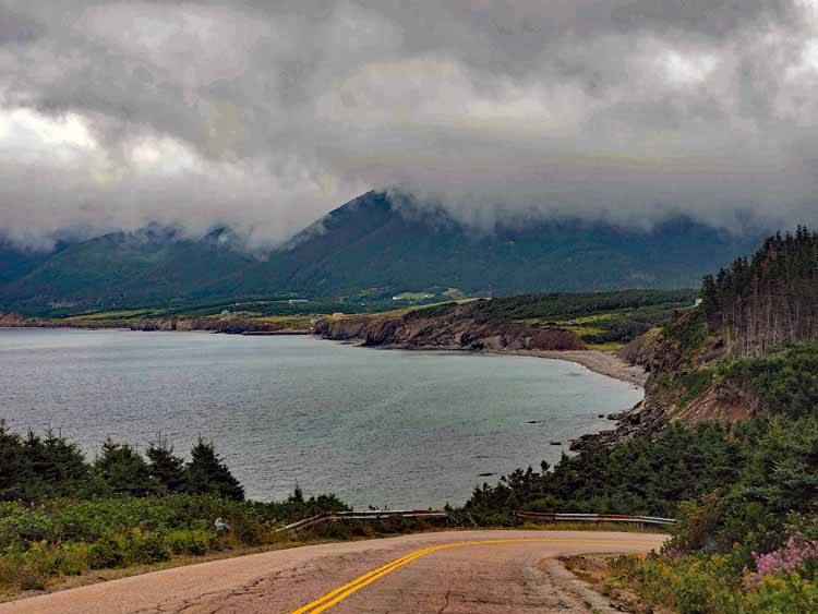
Pleasant Bay is a small community on the western coastline overlooking the Gulf of St. Lawrence, just north of Cheticamp.
When planning my trip to Nova Scotia, I noticed on the map a place called Meat Cove. Because it is so far off the beaten track, I added it to my list of what to see while doing the Cabot Trail. Then, once I got to Cape Breton and talking to people about the trip, they would invariably ask if I were going to Meat Cove. Well, that just reinforced my decision, so off I go. Meat Cove is the most northern spot of Cape Breton, 18 miles outside the park boundary. Its permanent population is less than 100, though I don't think I saw the community itself, only the campers who are given dry sites and views of the glorious landscape. One reaches Meat Cove by way of a winding 8 km (five mile) packed-dirt road off the Cabot Trail. For me it was an adventure. A case where the journey is better than the destination. I'm glad I went.
Cabins are also available at Meat Cove.
The community of Bay St. Lawrence, on Cape Breton's northern tip.
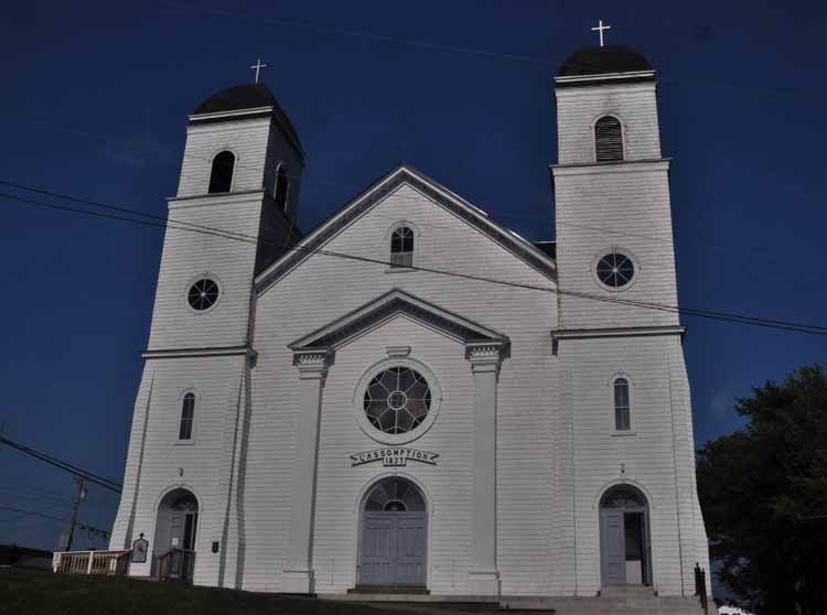
Our Lady of Assumption Church, Arichat, Isle Madame
Isle Madame is a small island , some 17 square miles, off the southwest point of Cape Breton. The first permanent settlement on record dates back to 1713, being part of a French colony. The largest town on the island is Arichat. The island population is around 4000 residents. It's a charming island with winding roads, one that eventually leads to a lighthouse. It is also on the Fleur-de-lis Trail, a scenic byway.
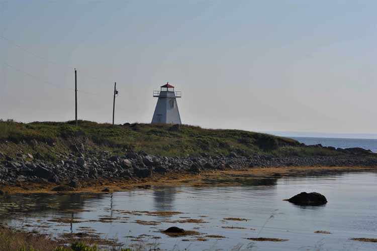
Marache Point Lighthouse, Isle Madame
Off Cape Auguet Road, Isle Madame
One of the bridges crossing the Bras d'Or
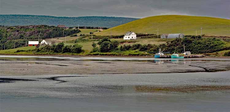
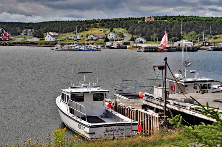
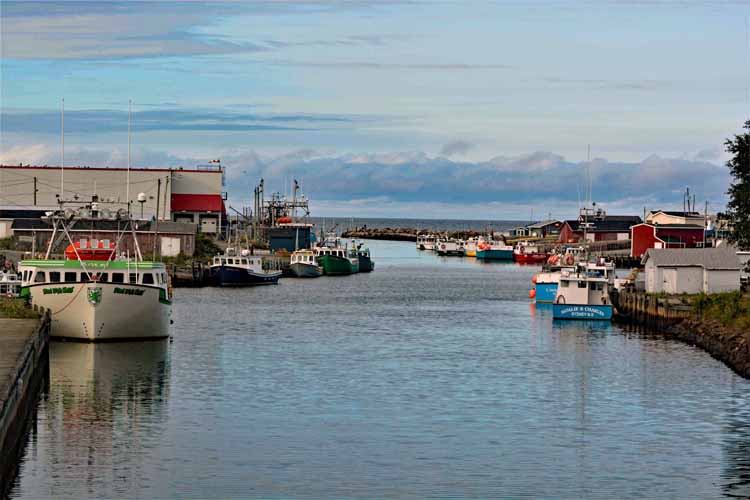
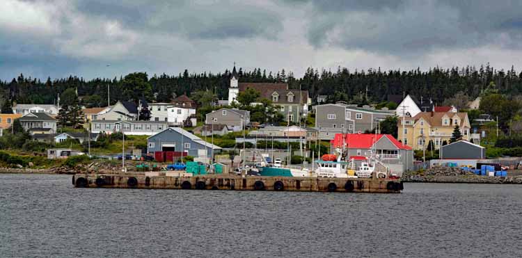
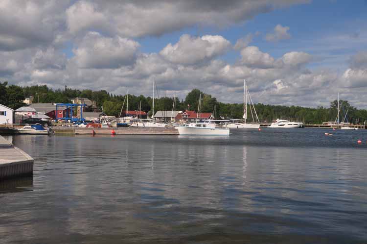
North Sydney harbor. North Sydney is a town on the eastern side of Cape Breton Island in the Bras d'Or Lake region.
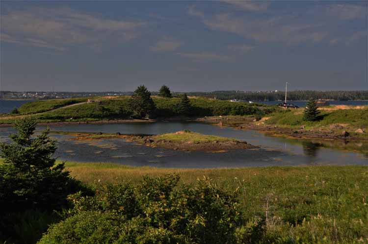
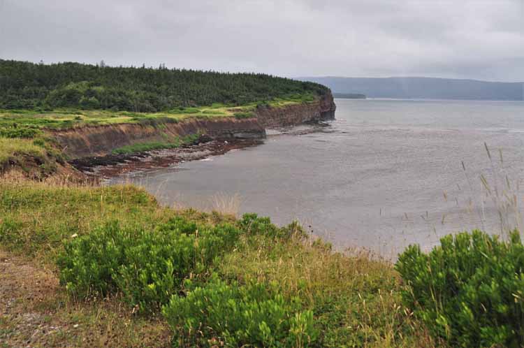
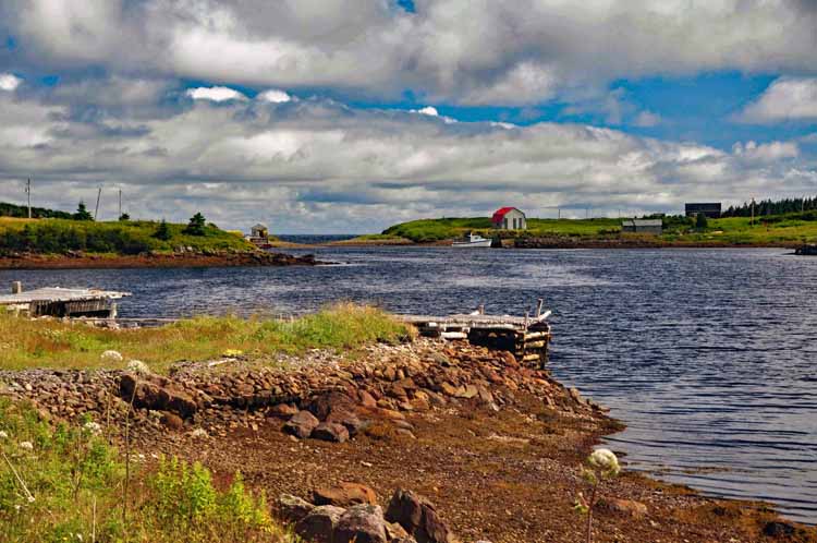
Another vast portion of Cape Breton is Bras d'Or Lake, with miles and miles of shoreline as fingers of coves and bays and channels interrupt the islands that make up the region. Many communities such as this, Big Bras d'Or, create stunning views of the coastline.
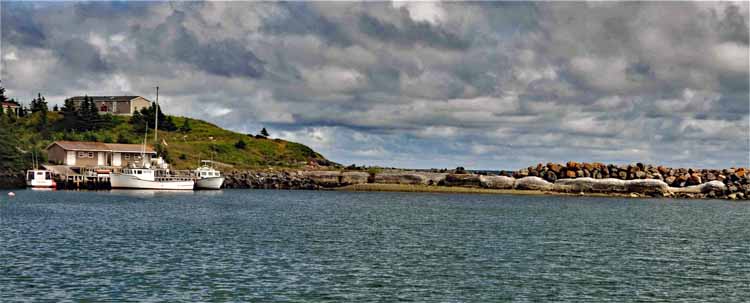
One of my destinations on this day trip around the Bras d'Or Lake was to the Point Aconi Lighthouse, located on a northern coast of the section of Cape Breton on Boularderie Island. Well, I didn't even take a picture of the lighthouse, it being no more than a metal pole with a light on it. Pretty disappointing, but the land on which it sits is gorgeous, rocky cliffs that drop down to the Cabot Strait.
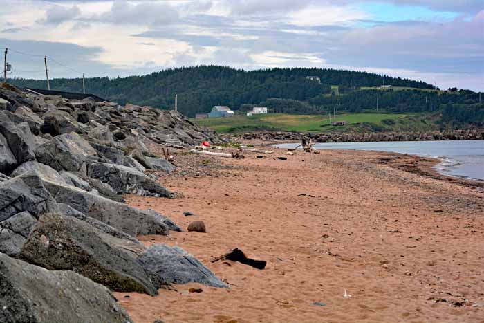
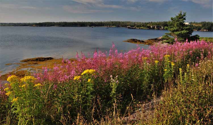
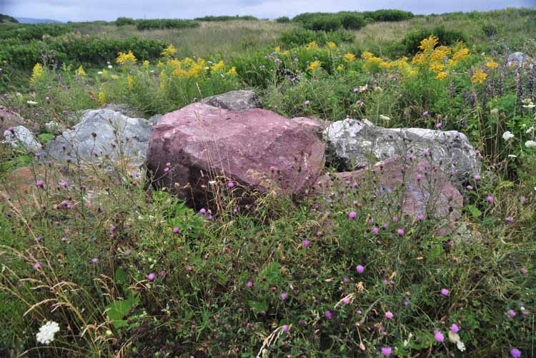
St. Margaree's red sand beach
The community of Main-a-Dieu (and below) at the most eastern point in Nova Scotia. It's located on the Marconi Trail, a scenic byway, that hugs the eastern coastline between Glace Bay and Louisbourg.
The shoreline of Little Lorraine, another community on the Marconi Trail.
Glace Bay is also on the Marconi Trail. The Marconi Trail is so named in honor of the Italian inventor Guglielmo Marconi who, in 1902, sent the first transatlantic radio signals between Europe (received in Cornwall, England) and North America from a tower near Glace Bay.
Waddens Cove (and below) is also a community on the Marconi Trail.
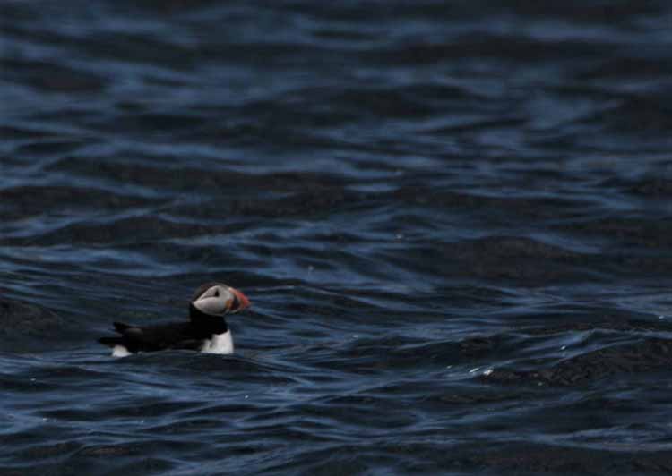
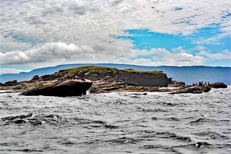
It was very difficult to get decent pictures of the little guys since both the puffins and the boat were in constant motion, usually in opposite directions, But even though we couldn't get very close to them, the views of the Bird Islands were spectacular. So, I just focused on them, and if a puffin got in the picture, all the better!
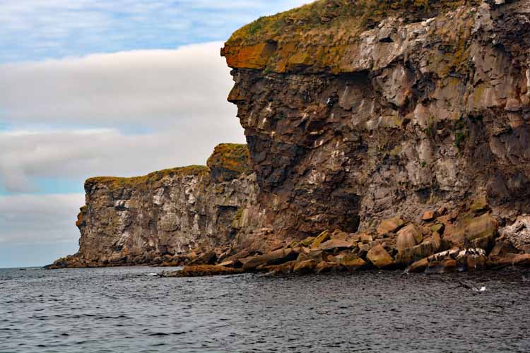
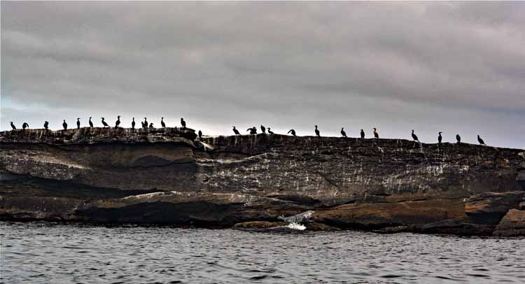
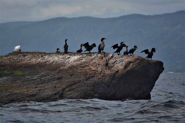
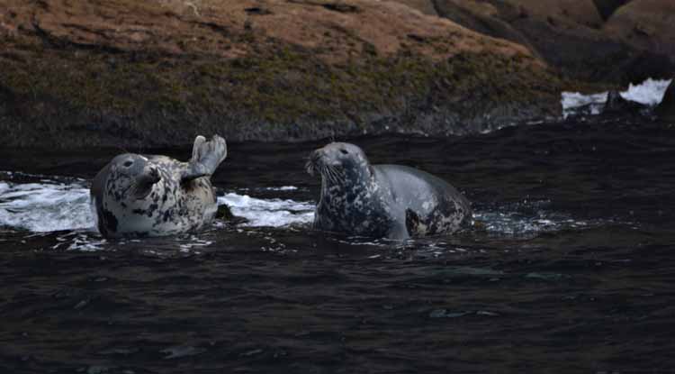
Very dramatic rock formations, none without either seals at the base of the rocks, or cormorants at the top.
In fact,we saw the Great Cormorant, a very rare bird of which birders come from all over to get a glimpse of. Sadly, my picture of him just wasn't focused enough to post.
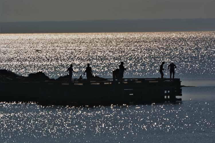
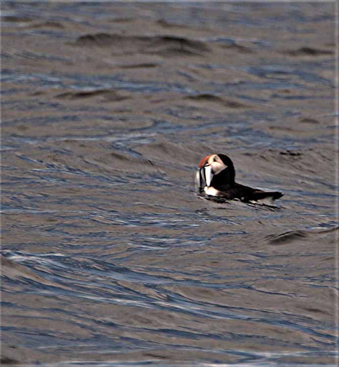
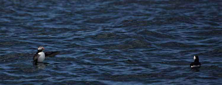
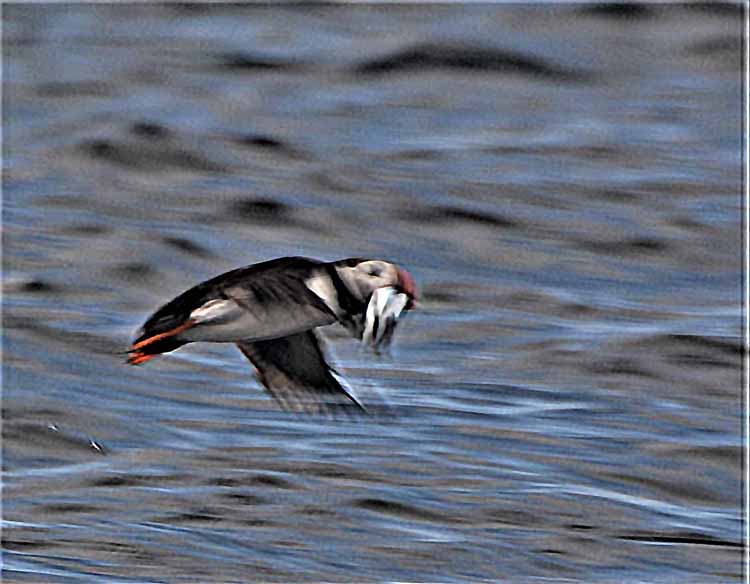
Donelda's Puffin Boat Tours offers rides into the Atlantic Ocean to two islands called Bird Islands where, if lucky, we see glimpses of the Atlantic Puffin, also known as the Common Puffin. The Atlantic Puffin is the smallest of the four types of puffins, weighing less than 20 ounces and standing only 11 inches in height. We were able to see many puffins, but only at a distance since they are elusive, quick to dive underwater and, due to their size, often hidden by the movement of the waves.
What appears to be a very long moustache is actually a fish, or perhaps more than one that the puffin caught.
Some interesting facts about the puffins:
There are 4 types: the Atlantic puffin (the smallest of them, which we see here); the tufted puffin, the horned puffin and the rhinoceros auklet.
The wings beat 300-400 times per minute for a flying speed of 88 kms or almost 55 miles per hour.
They mate for life and return to the same breeding area where they were raised.
They lay one egg only and both male and female share in incubation of 39 to 45 days.
They fledge after about 49 days.
Cemetery on the church grounds overlooking the Barra Strait on the Bras d'Or Lake.
The next community over from Iona is Plaster Cove, and between the two communities is this small picturesque body of water called Plaster Cove Ponds.
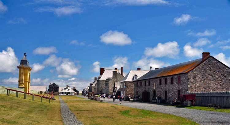
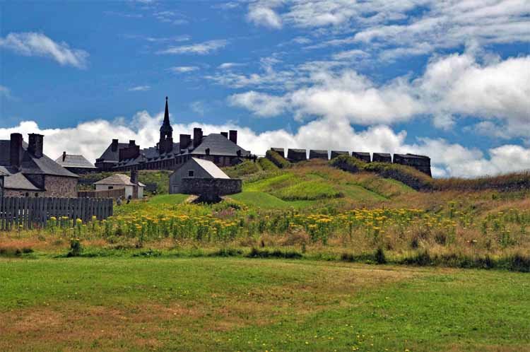
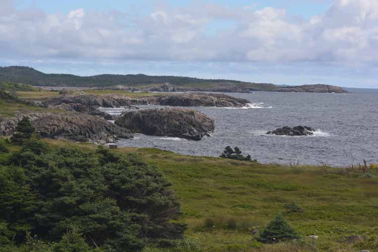
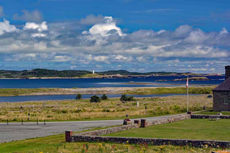
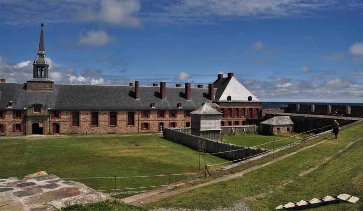
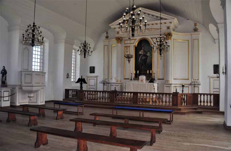
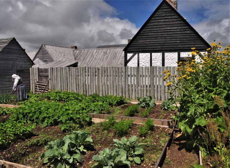
The Fortress of Louisbourg is a reconstructed open-air museum of an 18th century French fortress that played an important part in more than one struggle for what today is Canada. The fortress lies on the eastern coast of the island, facing the Atlantic, and is a National Historic Site. Across the Louisbourg harbor is the lighthouse (pictured below).
St. Colulmba Church is located in Iona, on Cape Breton on a piece of land that lies near the heart of the Bras d'Or Lake.
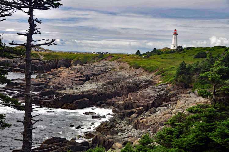
This lighthouse, on Lighthouse Point, across the harbor from the Louisbourg fortress, is the 4th to stand in this spot. It was built in 1923 and is an active lighthouse. The original that stood here was built in 1734 and was Canada's first lighthouse. The setting and the grounds are among the most magnificent in Nova Scotia.
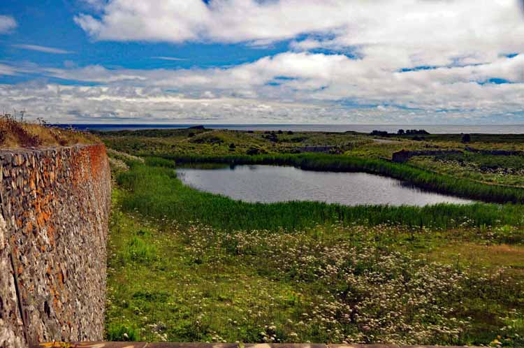
This is a piece of the wall that is a part of the original fortress. Beyond is the Atlantic Ocean.
The lighthouse can be seen across the harbor from the fortress.
Louisbourg, the town
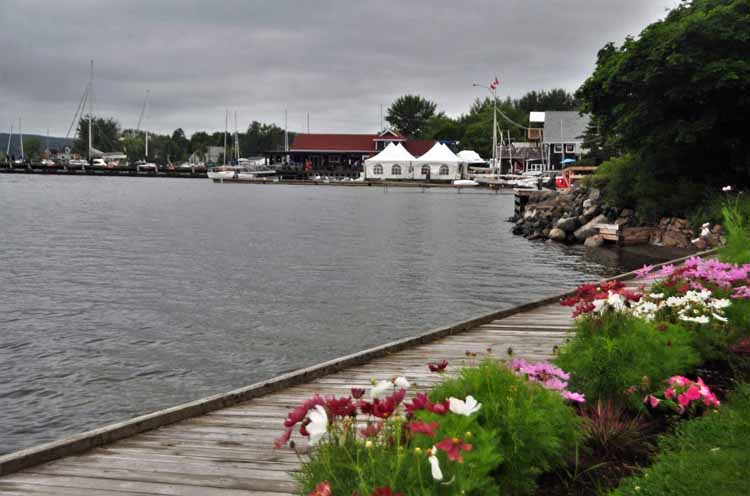
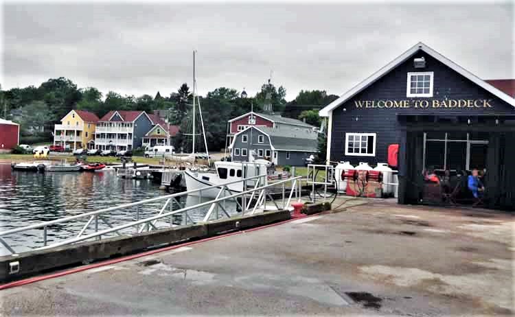
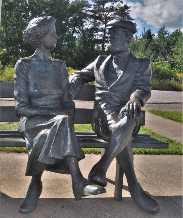
Baddeck is a charming small town at the south end of the Cabot Trail. Its highlight is the Alexander Graham Bell National Historic Site. Bell lived his last 30 years in Baddeck, high on a cliff called Red Head. He and his wife Mabel are buried there on their estate, called Beinn Bhreagh, which means "beautiful mountain in the Gaelic language. The estate is not open to the public. Alexander Graham Bell died in 1923. Mabel died in 1923.
Mabel and Alexander Graham Bell statue on Baddeck's harbor shore
Thank you for visiting these photo pages.
If you're interested in seeing more, please return to my Main Menu at the bottom of my home page and make your selection.
All images within thewanderingchick.com Web site are copyright protected. They may not be downloaded or otherwise copied.
Please contact me if you think a particular photo or set of photos can be used in your publication.
Though it's a pretty boat, it was not the intent of the photo. It just happened to be in the wrong place. Of note is not only the lighthouse in Baddeck's harbor, but the red cliffs in the background to the right. Known as Red Head, the Alexander Graham Bell estate can be seen above the cliffs.
It's known among the locals, and probably most tourists, that Inverness Beach is a top spot for finding seaglass. Needless to say, I had to find out for myself. The thing is, they didn't say how absolutely beautiful a beach it is, even without the seaglass. And yes, I found a few pieces, but not many.
-2022-08-10-can-ns-cabot trail- ingonish ferry road.jpg)
-2022-08-09-can-ns-cabot trail -ingonish beach.jpg)
-2022-08-09-can-ns-cabot trail-ingonish beach.jpg)
2022-08-12-cabot- st margaree.jpg)
.jpg)
2022-08-12-cabot- st margaree.jpg)
-cabot trail - grand etang harbor.jpg)
.jpg)
2022-08-12-cabot- along the cabot trail.jpg)
-2022-08-12-cabot- along the cabot trail.jpg)
-2022-08-12-cabot- along the cabot trail.jpg)
2022-08-12-cabot- along the cabot trail.jpg)
2022-08-12-cabot-pleasant bay.jpg)
2022-08-12-cabot-pleasant bay.jpg)
2022-08-12-cabot-pleasant bay.jpg)
2022-08-12-cabot-on the road to meat cove.jpg)
2022-08-12-cabot-on the road to meat cove.jpg)
2022-08-12-cabot- meat cove.jpg)
2022-08-12-cabot- meat cove.jpg)
2022-08-12-cabot- meat cove.jpg)
2022-08-12-cabot- meat cove.jpg)
2022-08-12-cabot- meat cove.jpg)
2022-08-12-cabot- bay st lawrence.jpg)
2022-08-13-donelda's puffin tour.jpg)
2022-08-13-donelda's puffin tour.jpg)
2022-08-13-donelda's puffin tour.jpg)
2022-08-13-donelda's puffin tour.jpg)
2022-08-13-an-nas-iona on unnamed island.jpg)
2022-08-13-an-nas-iona on unnamed island - Copy.jpg)
2022-08-13-an-nas-iona on unnamed island.jpg)
2022-08-13-an-nas-iona on unnamed island.jpg)
2022-08-13-an-nas-iona on unnamed island - Copy.jpg)
--2022-08-11--can-ns-louisburg lighthouse.jpg)
--2022-08-11--can-ns-louisburg lighthouse.jpg)
--2022-08-11--can-ns-louisburg lighthouse.jpg)
--2022-08-11--can-ns-louisburg lighthouse.jpg)
--2022-08-11--can-ns-louisburg lighthouse.jpg)
--2022-08-11--can-ns-louisburg lighthouse.jpg)
-2022-08-09-can-ns-baddeck.jpg)
.JPG)