the wandering chick
...Moab
and around
The city of Moab and its surroundings have a lot to offer, if you have free time after seeing the national parks. In any direction, there is something you'll be glad you saw.
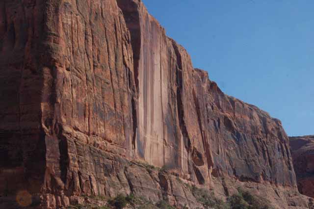
Particularly scenic is SR-128 which travels northeast out of Moab to the ghost town of Cisco, just off Interstate 70.Because it follows the route of the Colorado River, the locals call it "the river road." It's winding and narrow, but the scenery is filled with the deep red rock formations that are splendid. Even National Geographic has taken notice.
And Moab, the town itself, has a small but interesting section of downtown with a few enjoyable galleries.
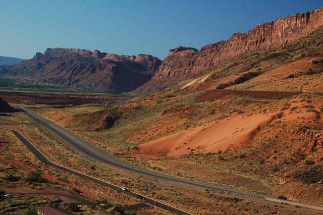
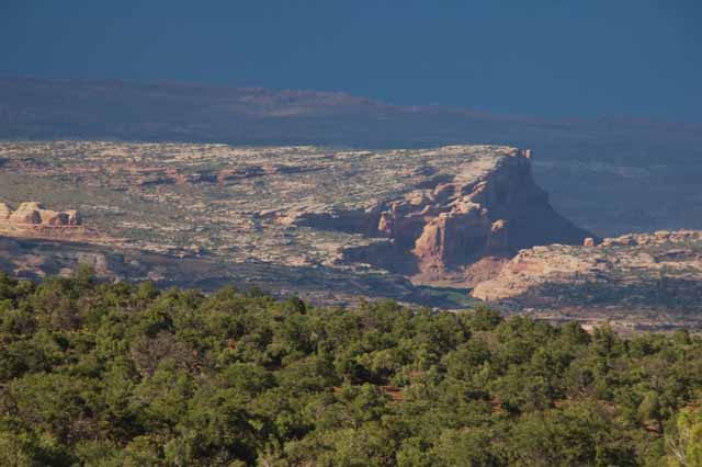
The landscape just outside Arches National Park is spectacular. You see two roads. The one closest to the mountains is SR-191. The one on the left is the smaller access road that goes into Arches NP. The shot was taken from a pullover on the switchbacks after just entering Arches.
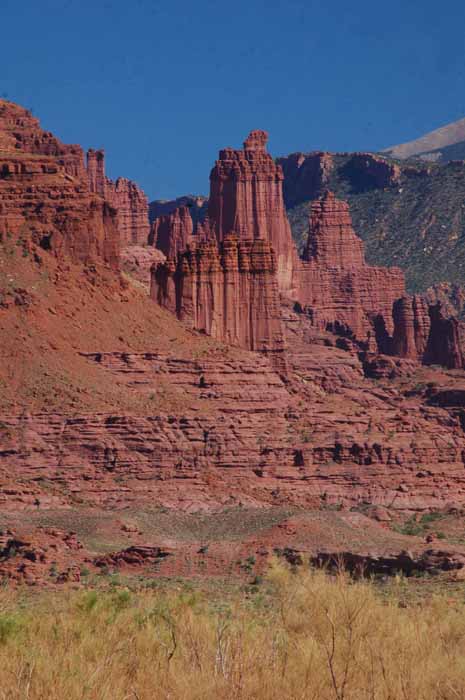
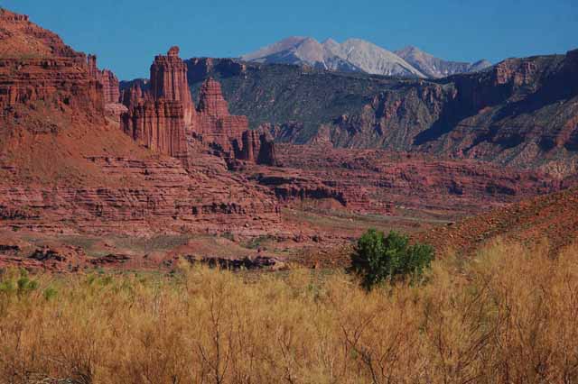
Above and Left: Made of the red sandstone, Fisher Towers stand majestically above the SR-128 scenic byway.
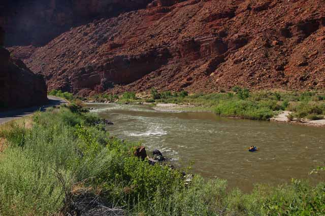
Above: The Colorado River escorts the SR-128 into Moab.
Below: The SR-128 scenic byway includes not only the red sandstone, but also Entrada rock such as this.
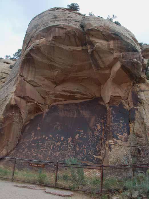
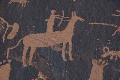
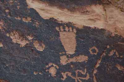
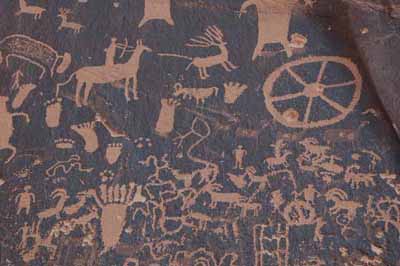
The petroglyphs on Newspaper Rock date back 2000 years. The Navajo call the rock Tse Hane....the rock that tells a story. Hence, Newspaper Rock. It's located off Highway 191, on the road that leads to the Canyonlands' Needles Overlook. Below are closeups of the petroglyphs. To date, there are no known ways of deciphering their meaning nor their age.
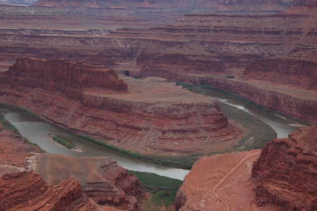
Overlooking the canyon and the Colorado River at Dead Horse Point State Park. The park is so named because the area which ju
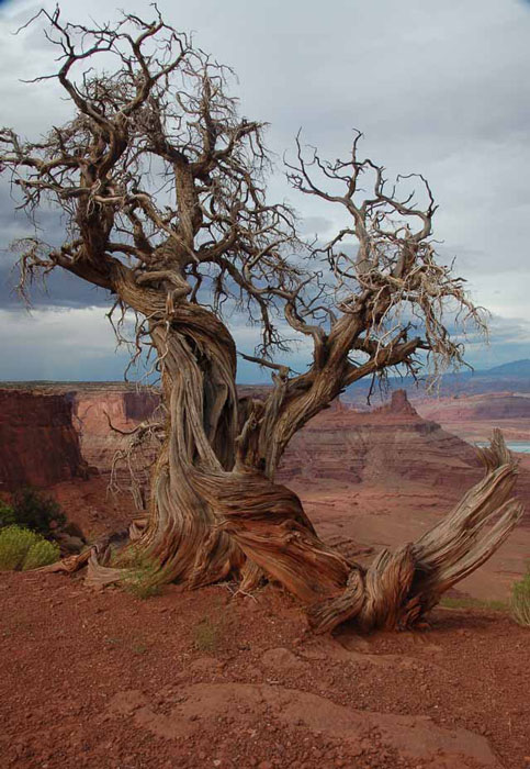
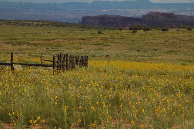
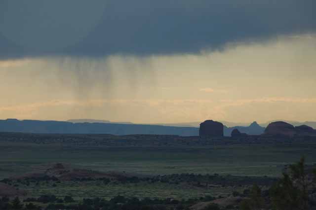
To have the pretty flowers, you have to have some rain, and this area doesn't get much. So, it's probably welcomed by all but the tourists.
ts out over the canyon was used by ranchers in the 1800s to round up their horses. They would use the point as a natural corral. When the sight was abandoned, many of the horses, for reasons unknown, wouldn't leave. They died of thirst and starvation.
Dead Horse Point was also used in the last scene of the 1991 movie "Thelma and Louise."
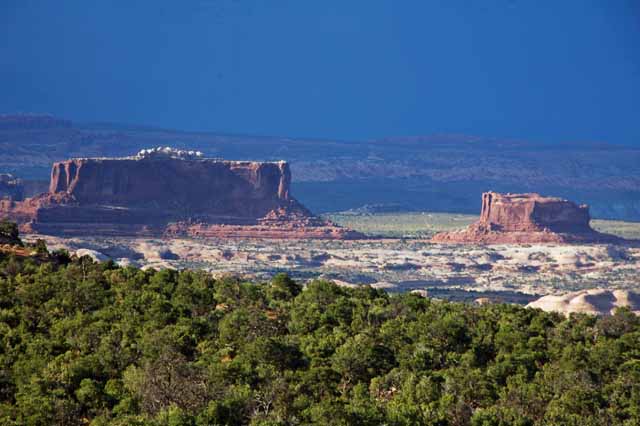
The Merrimac (on the left) and Monitor Buttes were named after the Civil War ships of the same name due to their striking resemblance. They sit prestigiously off Highway 313 near Dead Horse Point State Park and on the main road into Canyonlands Natl Park.
To view more of Utah's stunning parks and byways, return to the Utah home page.
Or, choose a different destination from below.
Thank you for visiting these photo pages.
If you're interested in seeing more, please return to the Main Menu at the bottom of my home page and make your selection.
All images within 'The Wandering Chick' Web site are copyright protected. They may not be downloaded or otherwise copied.
Please contact me if you think a particular photo or set of photos can be used in your publication.