the wandering chick
Leg 3 - Bend to Albuquerque
...A summer road trip
includes sights all along the way
This wonderful journey I have been on for the last two months is nearly at its end. When I think back to the sights I've seen and the days I've spent with friends witnessing what even this small portion of our world has to offer, I feel incredibly blessed. I head for home knowing I saw only a small portion of what was there for the taking, but even I, as much as I enjoy traveling, am ready to be home.
But I didn't pass up much that was in my path as I traveled east on Oregon's Highway 20 to the Idaho border, and then to a few sights in Twin Falls, Idaho. Once I pulled in to Albuquerque, a friend took me to a splendid area west of the city that I had not seen before.
If you've stayed with me through all these pages and pages of photos, you deserve kudos. Thank you. I hope they have inspired those of you who can go and see, to do so. And if you can't, I hope they have made you feel as if you have.
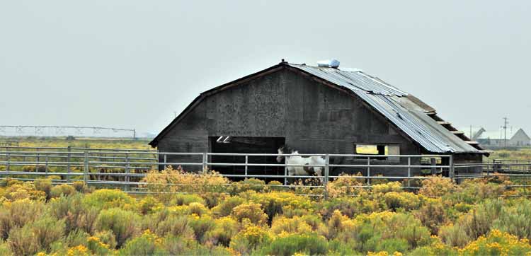
How fitting that I would see on my final leg of this whole trip yet one more barn. It wasn't too far out of Bend on the Highway 20 heading east.
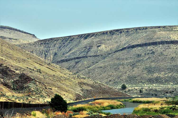
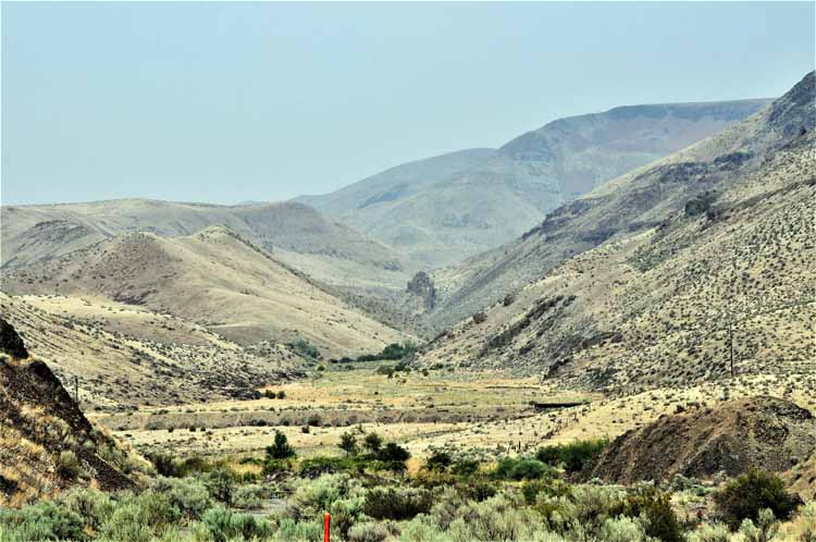
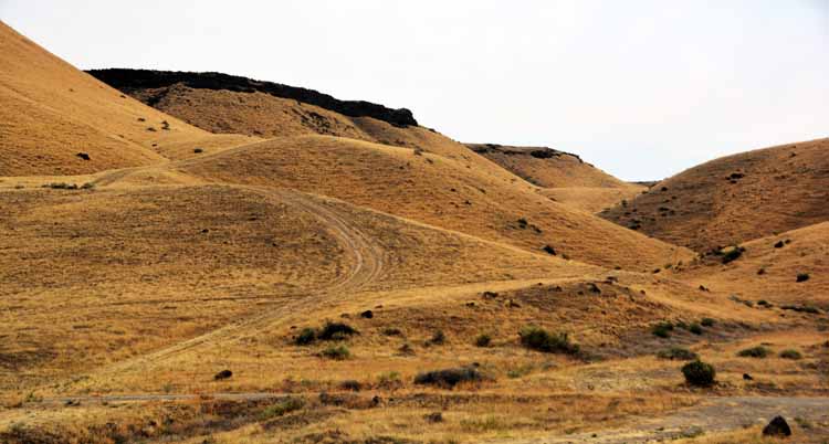
Most of these next few shots were taken in Oregon's Malheur County. The Malheur River began to parallel the highway, often crisscrossing it from one side to the other.
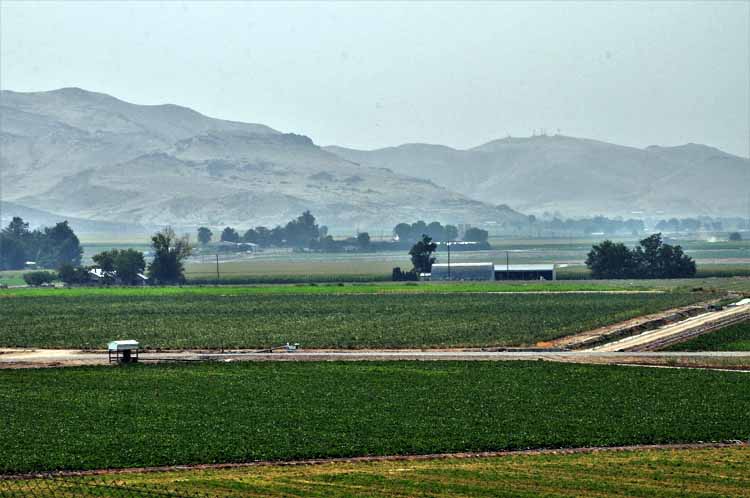
The terrain in the area was "soft" mountains of high desert brush. Before reaching the Idaho border, the landscape changed from high desert to agriculture. Malheur County is the state's highest producer of onions, sugar, beets and alfalfa hay.
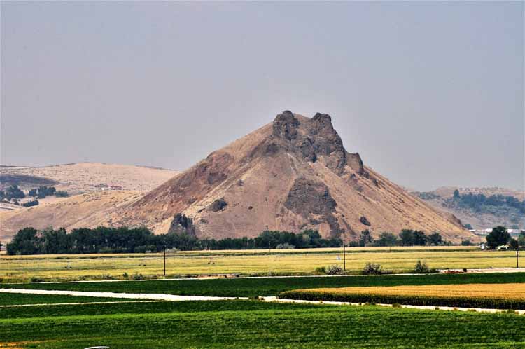
Malheur Butte is an inactive volcano that sits in Maulheur County just off the highway 20 and close to the Malheur River. It rises slightly more than 2600 feet.
In the town of Hammett, Idaho, I saw a sign leading to Bruneau Dunes State Park. I could see the backside of the dunes, and it looked intriguing. However, when I saw the next road sign that said it was 16 miles in, I decided to pass them up. But before I turned around, I got a couple shots of the Snake River, the fourth largest river in the U.S. The Snake River starts at Yellowstone Natl Park and runs 1,078 miles through Wyoming, Idaho, Oregon and Washington before emptying into the Columbia River in Washington.
.JPG)
.JPG)
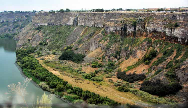
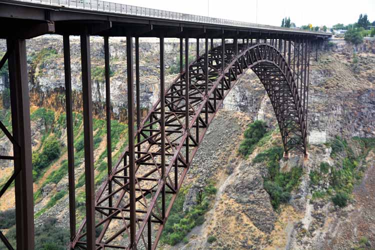
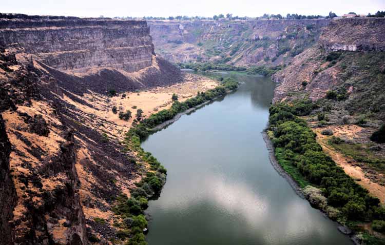
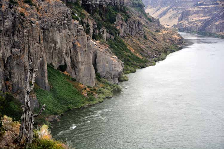
A fascinating stop in Twin Falls was the I.B. Perrine Bridge and gorge. The I.B. Perrine Bridge spans the amazing Snake River Canyon as it cuts through the northern end of the town. It bridge
is 1500 feet long and offers a series of overlooks on both north and south sides of the bridge. In 1974, Evil Knievel unsuccessfully
tried jumping the canyon with is 'skycycle.'
I.B. Perrine was a prominent farmer and businessman who lived from 1874 to 1943 and is considered
the founder of Twin Falls.
.JPG)
.JPG)
.JPG)
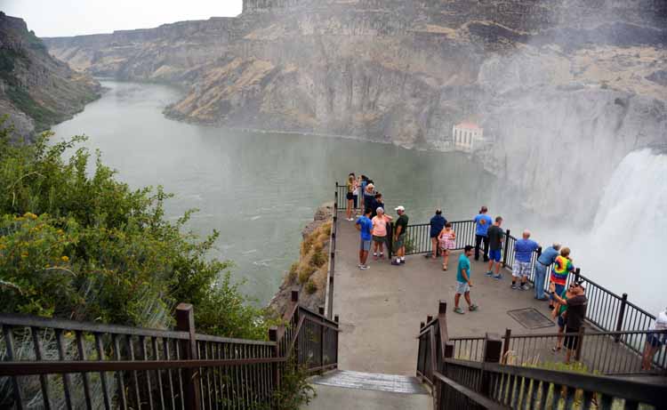
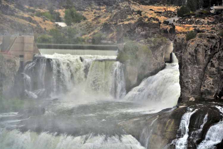
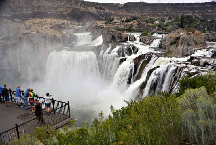
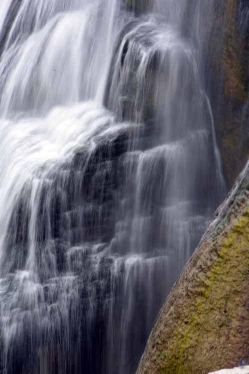
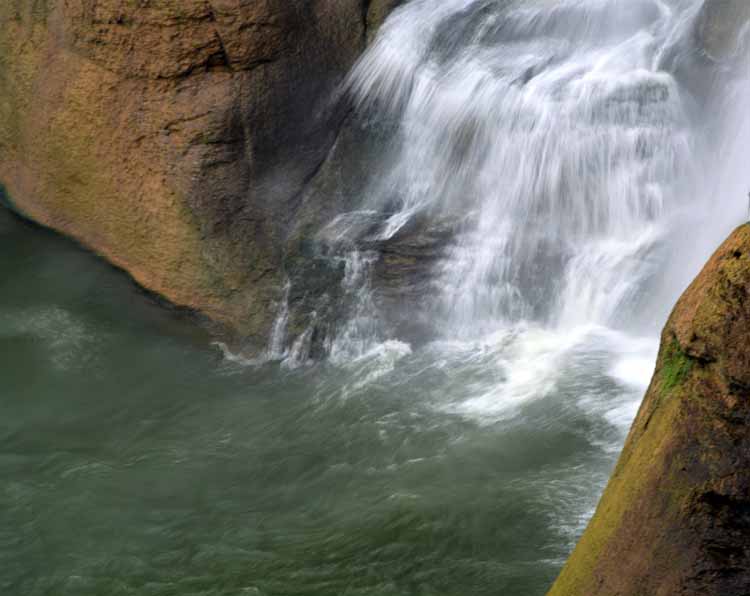
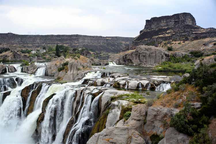
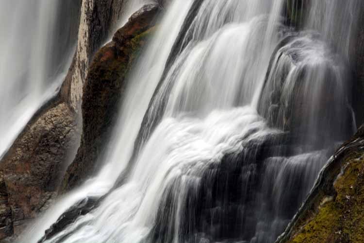
The Shoshone Falls is one of the largest natural waterfalls in the U.S. It's considered the Niagra Falls of the West, and as you approach its mighty
width, you understand why. Nine-hundred feet across and a 212-foot drop, the magnitude is startling. Spray fills the air as the water
from the Snake River seems to be gushing in a hundred different places, along side quiet little streams that are no less impressive. Anyone
who is in the near vicinity of Twin Falls should not miss this magnificent and picturesque sight.
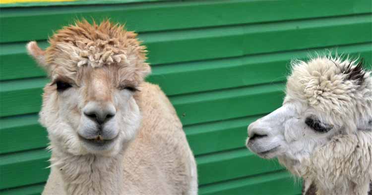
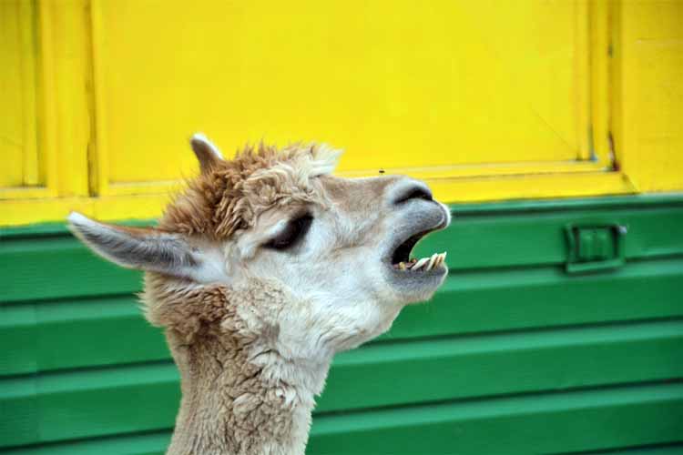
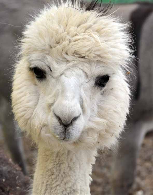
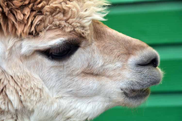
Alpaca, donkeys and sheep create smiles at a remote gas station off Interstate 84 in Sublett, Utah. Drop in for seeing the animals, not to get
gas...unless you're absolutely on fumes. The station's gas prices are near gouging (they were when I was there), and reasonable deals are not that far off in either direction.But then, perhaps we're paying for the entertainment.
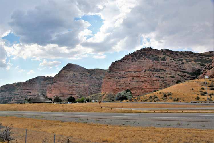
I knew at some point I'd have to get on an interstate, so I succumbed in Utah and rode out the I-84 and I-80 through the southern portioin of Wyoming and then the I-25 down to Albuquerque. As scenic as it was, these next few shots were the only ones I was able to get, such is driving an interstate.
Friends who are viewing the pictures of this trip may wonder why I have ended it in Albuquerque, knowing my home is in Texas. After taking in the Albuquerque excursion with a friend, I put my camera to rest. I have traveled several times the route from there to south Texas. And there ain't much to see.
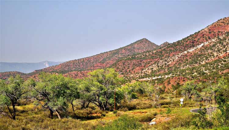
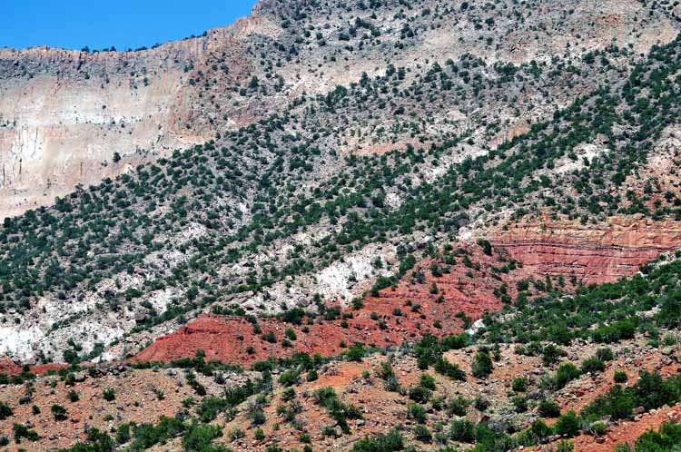
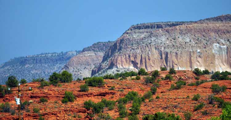
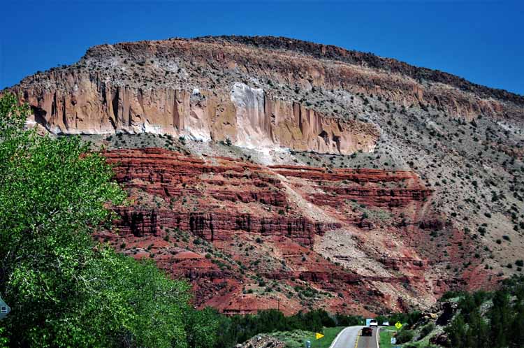
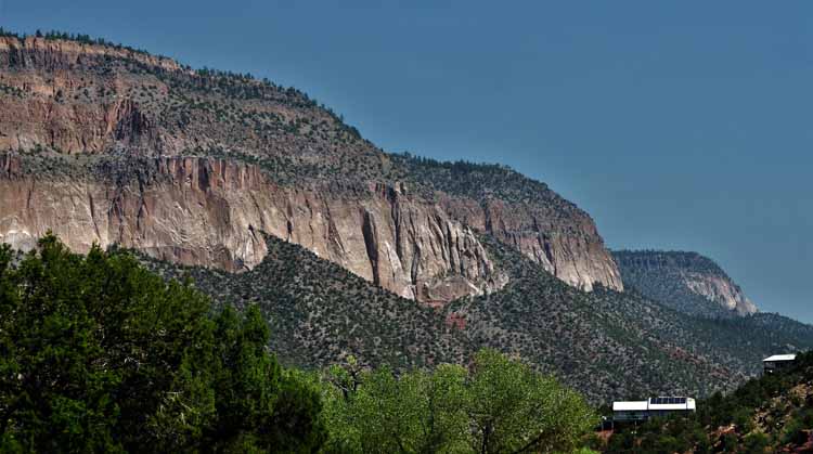
My friend living in Albuquerque took me on a day trip to a super cool area outside Albuquerque to the village of Jemez Springs and to the
Valles Caldera National Preserve. We made a short stop at Zia Pueblo to get up close and personal to the beautiful red rock in the area (pictured here), then stopped in Jemez Springs to visit the
galleries and gift shops that line the highway.
This is one of several shops in Jemez Springs.
The Jemez River flows at the foot of the mountains behind Jemez Springs, a village of less than 500 residents.
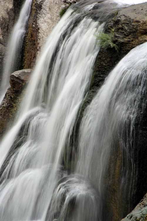
Soda Dam is the result of underground hot springs that have built up and formed an interestingly unique natural dam that blocks the flow of the Jemez River.
.JPG)
.JPG)
.JPG)
.JPG)
.JPG)
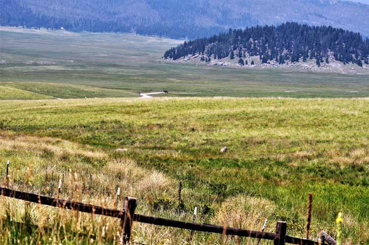
Well before Valles Caldera was established as a national preserve in the year 2000, scientists and researchers were visiting the land to study geology
and volcanic activity. Valles Caldera was formed more than a million years ago when a series of volcanic eruptions in the Jemez Mountains occurred. The
eruptions are said to have been 300 times greater than that of Mount St. Helens.
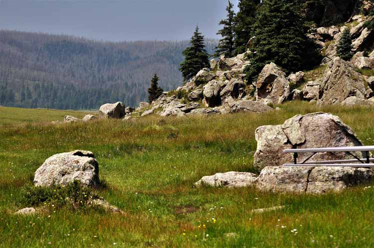
Visitors to Valles Caldera are actually standing in a sunken volcano.
After the eruptions occurred, a bowl-like depression (a caldera) was formed. As the molten
rock started falling back into the caldera, a central dome, called Redondo Peak, emerged. Today, the 12 miles of grassland that make up the preserve
may not appear to be the result of volcanic activity, but the presence of hot springs in the area indicates that the caldera is still part of an active system.
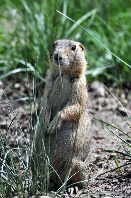
Hmmm. Perhaps he thinks he's hidden?
About half-a-dozen swallow nests had been built in the rafters of the Visitor Center's front porch. This one had four hungry babes.
.JPG)
.JPG)
.JPG)
.JPG)
.JPG)
.JPG)
.JPG)
.JPG)
.JPG)
.JPG)
.JPG)
.JPG)
.JPG)
.JPG)
.JPG)
.JPG)
.JPG)
.JPG)
.JPG)
.JPG)
.JPG)
.JPG)
.JPG)
.JPG)
.JPG)
.JPG)