the wandering chick
...Kremmling, CO
and the surrounding area
The town of Kremmling, population around 1500, is located pretty much in the middle of nowhere. Steamboat Springs is 50+ miles northwest; Grand Lake is 40 miles northeast. Other smaller towns such as Hot Sulphur Springs and Granby are closer. But, the scenery and terrain in this Grand County town in north central Colorado is some of the most spectacular I've seen. Wonderful yelllow-gold meadows abound around every corner, and the mountains of the more southern parts of Colorado can be seen in the distance. There is an endless number of hikes and scenic drives to be had, and Kremmling turned out to be the perfect hub for them.
The town was established during the boom days, but there were not enough minerals in the mountains to sustain it for any length of time. Ranching became the main industry. It's also along the route of the Colorado River Headwaters Scenic Byway, bringing in tourists and sightseers from everywhere.
Towering over the town are the Kremmling Cliffs, a sandstone formation that runs half the length of the town.
This old barn sits in a vacant lot across from the grocery store and gas station. In the background is the Gore Pass on State Route 134.
I arrived in Kremmling on a Saturday, and it was the last weekend of the rodeo at the fairgrounds. So, I wandered over to see what was happening. Well, the most exciting thing I came across were these beautiful and rare show birds. This one is called a White Silkie.
I was trying to get pictures of the birds through the cage when a teen came up and asked if I wanted him to take them out of the cage for better pictures. Of course, I said yes. I got names for most of them, but for this one and the one on the right, I did not. If anyone looking at these pages can identify them, I'd be grateful if you could email me with the names.
This guy (or gal) is not just having a bad hair day....that's just the way it was made. It's called a Red Frizzle, and I'm not making this up.
More white silkies
A Sultan. Notice the feathered feet.
This is a BlackPolish, and yes he does have eyes. These birds are of European descent, but not Poland. They actually originated in The Netherlands.
Sunset between the aspens, taken at the RV park.
County Road 22 which originates just behind the RV park where I'm staying travels for some 10 miles or so before becoming a dirt road. It was a pleasant drive, little traffic, so I was able to stop often for photos. The next several shots were taken along the C22.
Gore Pass in the background, taken from the County Road 22
To view more photos of my summer in Colorado, please return to the Colorado home page.
Or, you may wish to choose a location below.
Thank you for visiting these photo pages.
If you're interested in seeing more, please return to the Main Menu at the bottom of my home page and make your selection.
All images within 'The Wandering Chick' Web site are copyright protected. They may not be downloaded or otherwise copied.
Please contact me if you think a particular photo or set of photos can be used in your publication.
On the Highway 40 just east of Kremmling is this conglonmeration of barns and fences, once certainly with a busy and healthy life. It sits down in the valley between the highway and the creek that runs behind it. As I was overlooking it and taking pictures, someone in the truck (the photo on the left) was coming up the road. The driver, whose father still lives in the brown building, struck up a conversation. We talked, mostly about the sights of Colorado, at length. The name of this wee village: Troublesome.
In earlier days (the town was established in the late 1800s), the little bulding on the left side of the road was the post office. The postmaster would walk to the railroad tracks (seen going across the middle of the photo) each day as the train came through to pick up and drop off mail.
Byers Canyon is a short gorge on the Highway 40 between Kremmling and Sulpher Hot Springs. The Colorado River flows through it.
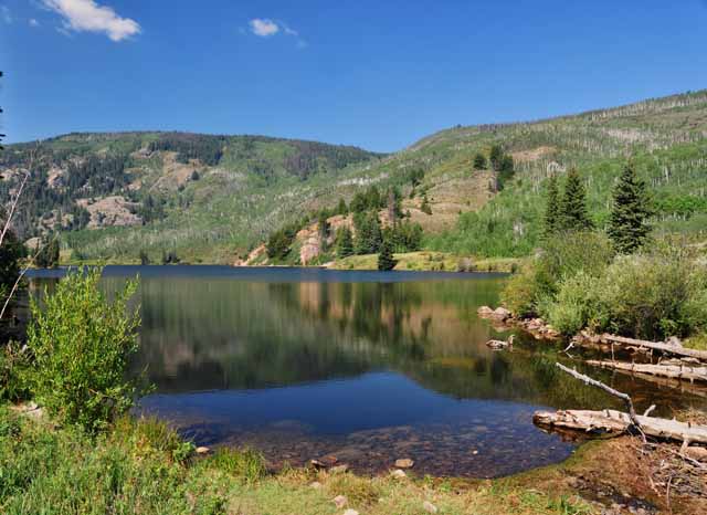
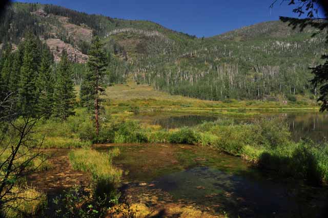
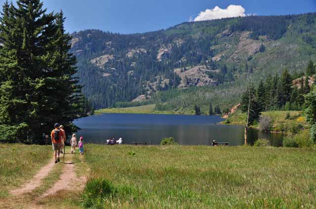
There's a wonderful and beautiful loop trail, about 2 miles, around the Lower Cataract Lake which is some 12 or 15 miles from Kremmling. The trail meanders through aspen stands, pine forests and a meadow which in the spring is filled with wildflowers. It's located in the Eagle's Nest Wilderness Area of the White River National Forest. In the distance, the Eagle's Nest, a 13-er, can be seen. On the day I did the hike, smoke from Idaho fires diminished the views somewhat.
Since the sun was hitting the Kremmling Cliffs so nicely, I took one more shot of them before departing town.
The folks of Kremmling seem pretty proud of this old smithy. The little white sign on the right side of the doors says it was erected in 1885, so they should be proud. However, only the facade is left standing; the rest of the building is long gone. A passerby resident told me the guys from the bar next door go back behind the facade and play horseshoes.
A glimpse of the Eagles Nest can be seen here from the highest point along the Lower Cataract Lake Trail.
.jpg)
.jpg)
.jpg)
.jpg)
.jpg)
.jpg)
.jpg)
.jpg)
.jpg)
.jpg)
.jpg)
.jpg)
.jpg)
.jpg)
.jpg)
.jpg)
.jpg)
.jpg)
.jpg)
.jpg)
.jpg)
.jpg)
.jpg)
.jpg)
.jpg)
.jpg)
.jpg)
.jpg)
.jpg)
.jpg)
.jpg)
.jpg)
.jpg)
.jpg)
.jpg)
.jpg)
.jpg)
.jpg)
.jpg)
.jpg)
.jpg)
.jpg)