the wandering chick
...Prince Edward Island
where the countryside outdoes even the lighthouses
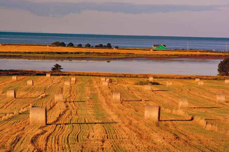
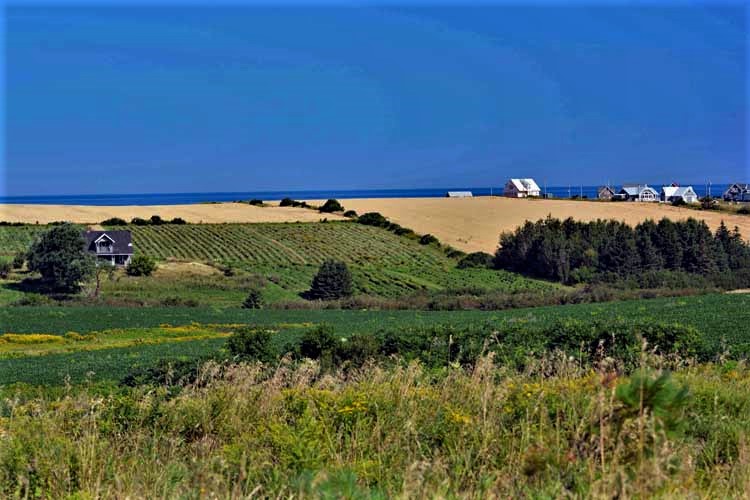
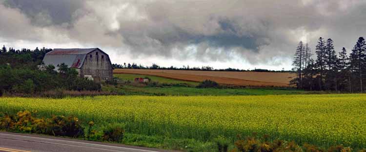
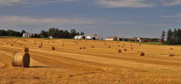
That's what I found most endearing about Prince Edward Island: the simple countryside. Blankets of neatly cropped farmland, vast wheat fields dotted with freshly-cut hay bales that can be seen all the way to the blue water's edge.
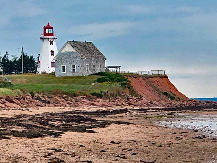
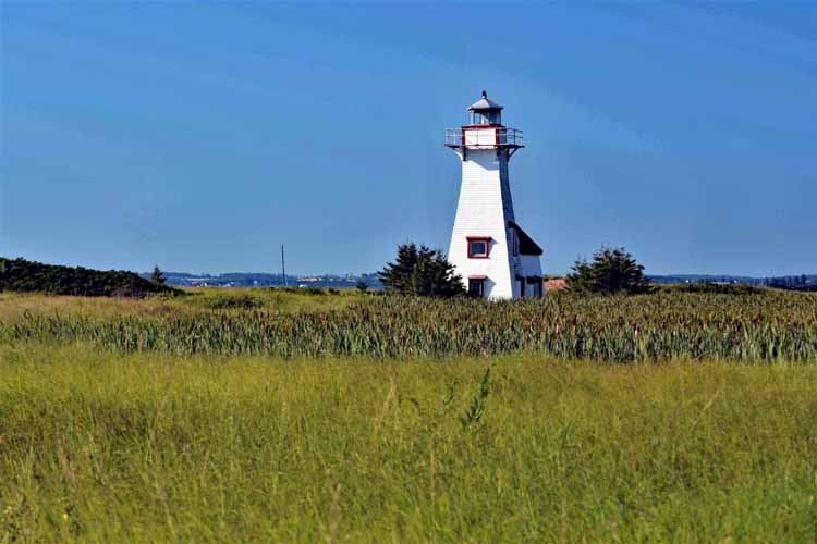
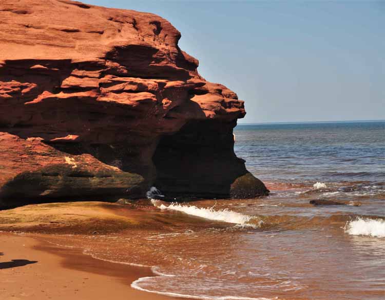
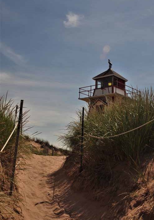
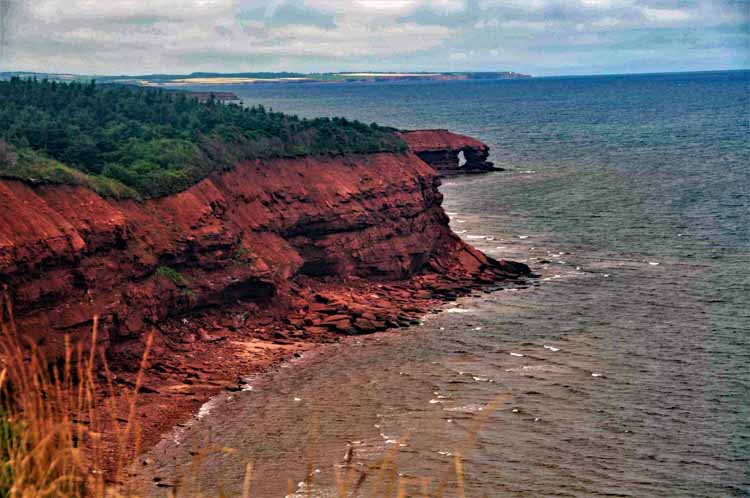
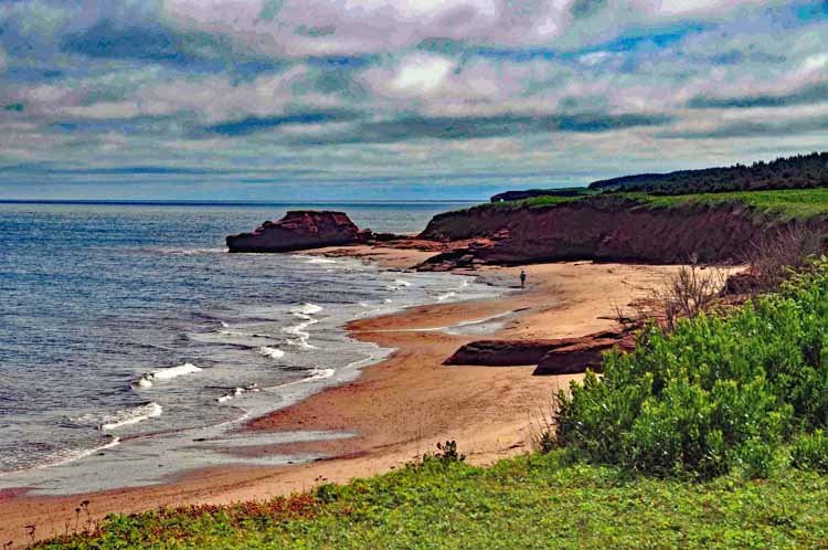
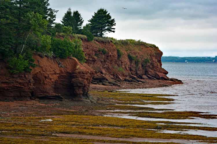
Lighthouses abound. I saw many; colorful harbors, vast beaches, rocky cliffs, sandy dunes...the sights go on and on.
P.E.I. is reached by ferry or bridge from Nova Scotia. It's part of Canada's maritime provinces along with Nova Scotia and New Brunswick. It's the smallest of the three, but still has a total coastline of some 1100 miles (1800 km). Most of the island is within 10 miles of a large body of water, and much of it within five miles. It sits mostly in an east-west direction with 140 miles (225 km) from the most western side to the most eastern. The driving distance is much longer due to detours around the bodies of water. The distance at its fattest north to south area is almost 40 miles.
It sits in the Gulf of St. Lawrence, surrounded by New Brunswick, Nova Scotia, Newfoundland and Quebec, pocket-size in comparison.
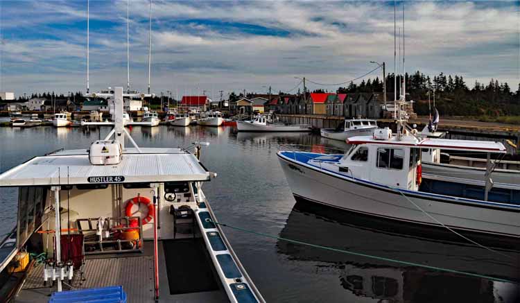
So, it's no wonder that the fishing industry is one of its top economic features along with agriculture and tourism.
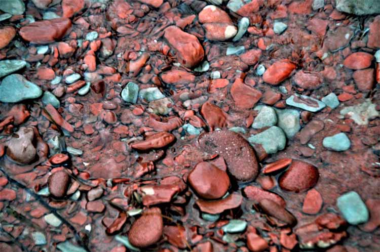
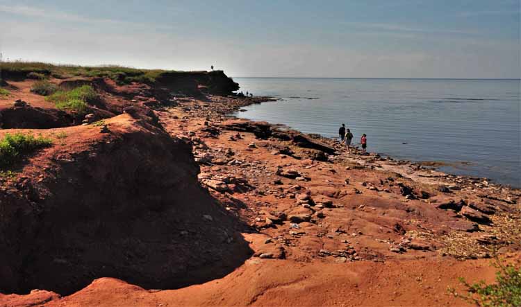
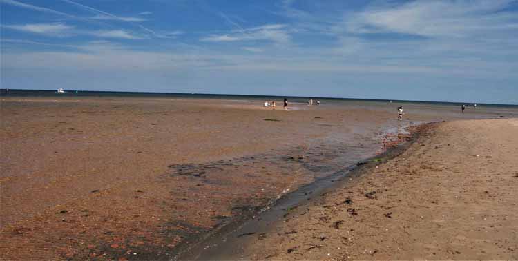
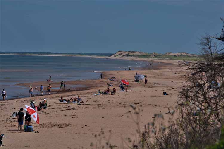
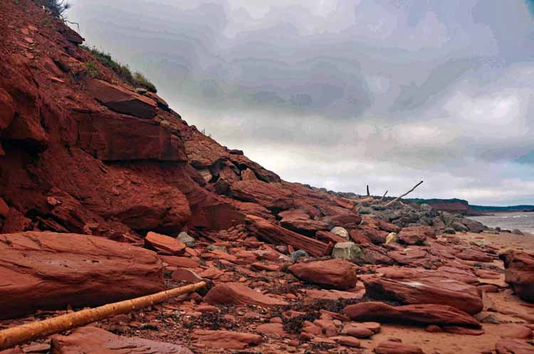
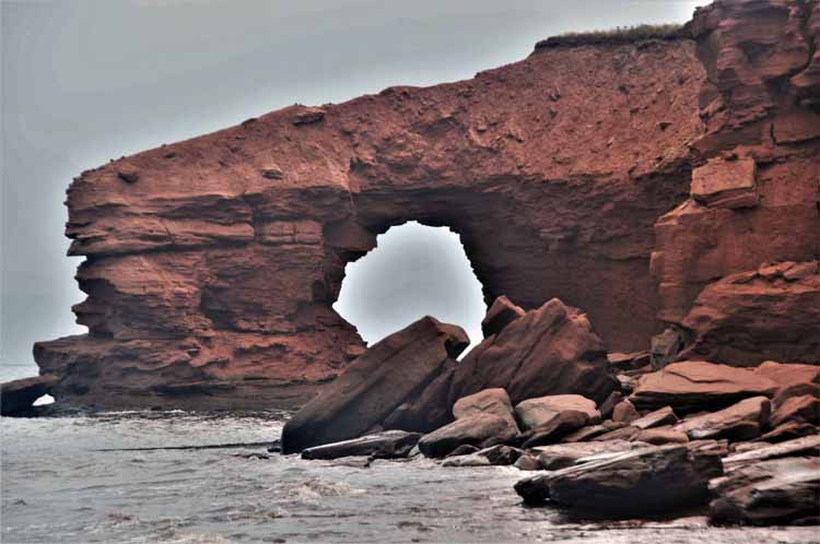
I saw as much as I could, traveling to the four corners. My second favorite sight has to be the beaches that make up the P.E.I. National Park on the north side of the island. Simply exquisite. But then there's also the 63 lighthouses (not that I saw all of them) and the many colors of rocks on its shores....hmmm. Looks like I had many favorites!
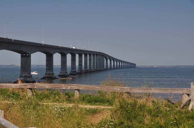
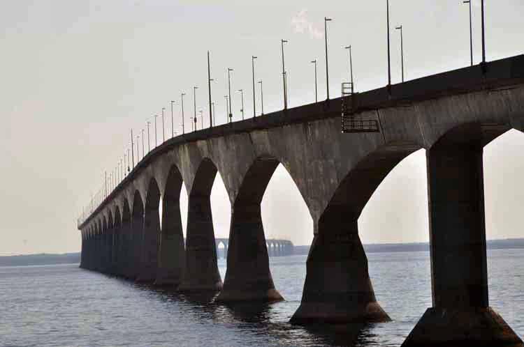
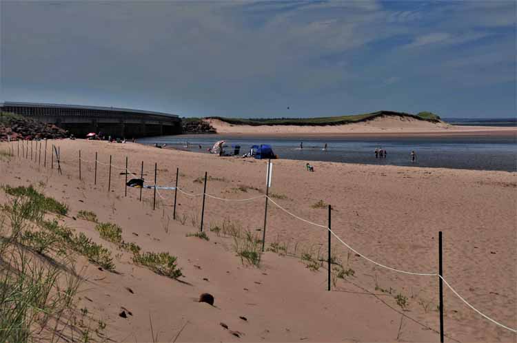
Confederation Bridge is an eight-mile connector from Nova Scotia to Prince Edward Island, crossing the Northumberland Strait on the south side of PEI.
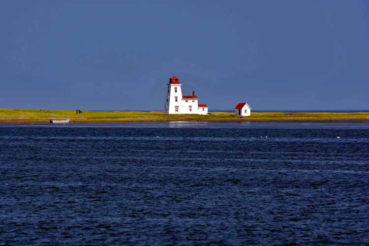
A privately-owned lighthouse and island off the coast from Northport. It's only accessible by boat and not open to the public.
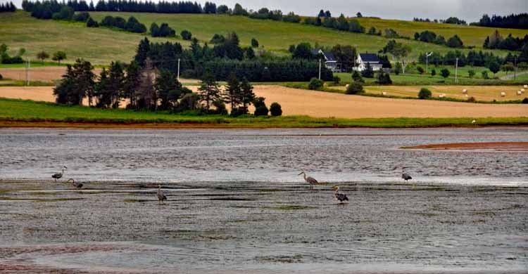
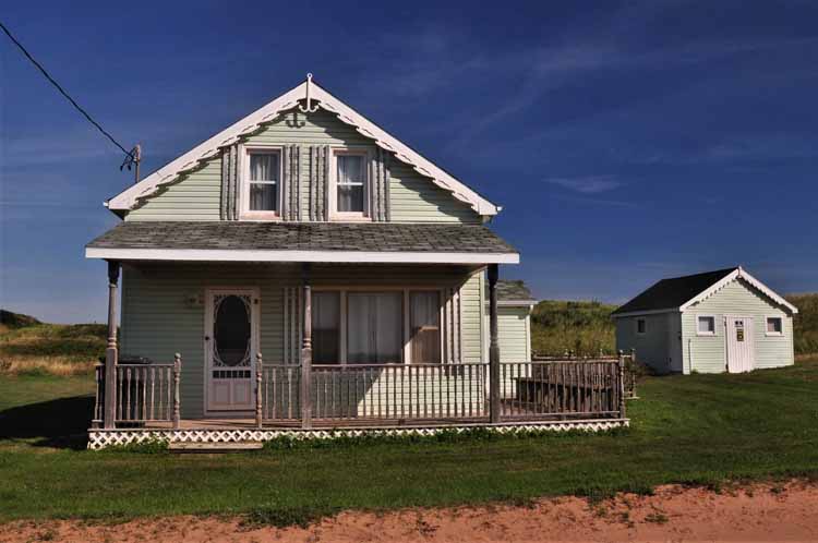
Thunder Cove Beach, on PEI's north shore
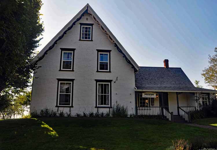
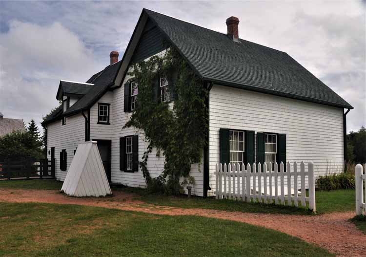
The home above, built in 1872, is now the Anne of Green Gables Museum, located in Kensington. It belonged to the aunt and uncle of Lucy Maud Montgomery, the well-known author of the fictional Anne of Green Gables series. Lucy Maud spent much time here where her writings were inspired. The museum holds many artifacts that belong to the author.
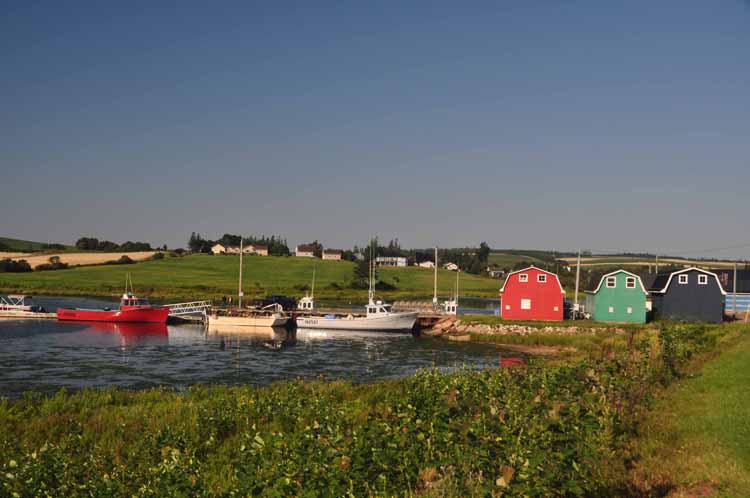
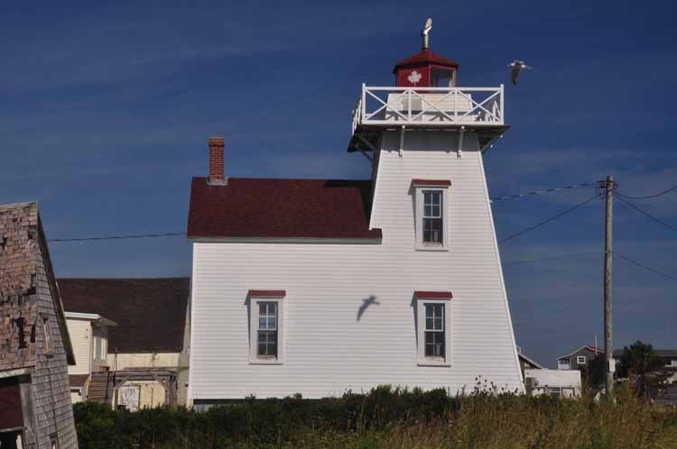
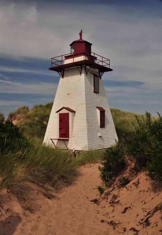
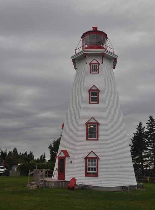
My intent on tackling P.E.I. was to see the four corners and as much of the interior as possible. Seeing the interior wasn't hard to do since there are few straight roads on the island that are of any length. Due to bays and coves and inlets that one must "detour" around, using the interior roads was the only option. Lucky for me. My first drive was the North Cape Coastal Drive which took me up to the most northwestern corner of the island, North Cape. It wasn't particularly picturesque, but, once again, the journey there was great. Above and below is the community of French River, and the lighthouse to the left is the New London light, both on the north central shore of the island.
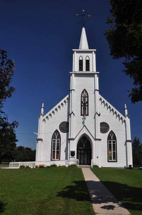
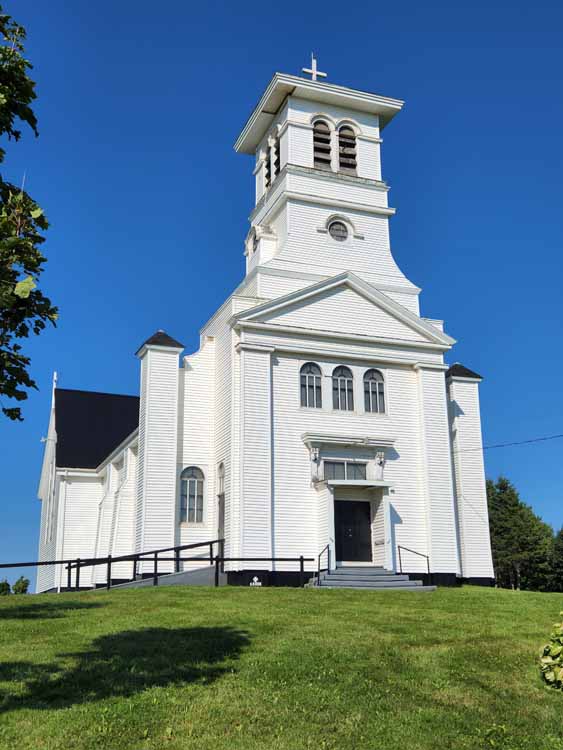
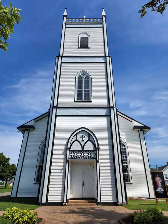
The United Church of Canada, Malpeque
North Cape is the most northern point on P.E.I., located on the northwestern tip. There's a (hardly picturesque) lighthouse there, but not much else.
Above and left: the countryside on the way to North Cape
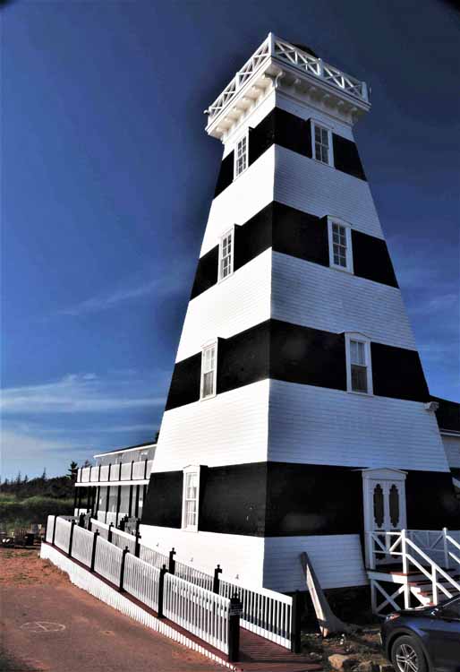
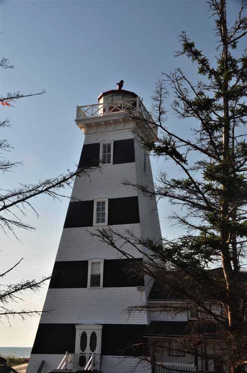
From Cape North I headed directly south to the southwestern corner of the island to the Cedar Dunes Provincial Park and this, the West Point Lighthouse. Completely different from all the rest on the island, its black and white bands are a nice change. The lighthouse, the tallest on the island and built in 1875, has a museum and, as well, rooms for overnight stays.
A section of Cedar Dunes Provincial Park
St. James Catholic Church, Summerfield, off the Highway 2 east of Kensington
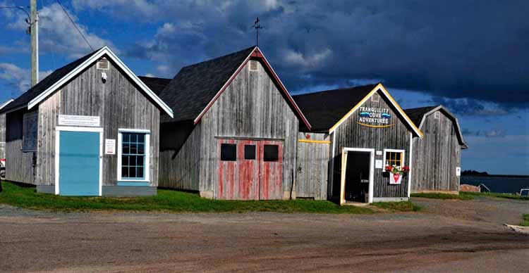
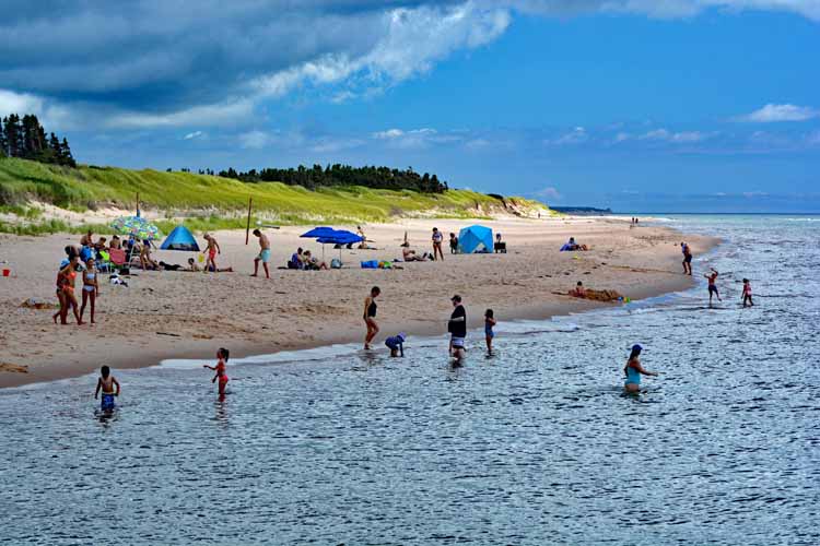
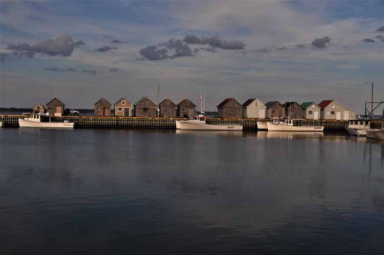
North Rustico is a delightfully picturesque fishing community with a fun harbor and great restaurants and galleries. It's located on the north central shore, overlooking the St. Lawrence River and is the western entrance to the Prince Edward Island National Park, a 37-mile coastline known for its pristine beaches. The next several shots were taken at North Rustico.
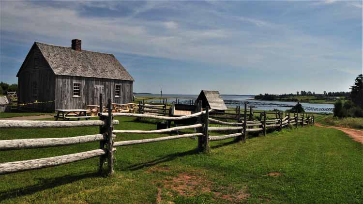
This, the Doucet House, is believed to be the oldest house on P.E.I. The house has the original frame, which was built in 1768 by local Acadians, but was restored and moved to this pictuesque setting in Anglo-Rustico. It is named after the first inhabitant, Jean Doucet.
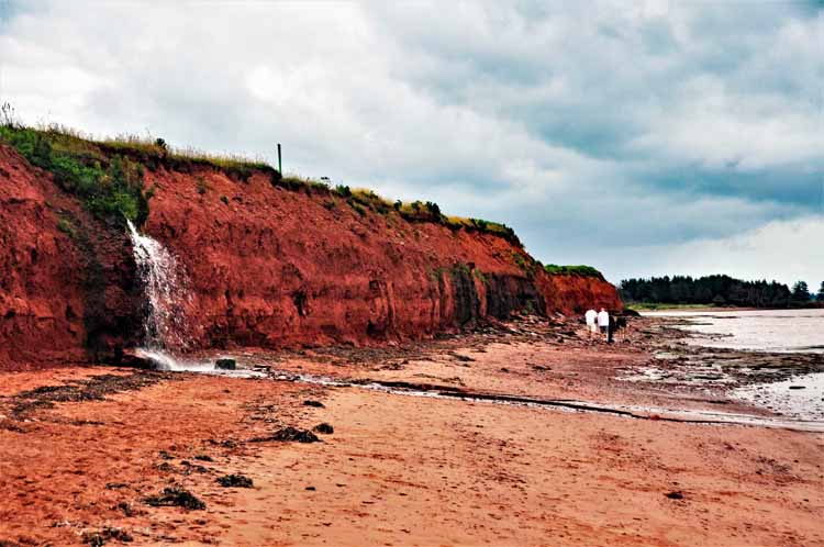
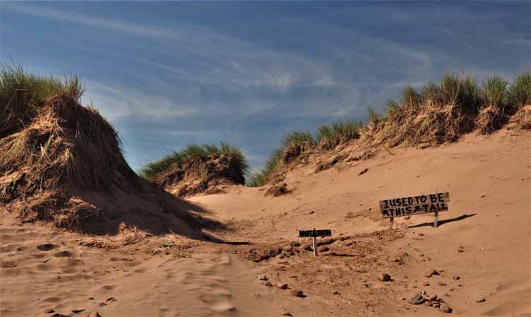
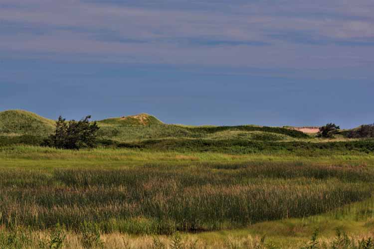
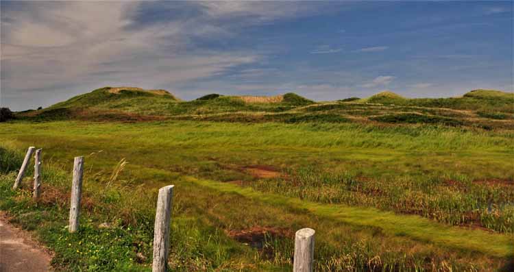
The Islanders are very protective of their sand dunes, and rightfully so. Reminders are frequent that the dunes are natural habitats for sea life, but equally important is that they act as barriers between their land and the sea. The dunes are extremely susceptible to erosion caused not only by strong winds, but simply by people walking over them since they have little vegetation to hold them together, This reminder at North Rustico is a little more humorous than the official provincial law signs.
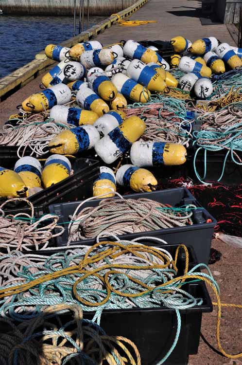
Oh buoy!!!
Church of St. Augustine, the oldest Catholic Church on P.E.I. that is still operating. It's located in Anglo-Rustico.
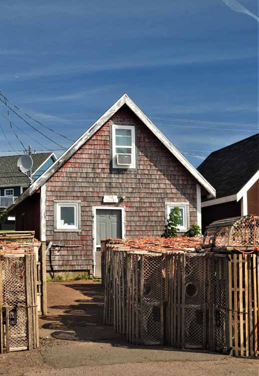
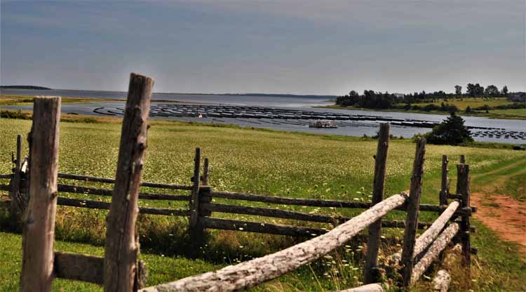
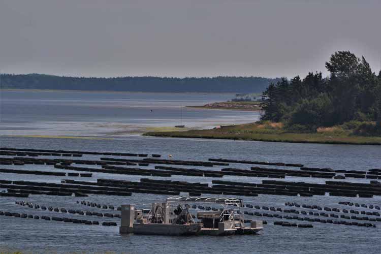
Rows of oyster traps on the Hunter River, Anglo-Rustico
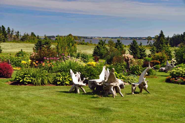
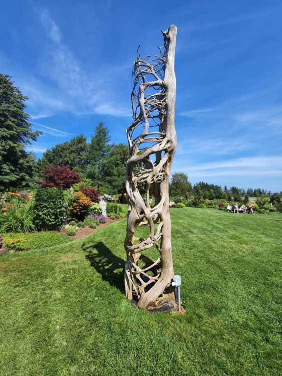
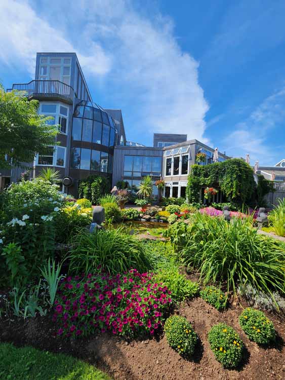
The Dunes Studio Gallery and Café at Brackley Beach is a wonderful stop for upscale gifts and home decor, a stylish eatery inside and a picturesque sculpture garden in the back.
The dunes at Brackley-Dalvay
On Cavendish Beach near MacKenzie's Brook
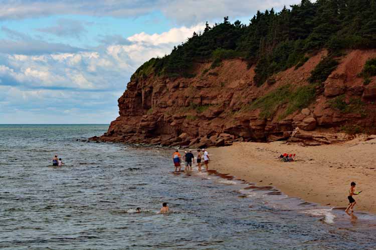
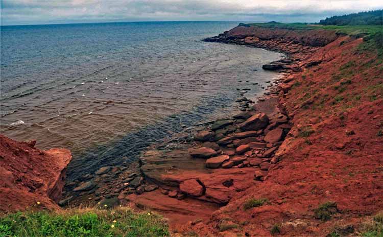
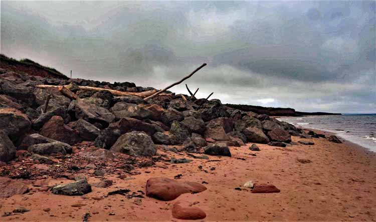
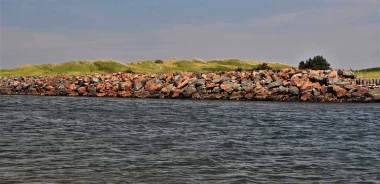
Savage Beach with its beautifully colored rocks that make up its breakwater
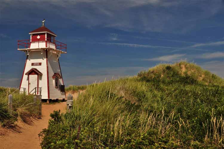
Covehead Beach
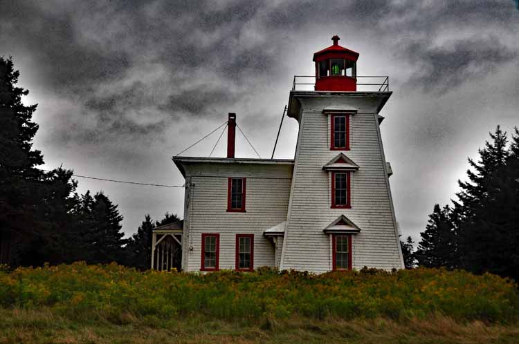
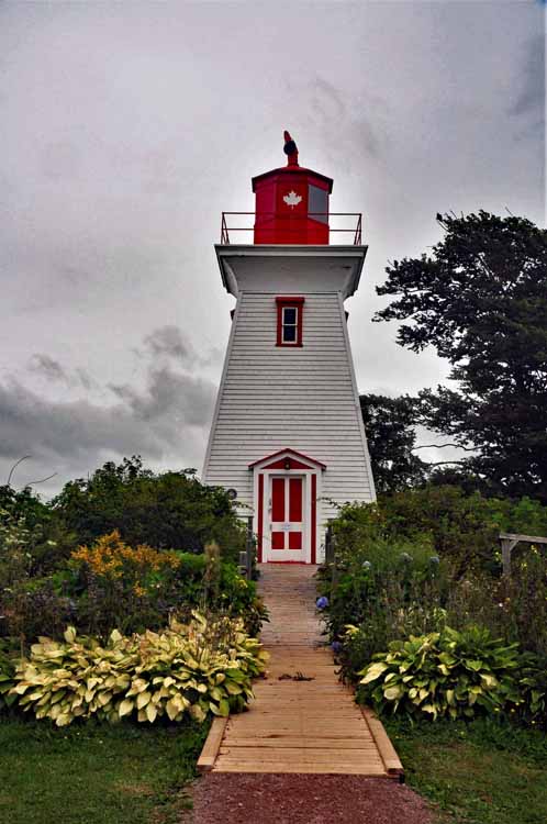
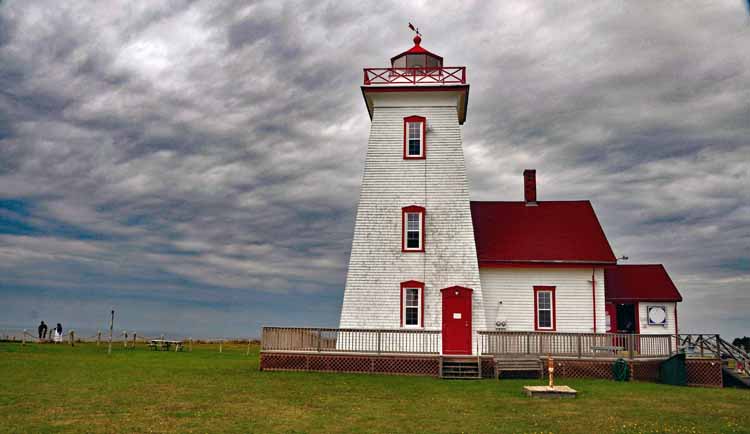
Covehead Harbor Lighthouse is one of the common lighthouse designs and color found on P.E.I. It sits on the dunes serving as a guiding light to the entrance to Covehead Bay.
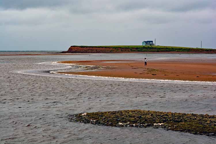
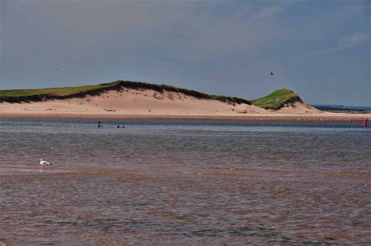
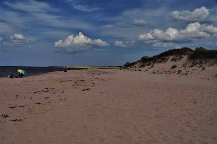
Prince Edward Island is known for its beautiful beaches, and the cream of the crop are the ones on the north shore that make up P.E.I. National Park, the 36-mile coastline roughly from Cavendish to Greenwich. The next several shots were taken along that route.
...or this one.
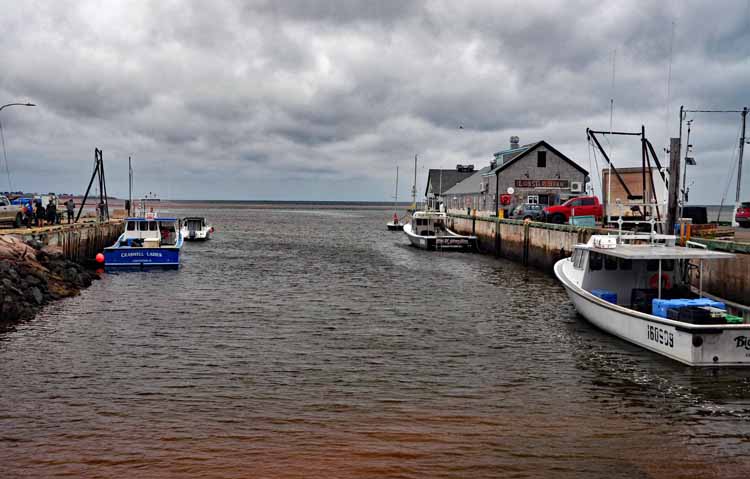
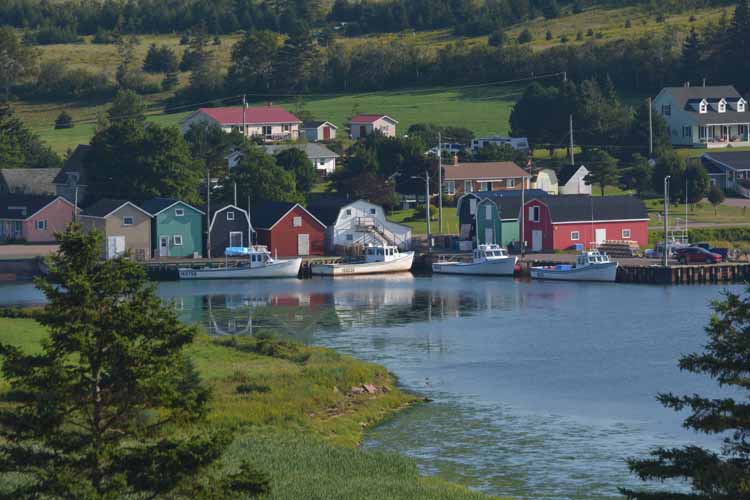
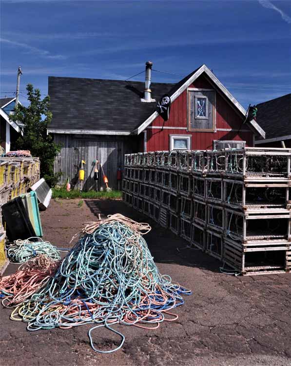
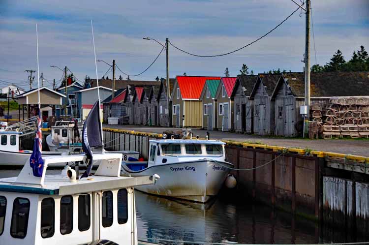
Though lobster is still king to the harbors of Prince Edward island, Red Head Harbor in Morell is the heart of the island's mussel industry and ships mussels all over the world. Mussels can be harvested year-round, but winter is when the taste and quality are at their finest.
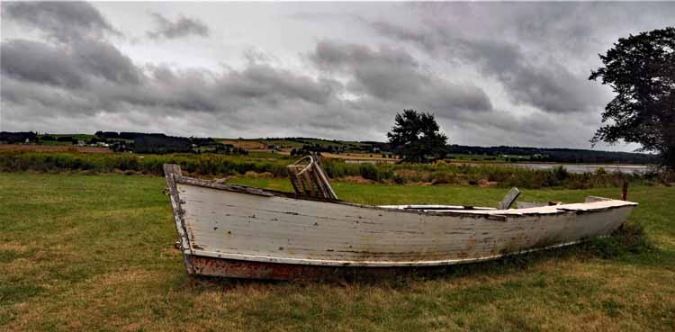
I'm not sure why I took this picture. ..
St. Peters Harbor Light and beach (right). The lighthouse station, though inactive, was constructed in 1881.
"Lover's Lane," as Anne called this forest, is on the grounds of Green Gables.
This is Green Gables, the house that was the setting for Lucy Maud Montgomery's fictional tales of Anne Shirley. Ms. Montgomery never lived here, but grew up nearby. In real life, the farmhouse was owned by David Macneill and his wife Margaret, cousins of Montgomery's grandfather. It was settled in 1831. Today, tourists from all over the world visit Green Gables Heritage Place.
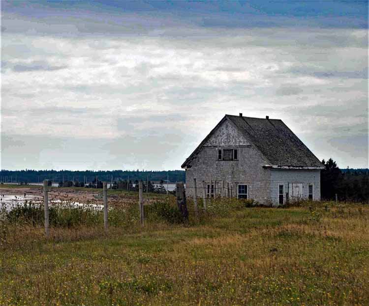
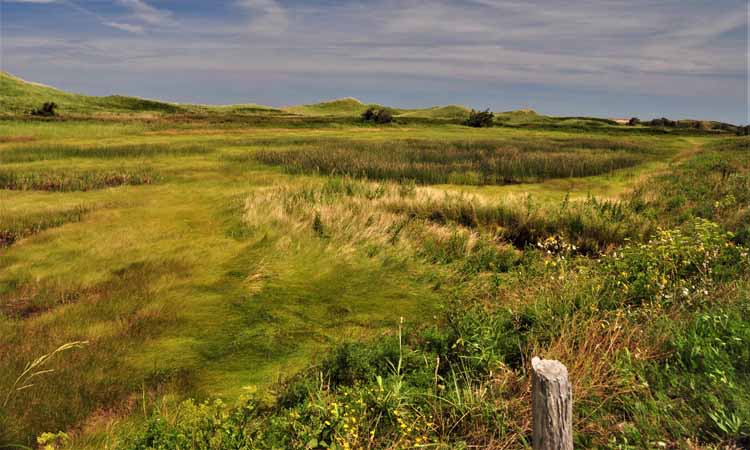
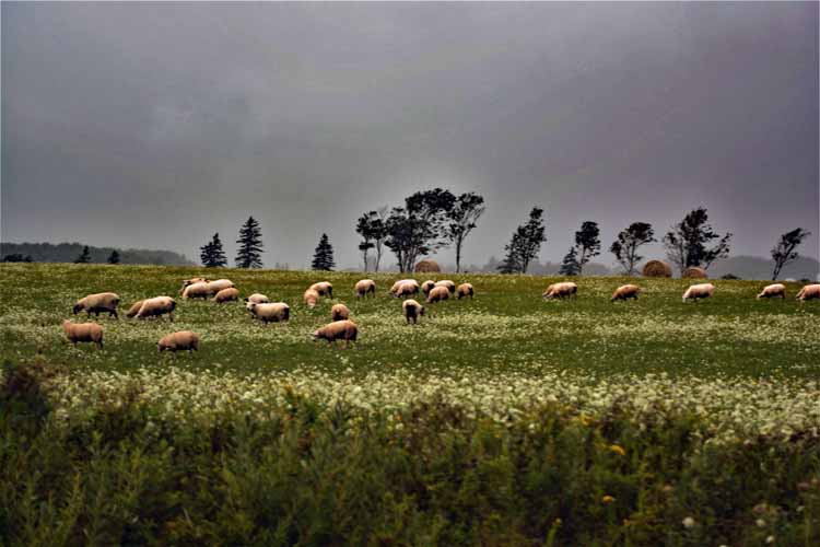
The island's beautiful countryside in the summer will be dotted with cattle, hay bales, sheep and crops that have yet to be harvested. "New potatoes" signs were abundant.
After touring most of the northern shore of the island, I headed down to the south central coastline to the Argyle Shore Provincial Park (pictured here, left and below), and to Victoria-by-the-Sea and up a small peninsula to Rocky Point.
Victoria-by-the-Sea, a charming fishing community that dates back to 1819.
The shoreline and lighthouse (right) at Rocky Point
This is Blockhouse Point Lighthouse at Rocky Point. Built in 1876, it has seen several alterations over the years, the most recent being in 2017 when it was repainted and minor repairs made. Blockhouse seems appropriate for its style, whether intended or not. Inside, the house consists of a kitchen, a parlor and two bedrooms on the bottom floor and four bedrooms and a bathroom on the second floor. It overlooks Charlottetown Harbor.
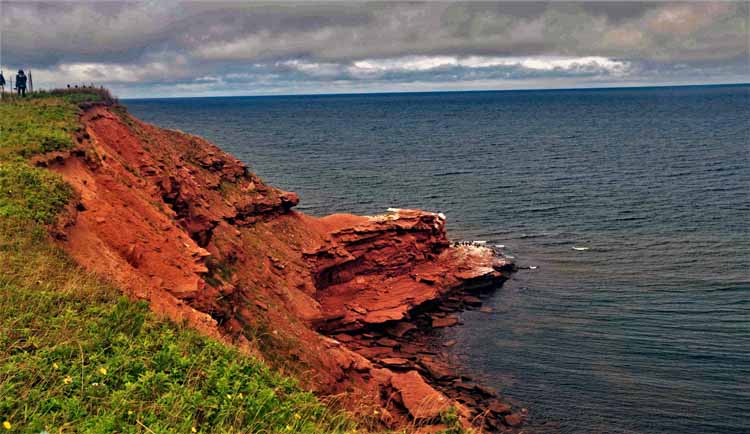
I found the colors of the rocks at Argyle Shore fascinating.
Victoria's lighthouse
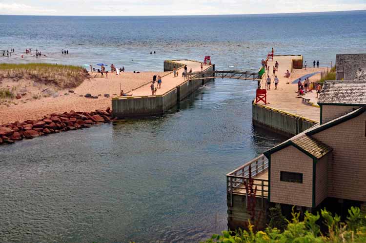
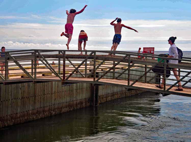
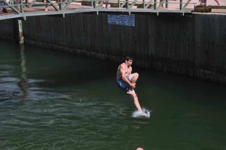
Basin Head Provincial Park was probably the most crowded of all the beaches I saw. It's no wonder, since it has this marvelous "jumping off" bridge that kids and adults alike took turns at.
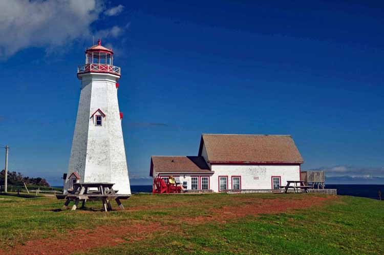
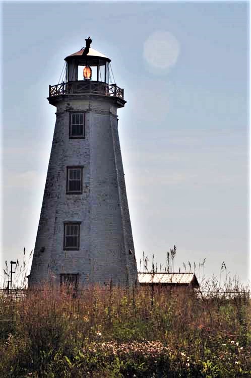
Souris East Lighthouse was built in 1880. A climb to the top offers panoramic views of the Northumberland Strait and Colville Bay. On the ground floor is an extensive collection and explanation of seaglass found around the world.
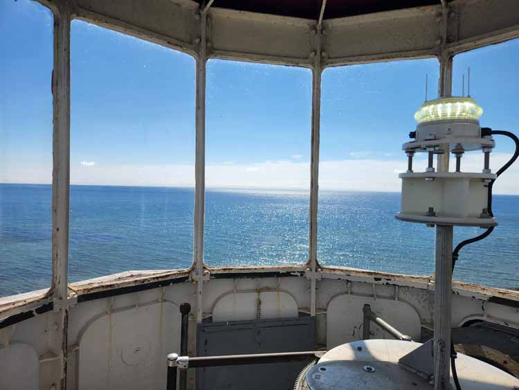
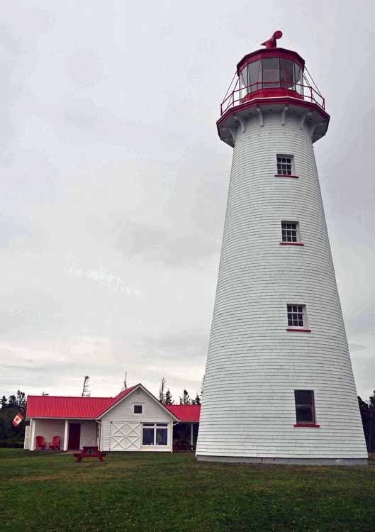
One can climb to the very top of several of the lighthouses on the island. This is the East Point Light, 64 feet tall and 67 steps to the top. It overlooks the point where the Gulf of St. Lawrence and the Northumberland Strait merge. It was built in 1867. On the grounds is a small, but delightful, gift shop.
Panmure HeadLighthouse on Panmure Island guides vessels as they enter into the Georgetown harbor. It is an active lighthouse and was built in 1853.
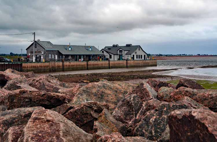
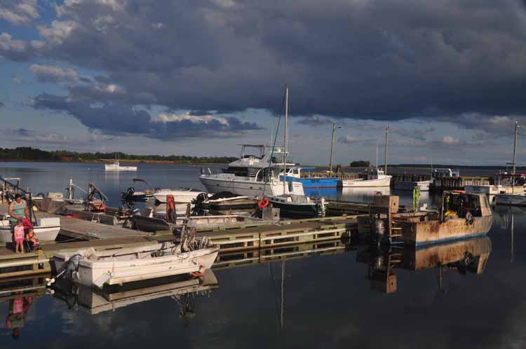
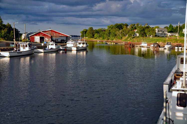
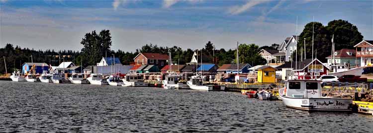
Georgetown Harbor (and below) was the first harbor to be built on the eastern side of the island. Georgetown was once a thriving ship-building center. Its location is especially interesting because it is at the convergence of three rivers that empty into Cardigan Bay.
I spent two days touring the Points East Coastal Drive, the east side of P.E.I. from top to bottom and then headed westward a bit from the southeast corner. This is East Point, the most northeastern point on the island as it juts out into the Gulf of St. Lawrence.
Basin Head's Beach is also called the Singing Sands beach because of the squeaking sound it makes when the white sand is walked on. The high level of silica content in the sand is a unique geological feature of this beach.
This, my last shot, was taken on P.E.I.'s southside on the day I left the island. I crossed back over Confederation Bridge into New Brunswick and then Maine. It symbolizes what I loved most about the island: the tranquil countryside.
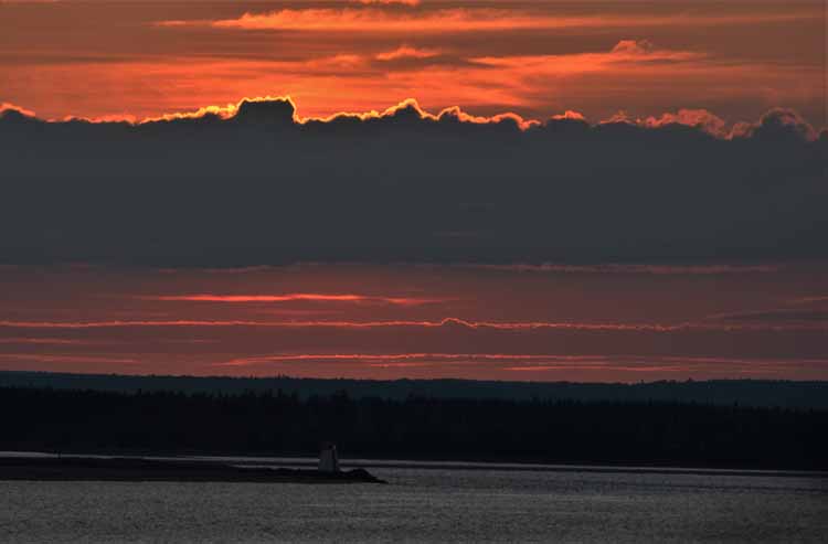
CThe ape Bear Lighthouse grounds was also the site of a Marconi Wireless Telegraph Station. The station received the first distress signal in Canada from the Titanic in 1914 when it hit an iceberg off the coast of Newfoundland. The station was relocated to Charlottetown in 1922. Today is serves as a private home in nearby Guernsey Cove.
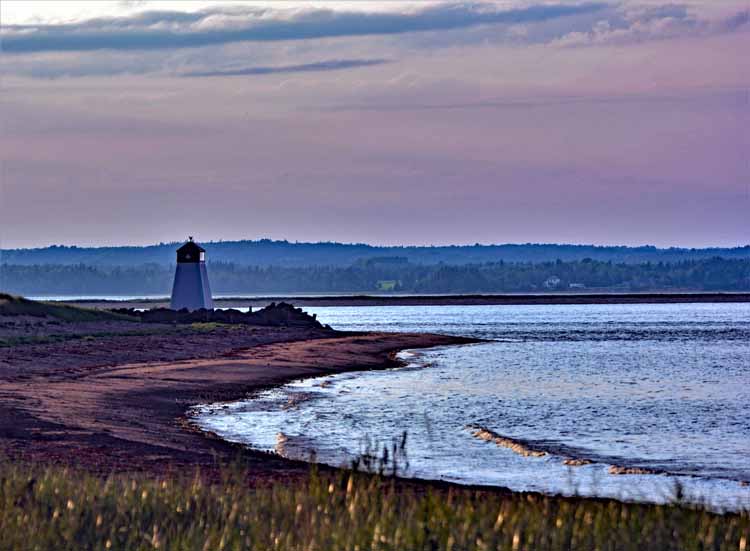
Beach Point Lighthouse - it was getting near sunset when this photo was taken. The lighthouse didn't show up too well, but the sunset was kinda nice.
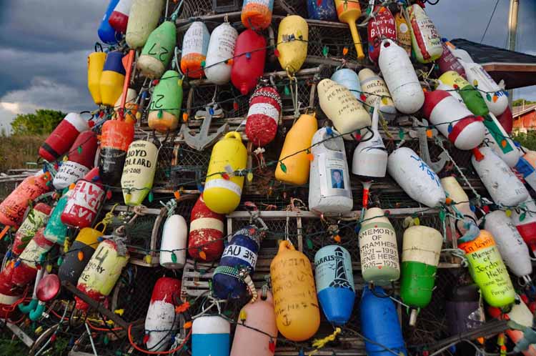
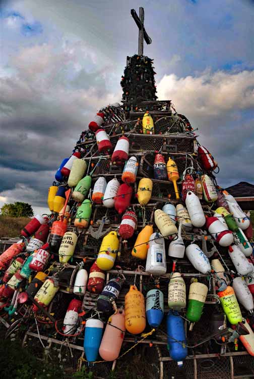
As one eye is always on the lookout for buoys, I got super excited to see this huge mound of them at Murray Harbor. Then, upon a closer look I was touched to realize it was a memorial to local mariners lost at sea. It appears to be a tradition that has cropped up on Canada's shores in recent years. Underneath the buoys, the frame of the memorial is, appropriately, constructed with lobster traps. What a sobering tribute.
Like many harbor communities on Prince Edward Island, Murray Harbor's rich history is steeped in both fishing and farming. Murray Harbor is located at the very southeast corner of the island. The harbor itself runs deep inland merging into the Murray River. The community is on the south side of the harbor on a peninsula that contians a couple other locations I visited, Cape Bear and Beach Point, both a part of the Points East Coastal Drive scenic byway.
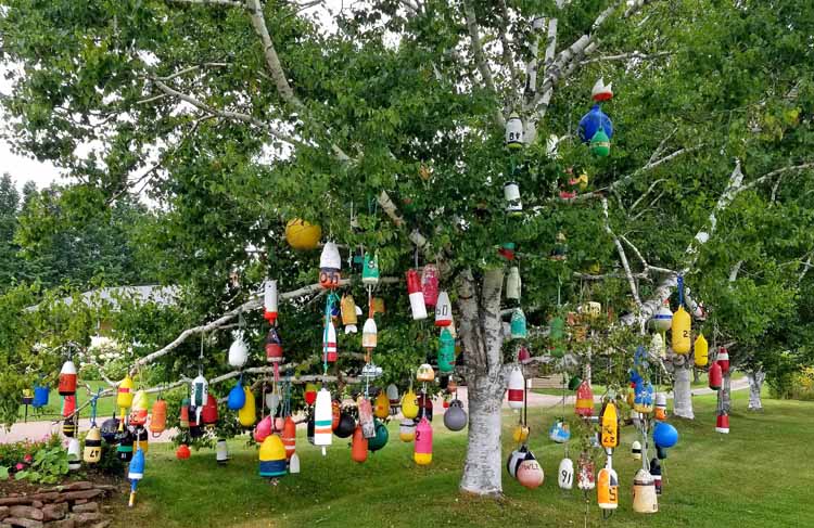
Another exciting moment to see this tree covered with hanging buoys on one of the several side streets between Cape Bear and Beach Point.
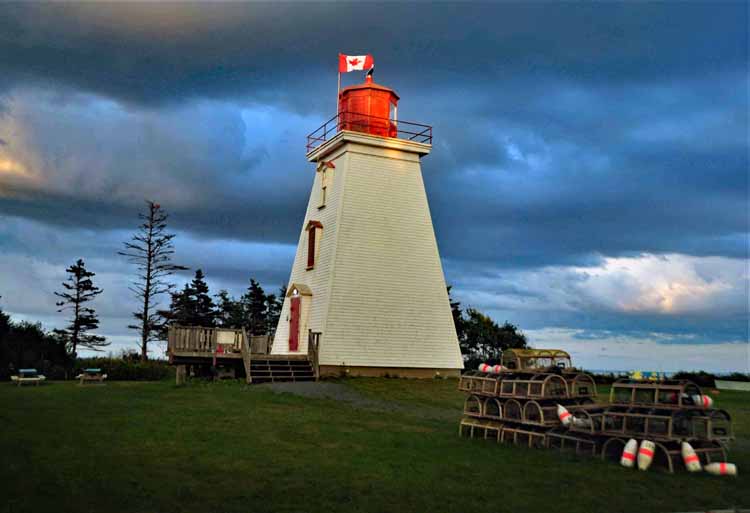
As the Points East Coastal Drive nears the very southeast corner of the island, it turns the corner and travels along the southern coastline. It's here that Wood Islands Lighthouse is located at the Wood Islands Provincial Park. Also in this area are the ferry terminals that travel to Nova Scotia. The lighthouse was built in 1876 and has six bedrooms on two stories.
Point Prim Lighthouse sits at the tip of a spit of land that juts out into the Northumberland Strait on the island's south side. It is the oldest on Prince Edward Island, built in 1845 and is unique in that it is the only round brick lighthouse on the island. The keeper's' cottage is now a gift shop.
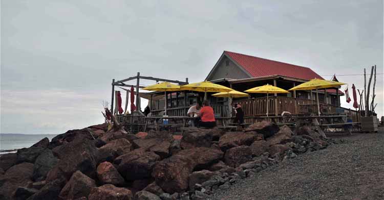
The Chowder House eatery at Point Prim
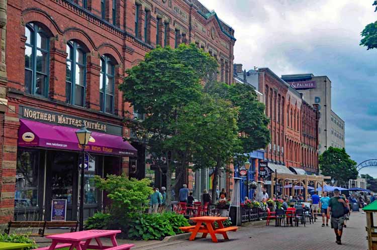
Victoria Row is the only pedestrian street in downtown Charlottetown. It's filled with shops, galleries and outdoor cafés and is a great people-watching spot.
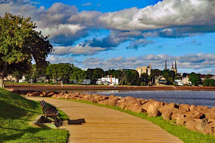
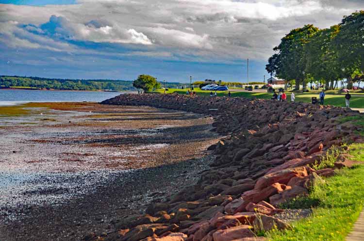
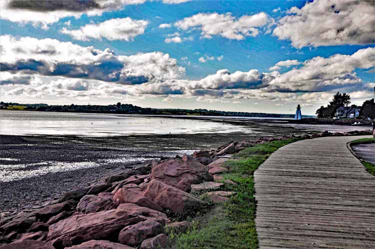
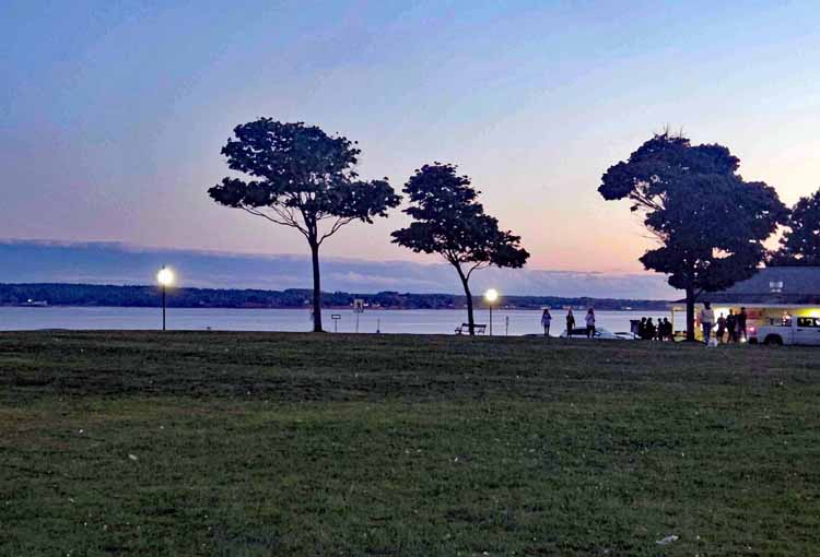
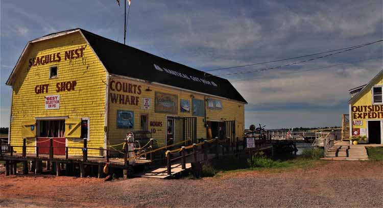
Charlottetown is the capital city of P.E.I. It's small in comparison to other capital cities, but is the largest city on the island with a population of just under 40,000. It has a colorful wharf, a great downtown section with lots of shops, galleries and eateries, a vast park that overlooks the Charlottetown Harbor and an impressive number of museums.
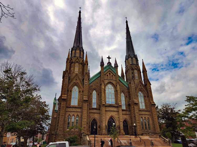
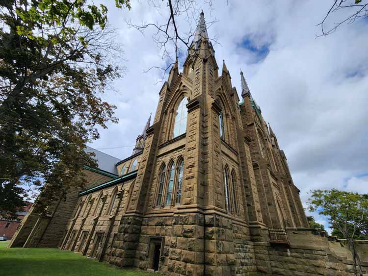
St. Dunstan's Basilica Parish in Charlottetown was constructcd in 1919. It is a National Historic Site, considered one of the most elaborate churches in the Atlantic provinces. It's the largest structure in Charlottetown, its spires reaching high over the city skyline.
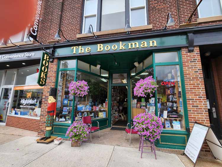
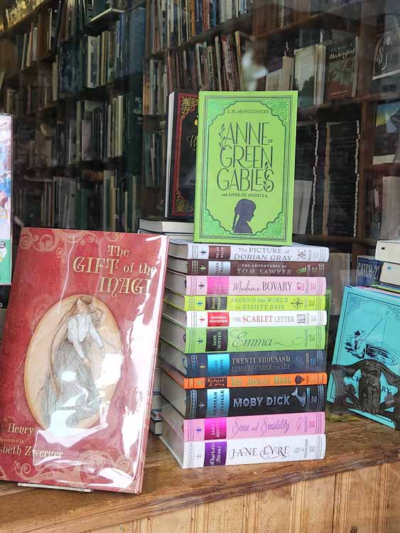
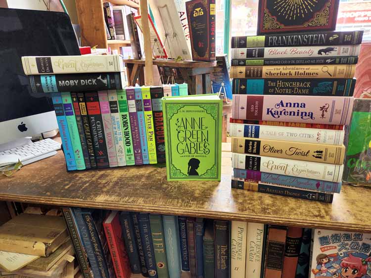
The Bookman is a wonderful second-hand bookstore with a collection of new and used books. Its extensive collection of literary classics is amazing. Just look at the book titles!
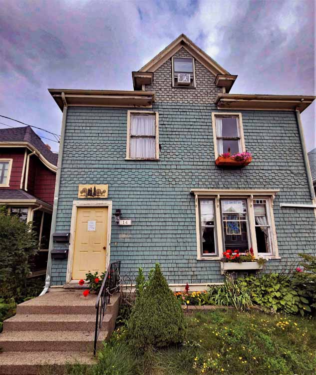
One of several styles of residential homes in Charlottelown
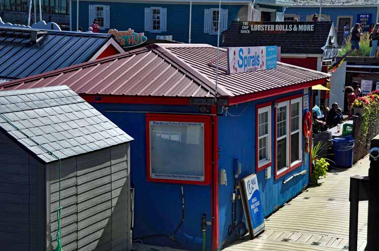
Peak's Wharf is mostly a small conglomeration of snack eateries and souvenir shops.
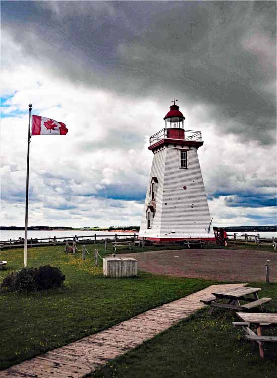
Charlottetown's Victoria Park and lighthouse overlook Charlottetown Bay
To see more locations in Canada, please return to the Canada home page.
This is the last page of photos of my journey through New Brunswick, Nova Scotia and P.E.I. Thank you for viewing.
Thank you for visiting these photo pages.
If you're interested in seeing more, please return to my Main Menu at the bottom of my home page and make your selection.
All images within thewanderingchick.com Web site are copyright protected. They may not be downloaded or otherwise copied.
Please contact me if you think a particular photo or set of photos can be used in your publication.

-can-pe-cedar dunes pp.jpg)
-2022-08-23-can-pe-anne of gg.jpg)
-2022-08-23-can-pe-anne of gg.jpg)