the wandering chick
...The Eastern Sierra Nevadas

Give me the beach any day. Sunny skies, flat roads and enough heat for everyone. But If you have to be in the mountains, I'd say this is a pretty darn good place to be.

I'm here for several reasons, but mainly because I'm meeting friends here later in the summer. I'm working my way up to the Yosemite area to our rendevouz location.

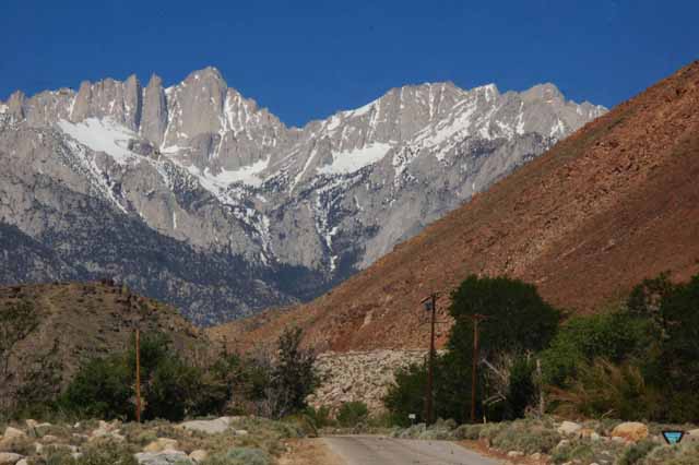
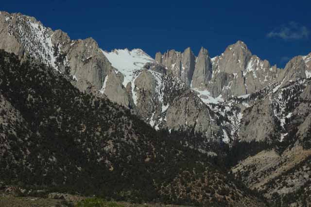
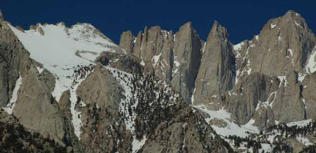
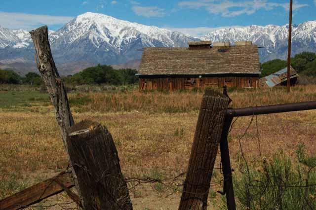
I've been traveling the Highway 395 from Barstow, where I did an overnight. My first stay was Lone Pine, home of Mt. Whitney and the Alabama Hills.

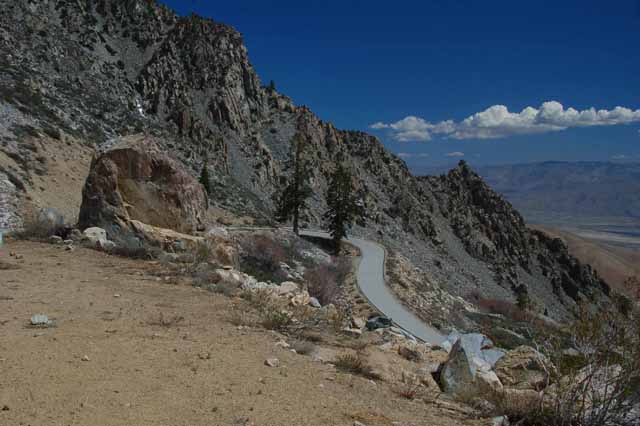
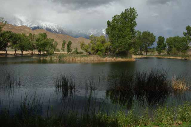
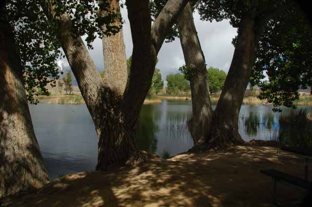
My next destination was Bishop, about an hour north. There's so much to do in this area. I'll probably come back later in the summer to visit some of the higher locations around Bishop. Right now, in May, they're still snow-bound. Yuck!!

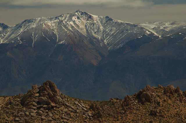
The Sierra Nevadas is a major mountain range that runs north to south some 400 miles in California and Nevada. Its highest peak is Mt. Whitney, rising 14,505 feet. Lake Tahoe, Yosemite and the Sequoia Natl Park are but a few of the well-known locations in the eastern Sierras.

inyo mountains in lone pine

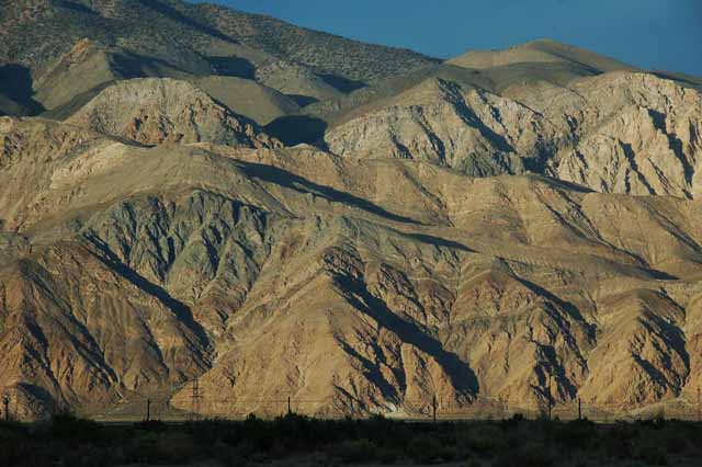
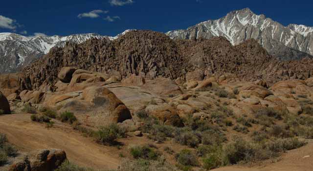
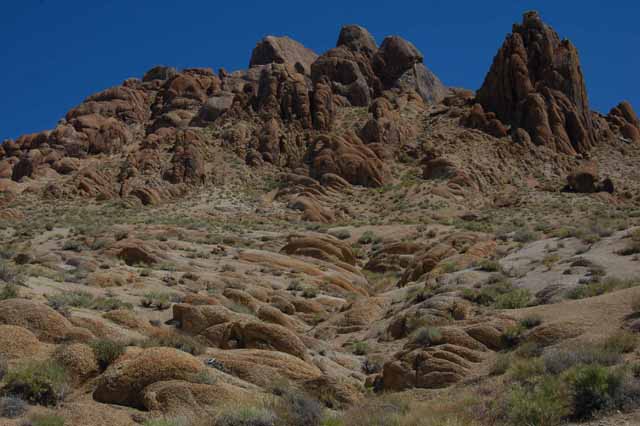
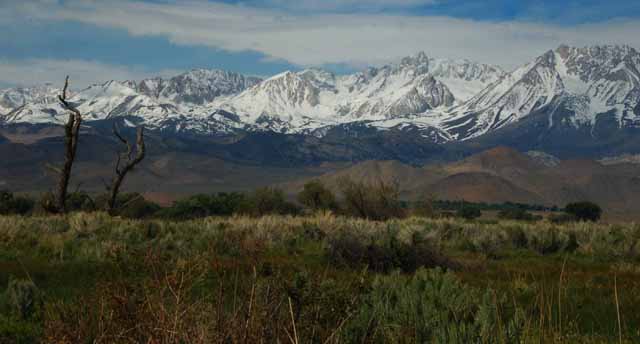
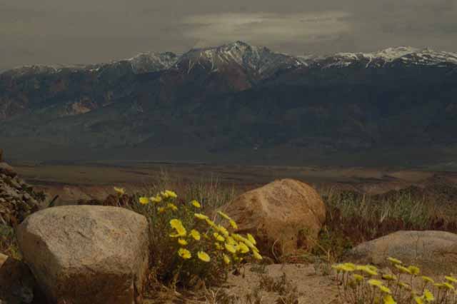
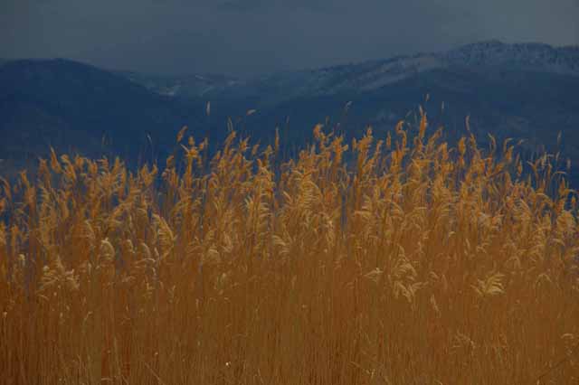
Above: In Lone Pine, the Inyo Mountains also parallel Highway 395. They are a smaller range than the Sierras and not has tall.

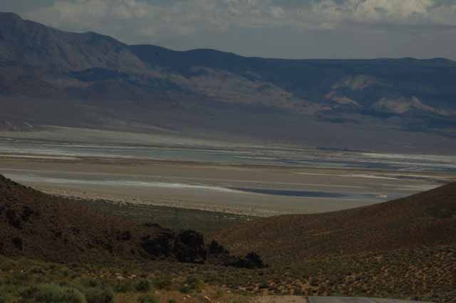
Below: the Inyos are also the backdrop to Owens Lake, a now dry lake bed that lies just south of Lone Pine. Once the water from Owens Lake evaporated, the salt was all that was left, a phenomenon typical of this high desert area.

Along Highway 395, from Lone Pine to Bishop
the Sierras and Alabama Hills
Owens Valley
The snowy Sierras and the lower Alabama Hills
Mt. Whitney
Above: The Whitney Portal Road in Lone Pine leads head-on toward the looming Mt. Whitney. Along the way, you pass through the Alabama Hills and, once you're high enough in elevation, you'll get a nice overview of the scenic Owens Valley (Left).
the Alabama Hills and Sierras
Mt. Whitney
Mt. Whitney at 14,505 feet is not only the tallest peak in the Sierras, but it's the highest in the lower 48.
Mt.Whitney
Sierras and Alabama Hills
the Sierras and Alabama Hills

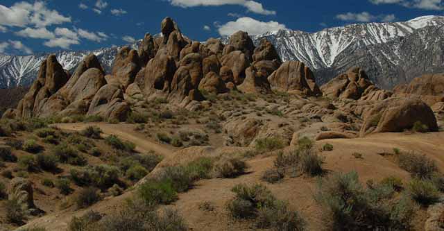
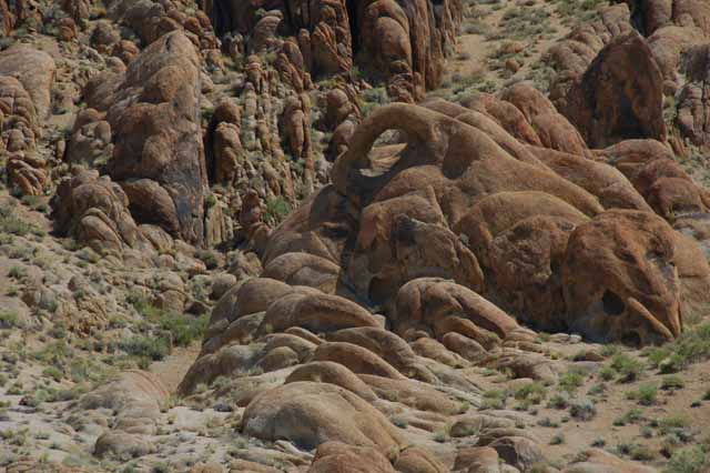
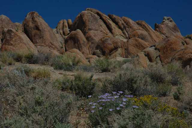
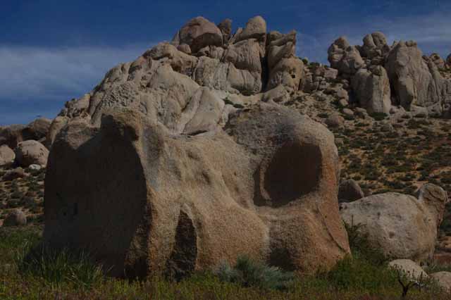
If you've ever watched an old western movie on T.V. you've seen the Alabama Hills. A museum in Lone Pine displays the memorabilia, including saddles, hats and costumes, movie posters and even an original horse-drawn coach from one of the earlier movies.

Since 1920, hundreds of movies and T.V. episodes were filmed here, including "How the West Was Won," "Gunga Din," "High Sierra," "The Lone Ranger" and "Bonanza."

Roy Rogers, Tom Mix, Gene Autry, Humphrey Bogart, Gary Cooper, Hopalong Cassidy and John Wayne are only a few of the actors who filmed here.

Though it seems the heydays of the western filming is over, it wasn't just the westerns that were filmed here. Several commercials and, more recently, "Star Trek 5" and "Iron Man" are included in the line-up.

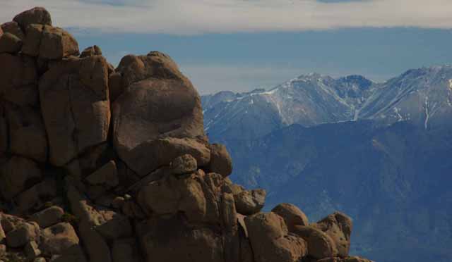
To get to the Alabama Hills, follow the Whitney Portal Road within the town limits of Lone Pine. A side road, which becomes a dirt road almost immediately, and appropriately named Movie Road will put you right in the heart of the loveable brown hills.

Alabama Hills
Alabama Hills
Alabama Hills
Onion Valley
Mary Austin Home, Independence
Just up the road from Lone Pine is the even smaller town of Independence. And just off the main road (Highway 395) that bisects the town is the home of Mary Austin, writer of the desert and American southwest. She lived 1868 'til 1934. Her most well-known book is "The Land of Little Rain," and a plaque in front of her home quotes a paragraph from the book.
Mary Austin home
Onion Valley Road leads out of Independence and up into the hills. I didn't get as far the meadow that's supposed to be up there (winding, steep roads with no guardrails make me way too jittery), but the view from as far as I got was pretty.
bishop
Bishop
A drive around the outskirts of Bishop had me pulling over quite often for pictures. Always within 'range' are the snow-capped Sierras or the smaller White Mountains, which also gathered some snow on their peaks during my visit.
Bishop
Tom Mountain
Buttermilk Country
Tom Mountain sits prominently and stately above the town of Bishop.
West of Bishop, toward the Sierras, is an area called Buttermilk Country. It gets its name from the old days when stagecoach travelers would stop in at the local dairy farms for a refreshing drink of buttermilk. The area today is a wonderful meadow of huge bolders, not unlike the Alabama Hills, and popular with climbers.
Buttermilk Country
Buttermilk Country
Buttermilk Country
Above and Below: The White Mountains rise majestically in the distance over Buttermilk Country.
Buttermilk Country
Millpond Recreation Area
Above and Below,Left: The Millpond Recreation Area, a county park, has everything from tennis to camping.
wheat reeds near the Pleasant Valley area
wheat reeds
Above and Left: Wheat reeds tower over the Pleasant Valley area north of Bishop. The White Mountains are in the background.
the Owens River
Millpond Rec. Area
Cottonwood trees line the pond at Millpond Recreation Area.
The Owens River meanders through the Pleasant Valley north of Bishop.
Tom Mtn
Pleasant Valley bolder
The Pleasant Valley area has a lot to offer with camgrounds, the Owens River for fishing and the Happy and Sad Boulders for bolder climbers. Tom Mountain watches it all.
Chalk Bluff Road
Sierras at Pleasant Valley

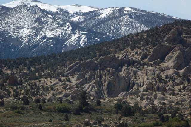
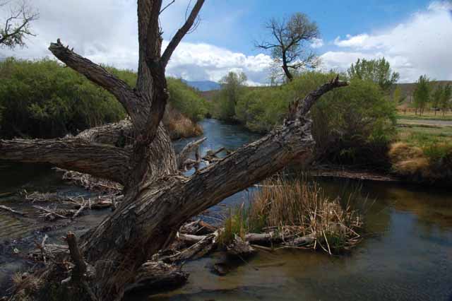
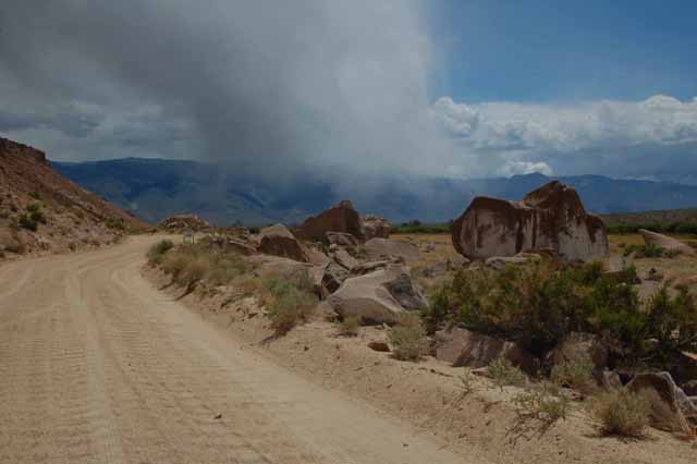
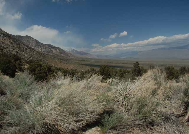
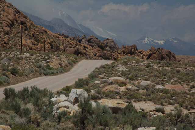
Above: Chalk Bluff Road separates the Pleasant Valley Reservoir from the valley. It offers access to the Owens River and to bolders big and small.

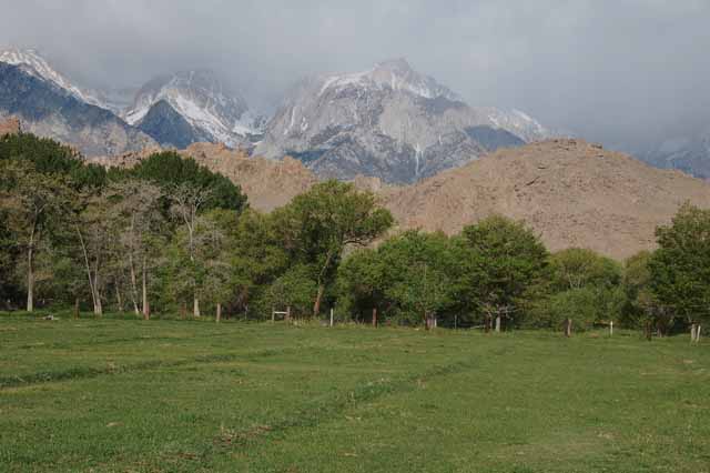
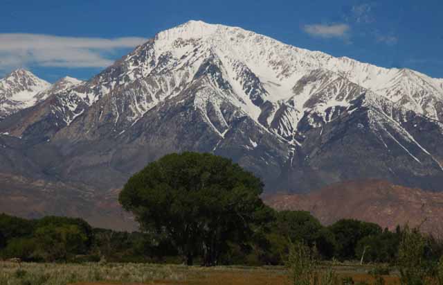
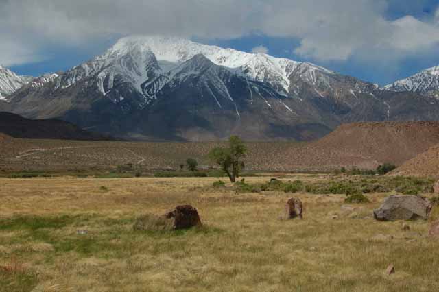
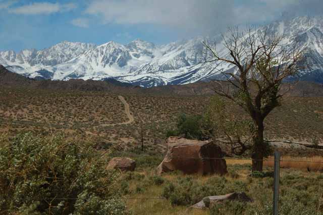
Right Above: The ever-present Sierra Nevadas loom over the valley.

red-winged blackbird
A red-winged blackbird flew right into my picture. All I had to do was click.
cloud over Sierras
Even the clouds can be spectacular as they compete against the Sierra Nevadas.

Visit more California locations by returning to the California home page

Thank you for visiting these photo pages.

If you're interested in seeing more, please return to the Main Menu at the bottom of my home page and make your selection.

All images within 'The Wandering Chick' Web site are copyright protected. They may not be downloaded or otherwise copied.

Please contact me if you think a particular photo or set of photos can be used in your publication.