The wandering chick
Land of Standing Up Rocks
...Chiricahua National Monument

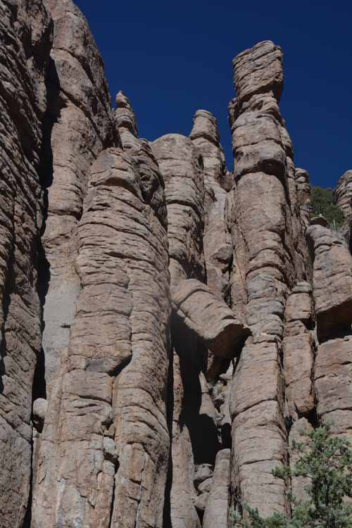
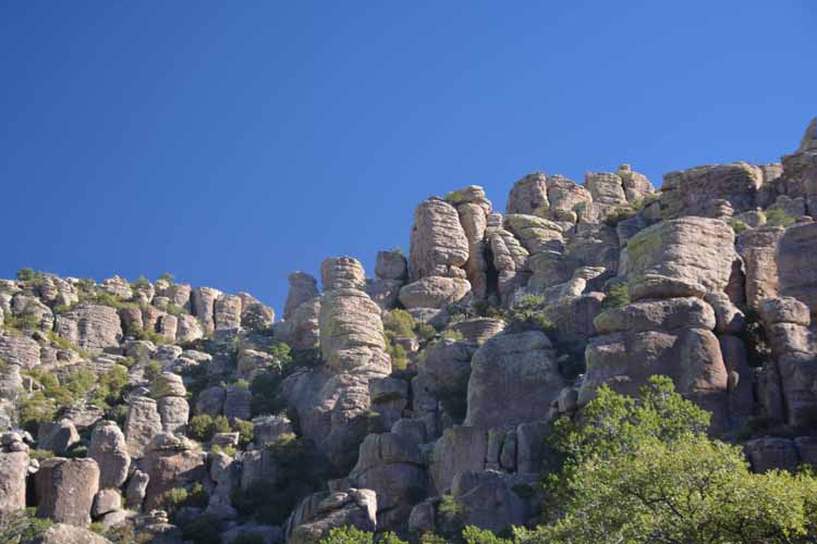
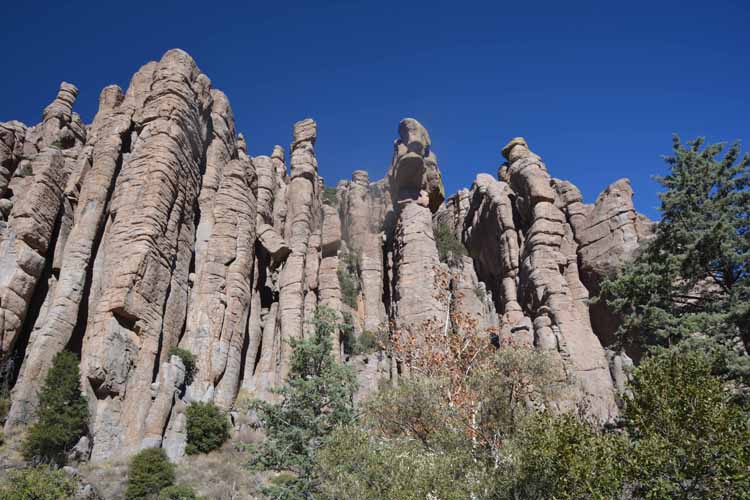
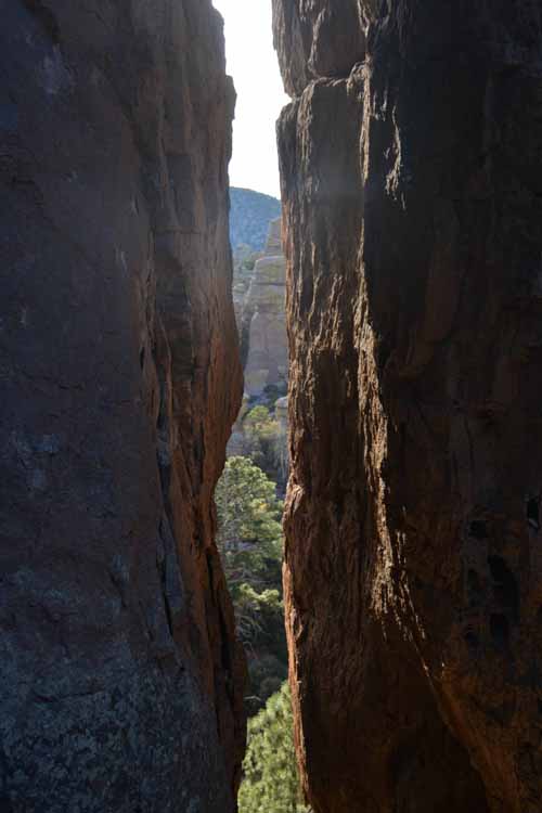
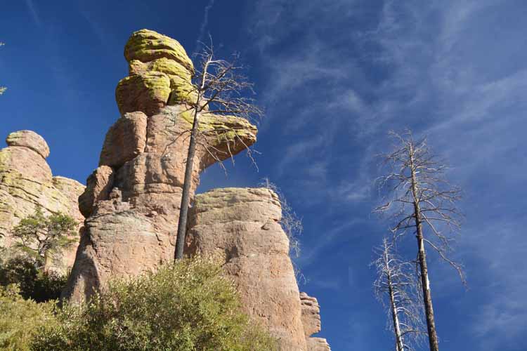
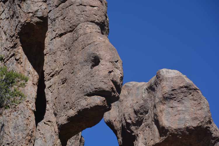
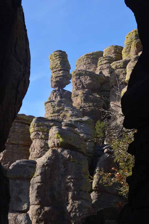
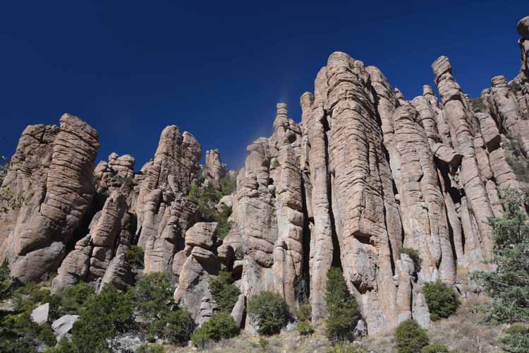
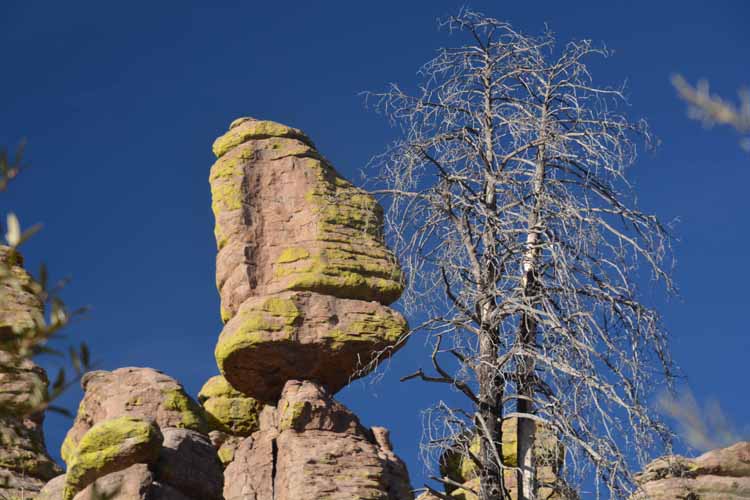
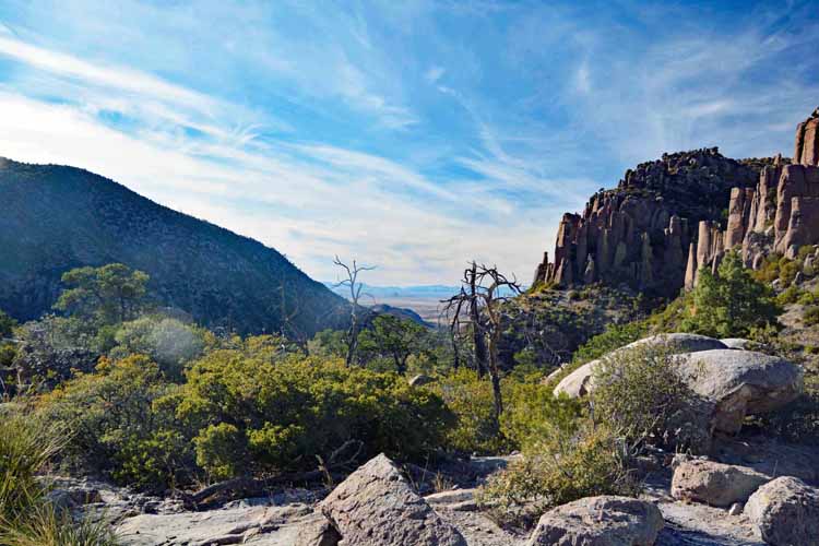
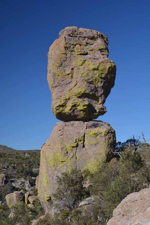
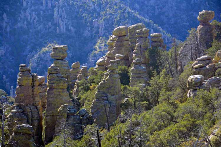
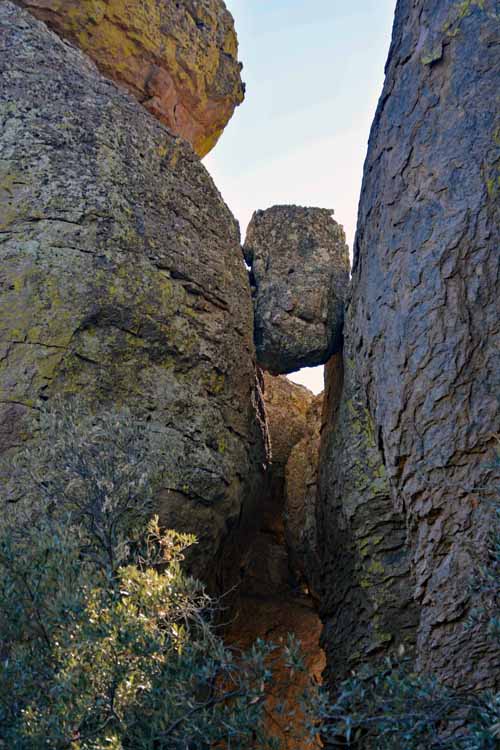
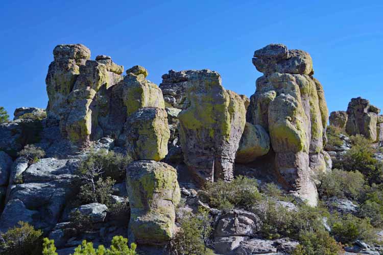
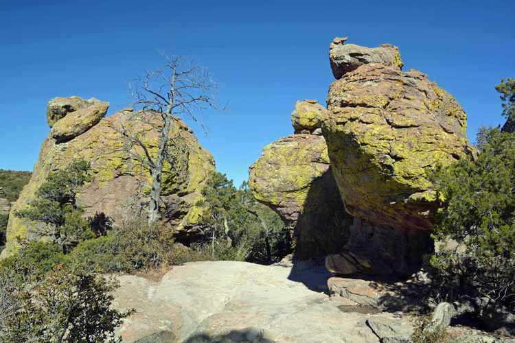
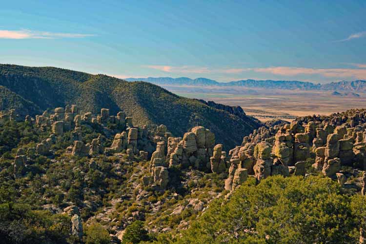
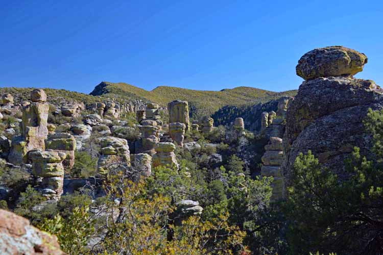
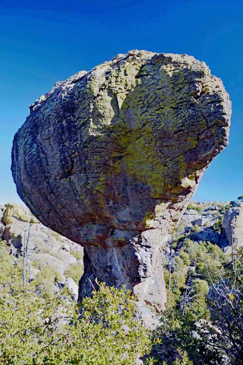
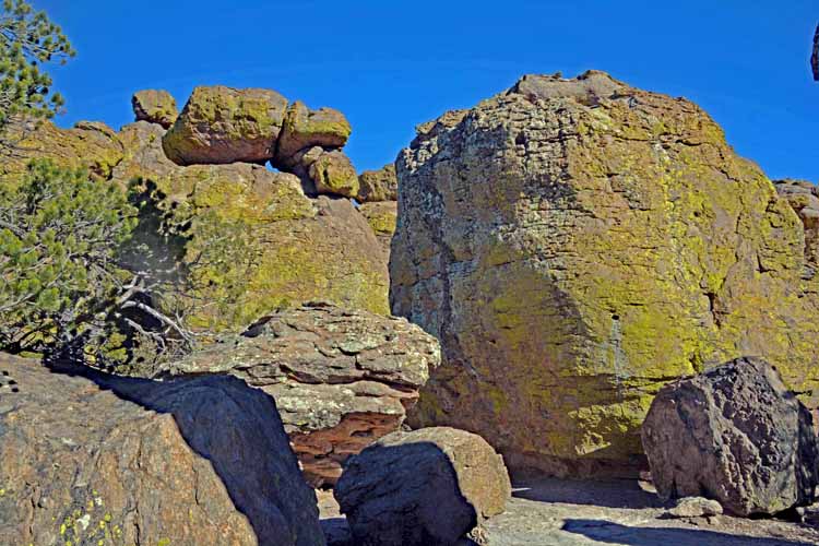
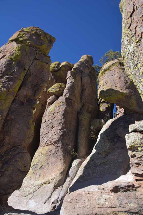
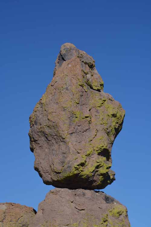
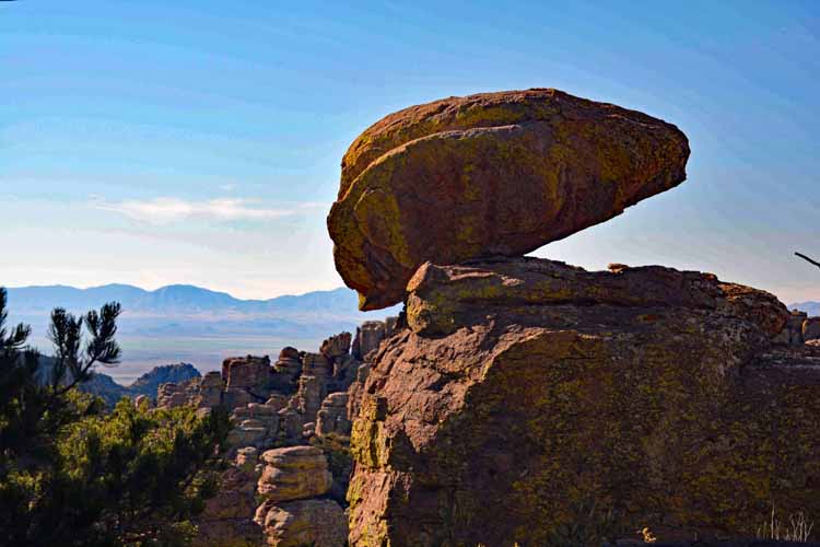
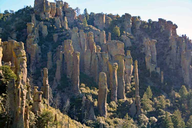
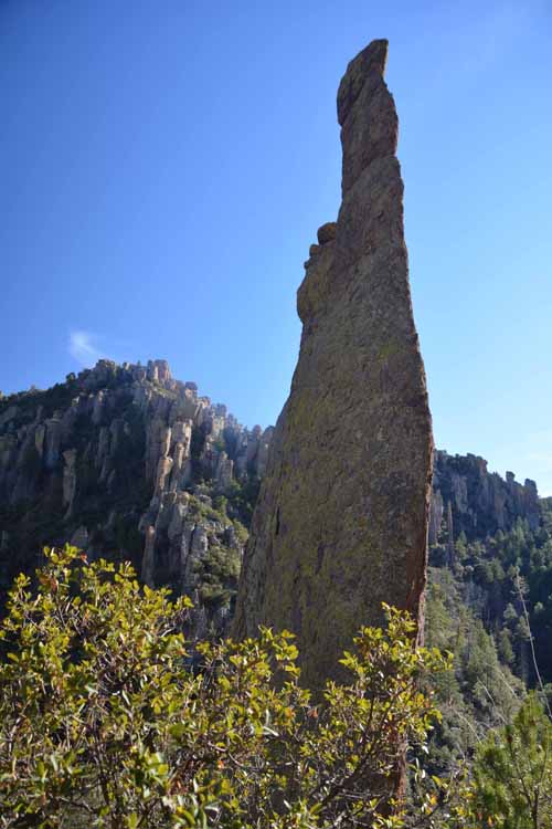
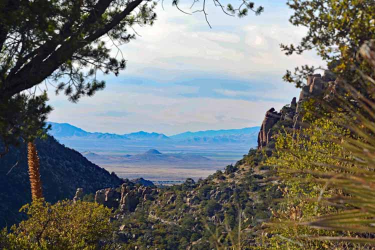
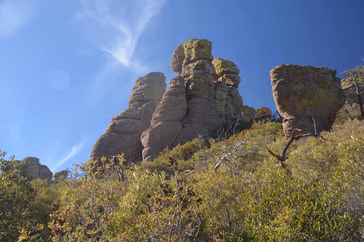
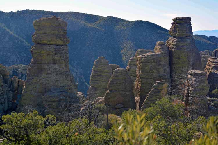
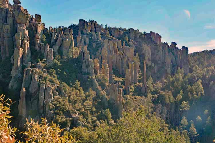
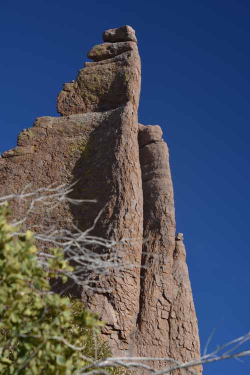
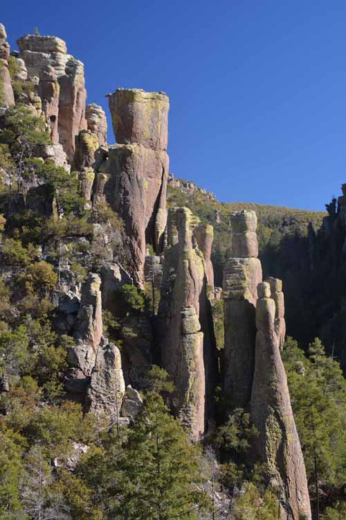
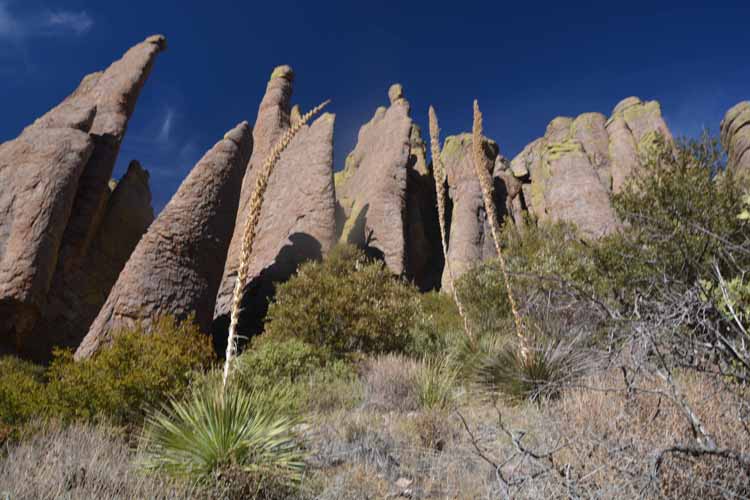
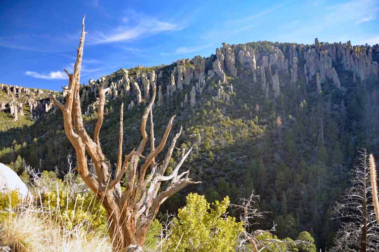
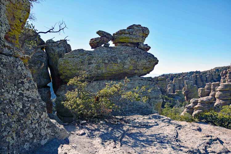
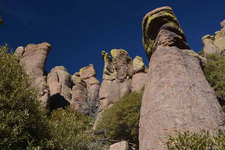
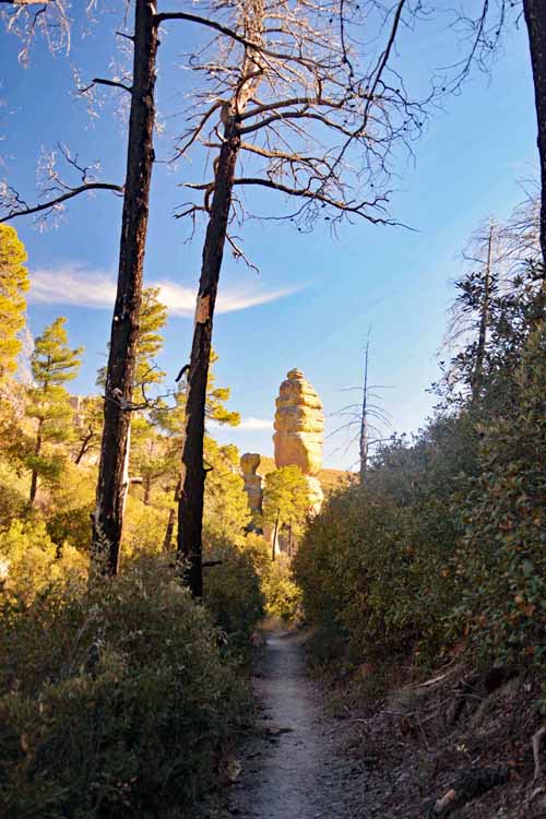
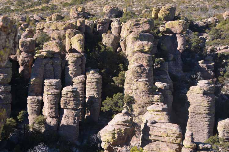
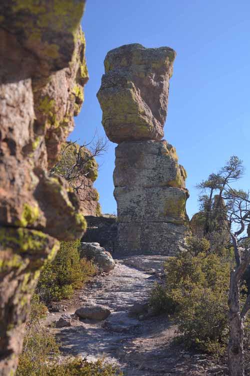
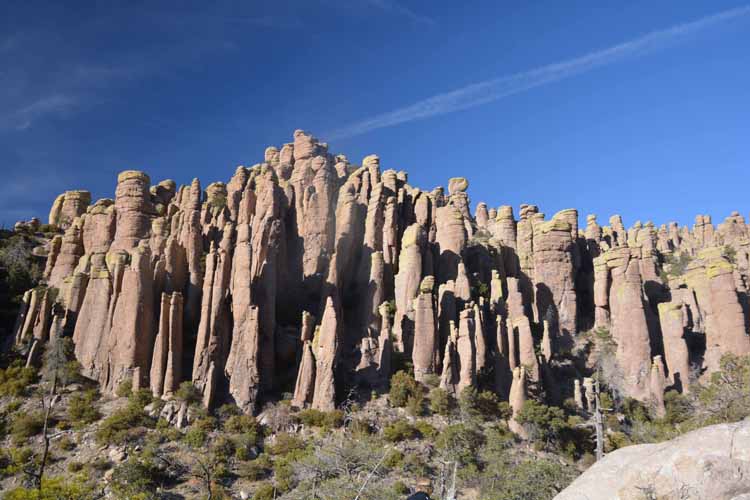
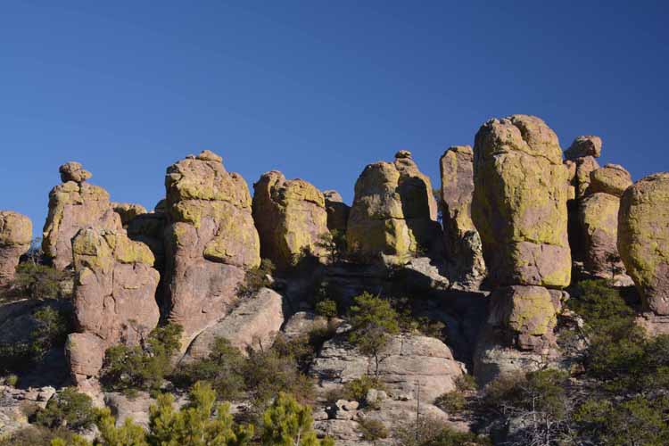
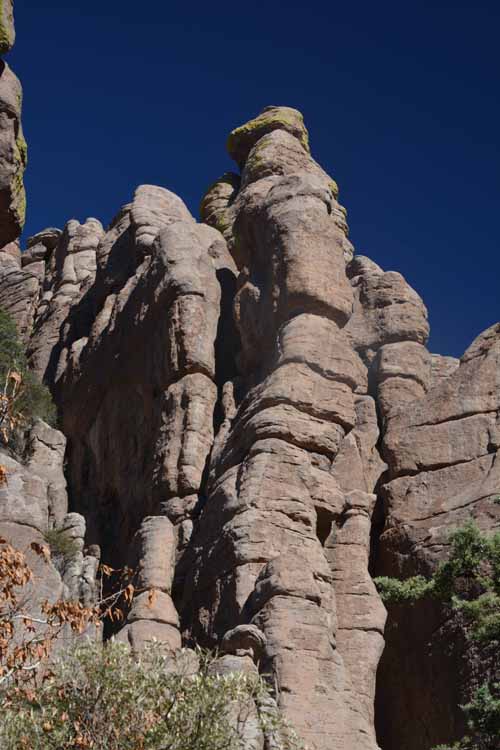
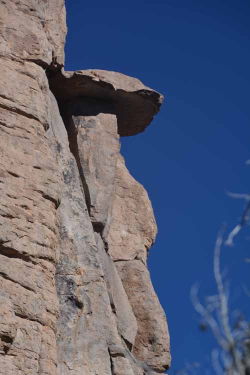
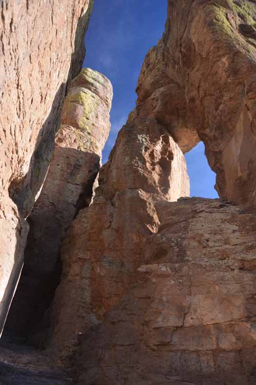
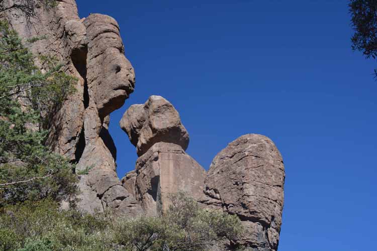
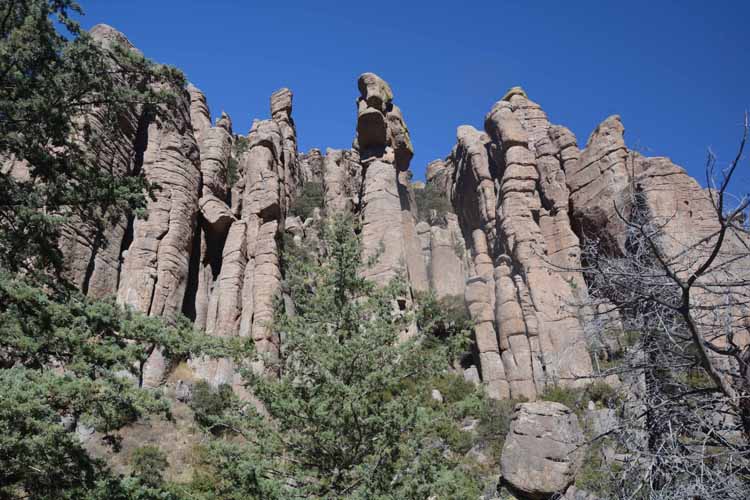
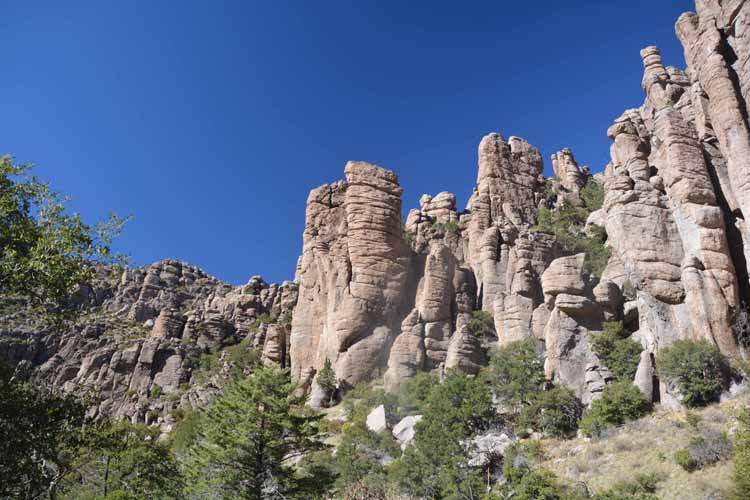
As you enter the Chiricahua from the otherwise flat landscape, you'll understand why the Chiricahua Apaches called this vertical island "the land of standing up rocks." Rhyolite rock formations formed 27 million years ago surround you as you drive the eight-mile scenic drive within the park.

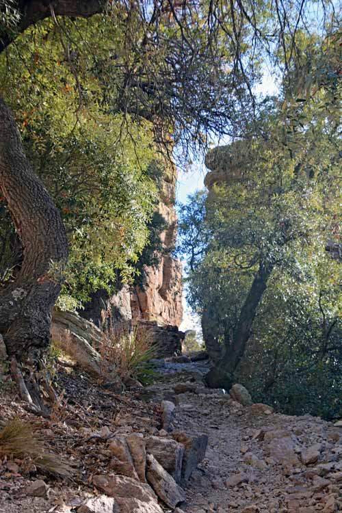
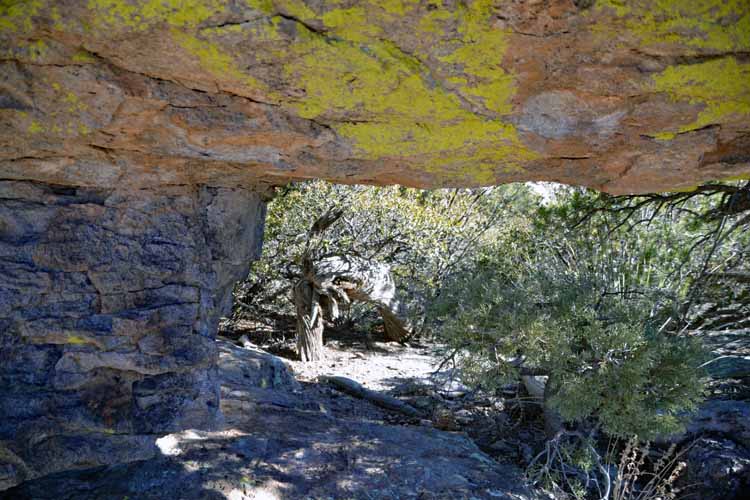
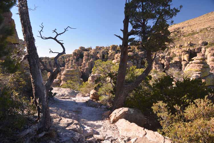
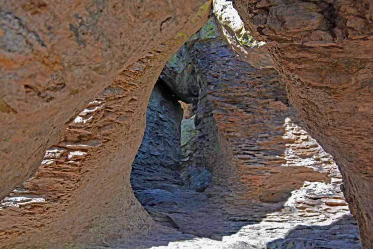
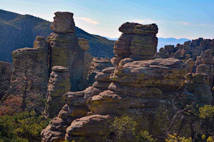
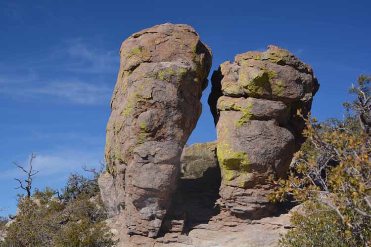
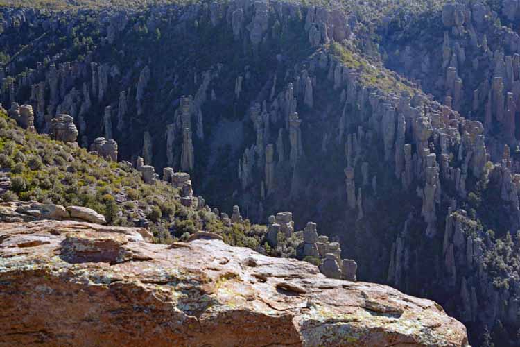
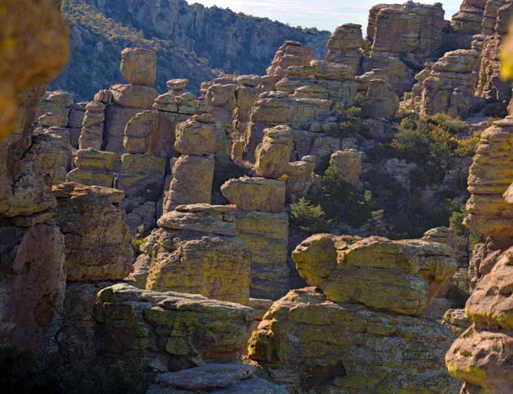
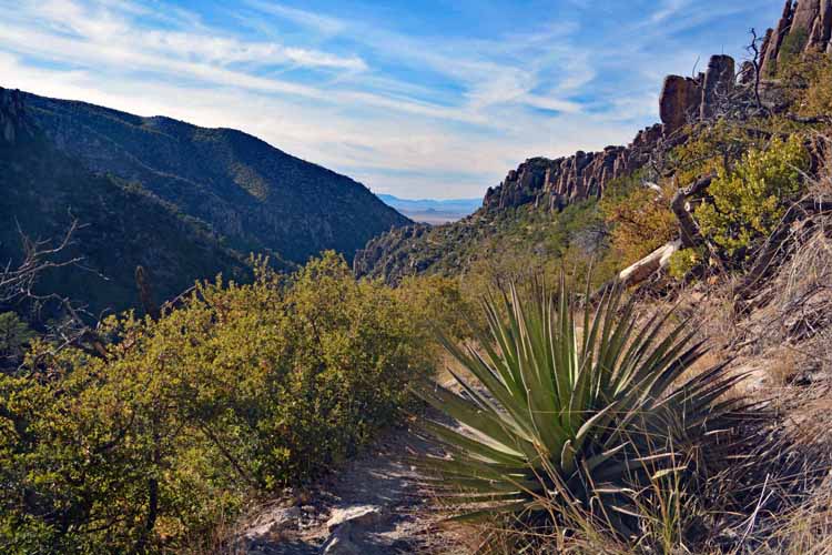
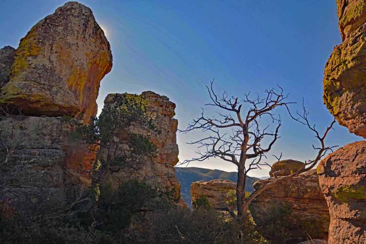
For a close up, several hiking trails wind through the sculpted pinnacles, allowing you delightful panoramas of the 12,000 acres of unaltered wilderness.

Near the entrance to the park is Faraway Ranch and its few remaining buildings, built and homesteaded by Swedish immigrants and later turned into a guest ranch.

Located deep in Arizona's southeast corner, the park is not the only highlight. The drive in via State Highways 186, 181 and 191 is spectacular, offering views of the vast grassland and the Dragoon Mountains in the distance.

horses in grassland
There is very little indication of the stark contrast of the rock formations that await you as you drive the scenic highways that lead to the Chiricahua National Monument.
highways near the park
bird in tree
the Dragoon Mountains in the distance
the Dragoon Mountains
The not-too-distant range seen to the west of the highways are the Dragoon Mountains.
grassland
distant mountains
distant mountains
cow in pasture
bird in tree
heading into the park
Faraway Ranch
One of the first glimpses of the "standing up rocks" is seen looming over the Faraway Ranch.
Faraway Ranch was built by Swedish immigrants Neil and Emma Erickson in 1888. By the 1920s, their oldest daughter Lillian and her husband Ed Riggs bought the settlement and turned it into a guest ranch as it so remained until 1973. Upon their deaths, the ranch and land were incorporated into the National Park Service.
ranch's windmill
I rather doubt that Pebbles, Tip, Calico and the other cows cared - or even knew - which stalls were theirs. The markers must have been created for the amusement of the guests.
milk pails lined up
road leading into the park
named stalls in the ranch's barn
Okay, here we go into the park!!! Pronounced "Cheer-ee-cow-ah," the Apaches had a different name:"Land of the standing up rocks." Others might call them hoo-doos. This is the main entrance into the park which comprises an 8-mile scenic drive.
Organ pipe formation
close up of rock formations
Some of the rock formations were named by the American people based on what the eye may see. This one was nicknamed the Organ Pipe formation.
The rocks were formed when a volcano spewed ash over the entire area. The ash particles melted together and formed layers of gray rock called rhyolite. Thousands of years of weathering, cooling, ice wedging, water erosion and other natural conditions have enlarged the cracks as well as worn away weaker material in the rock, constantly sculpting them into spires, pinnacles and myriad other shapes. And so will it continue for eons to come.
rock formations
rock formations
rock formations
rock formations
hiking trail
At the end of the 8-mile scenic drive is Massai Point. Looking west, the sunsets are said to be super.
along one of the hiking trails
rock formations
Hiking trails meander around huge rock formations, offerning great panoramic views as well as close ups of the pinnacles and sculptures. Some 17 miles of hiking trails are available, ranging from wheel-chair accessible to strenuous. Most seem to be in the moderate range. Whereas in this picture, the trail may look like it is on the edge of a cliff, it is not. If you're afraid of heights and drop-offs, as I am, not to worry on this Echo Canyon Loop Trail.
rock formations
rock formations
pinnacles
rock formations
along a hiking trail
"Son, how many times do I have to tell you: Stand up straight, " said the solid-as-a-rock mom.
sunset over the Dragoon Mountains
Sunset over the Dragoon Mountains
sunset over the Dragoon Mountains

To see more locations in Arizona, please return to the Arizona home page.

Or, you might be want to return to the Main Menu to view more locations.

rock closeup

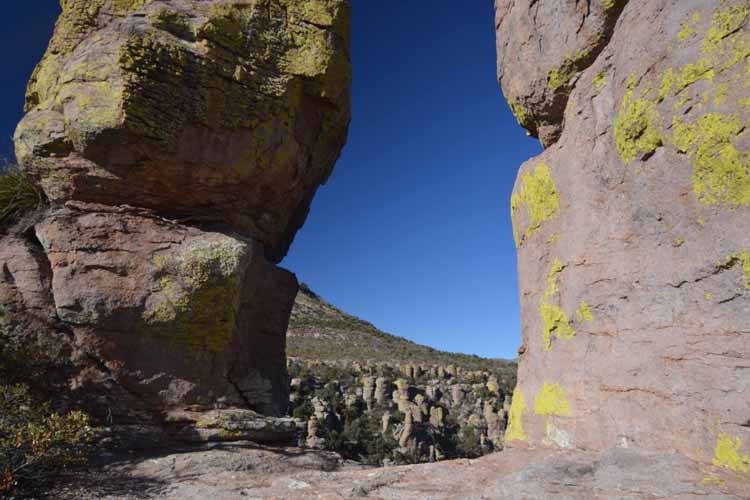
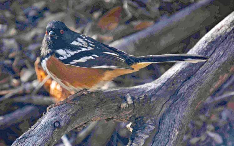
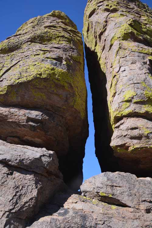
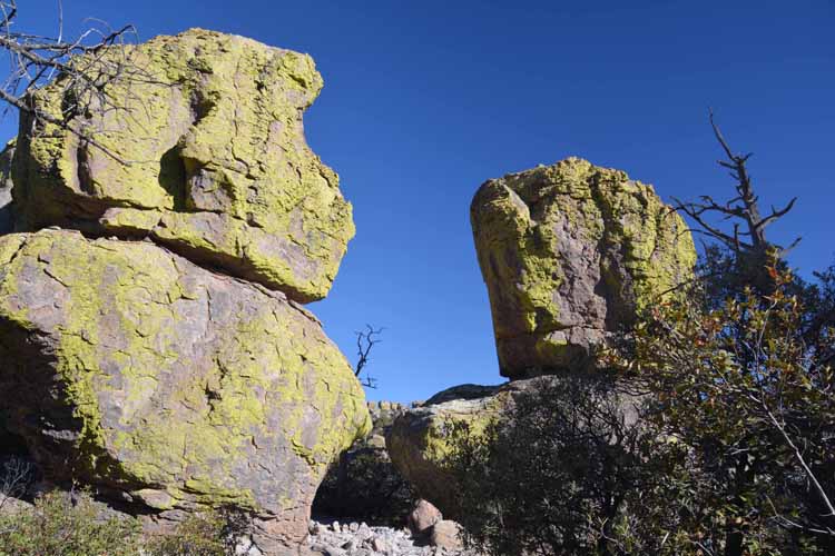
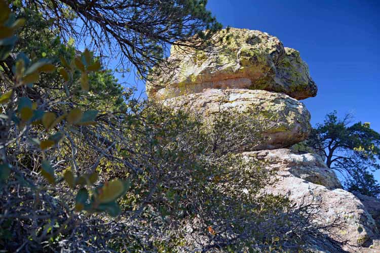
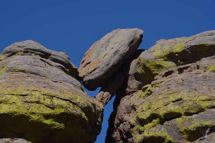
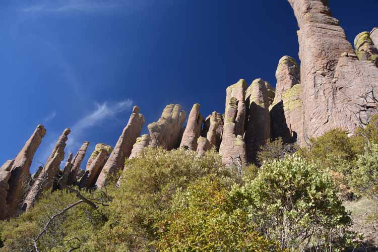
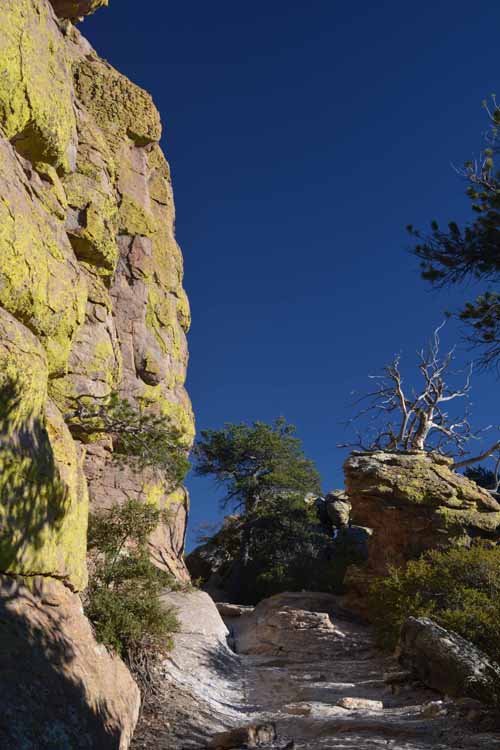
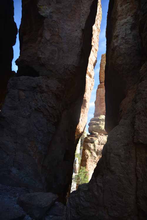
My second trip to Chiricahua was a two-day hiking trek that was absolutely exhilirating. As exhausting as it was, every step was well worth the effort. The crystal blue cloudless sky brought out the bright yellow-green lichen formed on so many of the rocks.

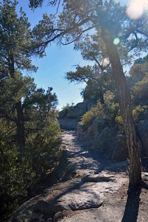
On the first day, my two travel partners and I hiked a portion of the Echo Canyon Loop Trail going counter-clockwise. On day two, we took in Faraway Ranch and a portion of the Massai Point Nature Trail with a .3-mile hike that led to the Ed Riggs section of the Echo Canyon Loop. We then continued clockwise along the Ed Riggs Trail to the Hailstone Trail and then did a repeat of the west side of the loop through Echo Park and the grotto.

Considered a moderate hike, Day Two was about seven miles of gentle ups and downs on otherwise easy rocky trails. It's recommended by the Visitor Center staff that the trail be hiked in a counter-clockwise direction, I think because the incline is a bit more gradual.

Because we couldn't get a parking spot at the Echo Canyon Loop trailhead, we ended up parking at the Massai Point lot and walking the .3-mile trail to hook up to the Echo Canyon loop. However, when we finished the loop, we were too exhausted to return to the lot where our car was. A very kind couple took pity and offered one of us a ride over to the Echo Canyon loop parking lot to retrieve the car. Yes, there are still good people in our beautiful but chaotic nation.

The images below were taken on this wonderful return trip to one of the lesser-known national monuments in Arizona.

rock closeup
closeup rock
rock formation
hoodoos
closeup rock
grotto
many rock formations
the trail
close up rock
hoodoos
The grotto is a fascinating section of the Echo Canyon Loop. The rocks are practically fused together with lots of slits and crevices throughout.
rock formation
From the very start of our hike at the Echo Canyon Loop Trailhead, we knew we were in for some mighty awesome sights.
rock formations
single rock formation
the trail
rock closeup
rock closeup
rock formation
So, here's the cool thing about walking among the rock formations: one slightly different angle of the same rock will completely change the view...so it's like seeing way more rocks than there actually are! This rock and the one in the middle photo are the same! Cool, right?
hoodoos
rock formation
the trail
the grotto
rock formations
The trail was consistently rocky with ups and downs that kept us on our toes, so we'd stop often - around every corner, in fact, to take in yet another stunning scene.
balanced rock
hoodoos
hoodoos
hoodoos
distant mtns
trail
hoodoos
hoodoos
massai point tower
hoodoos
rock closeup
hoodoos
hoodoos
hoodoos
rock formations
hoodoos
the trail
distant scenic
rock formation
hoodoos
hoodoos

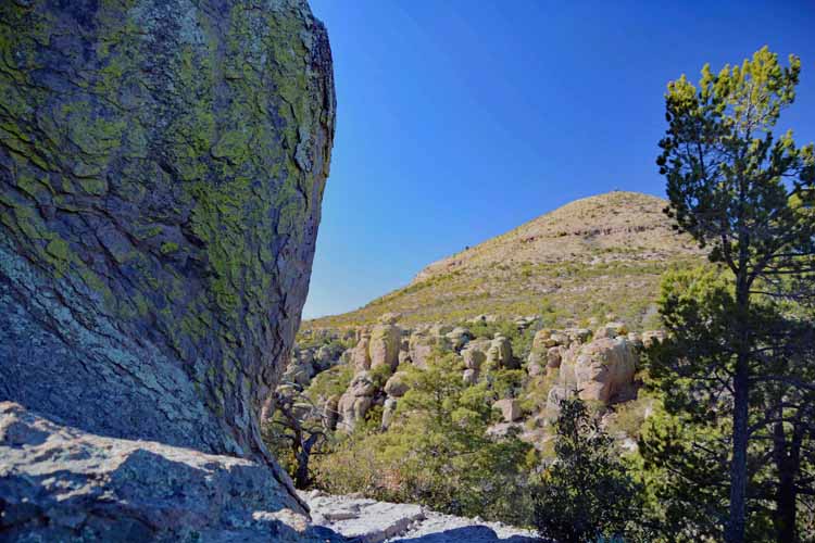
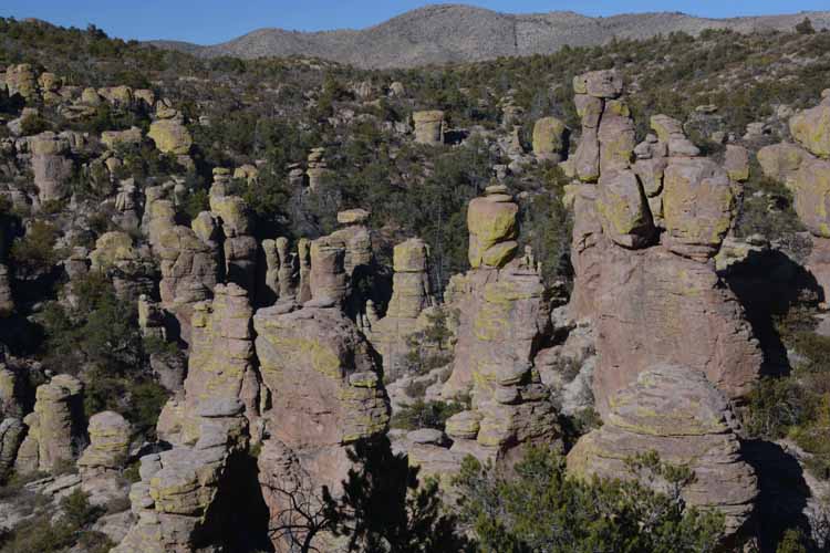
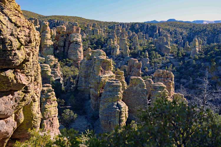
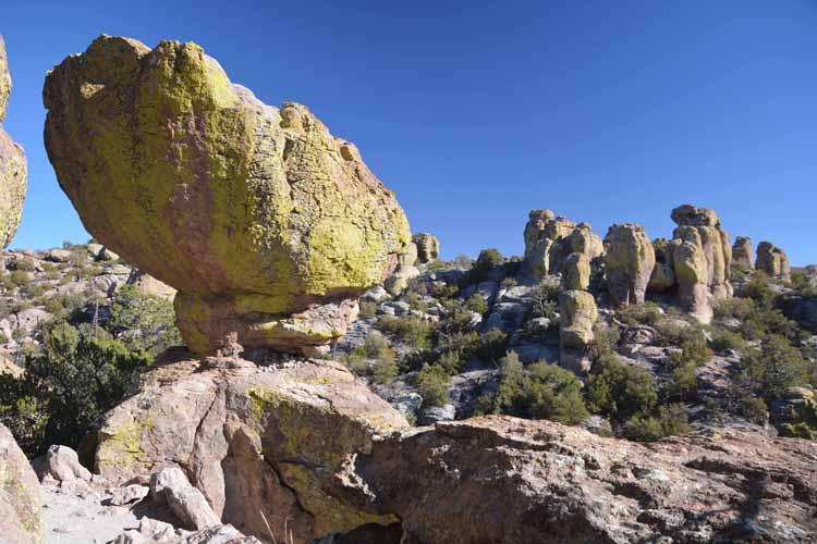
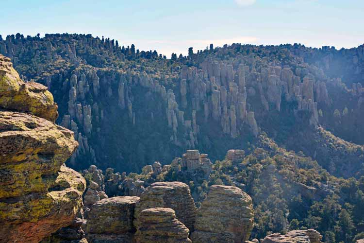
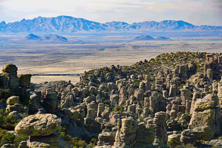
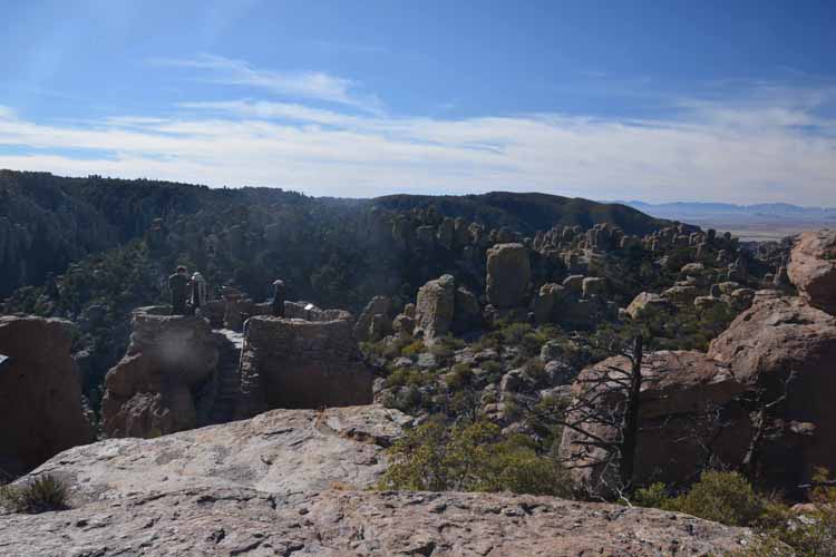
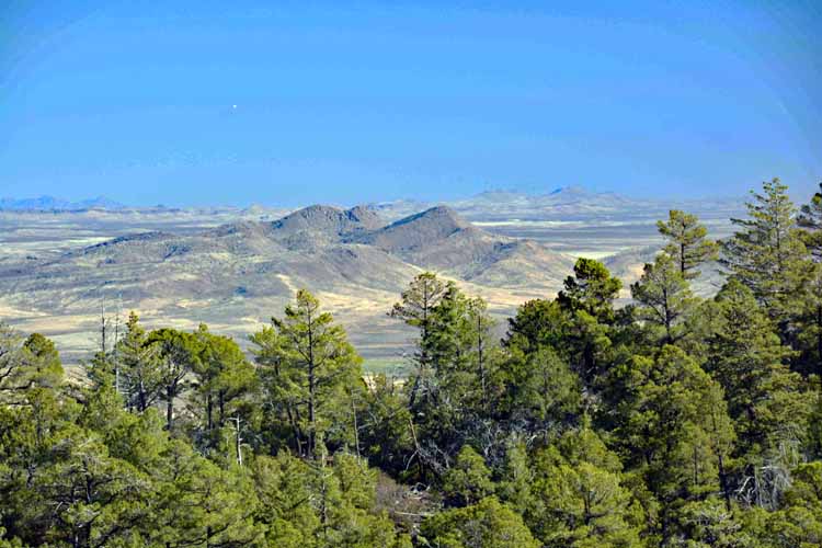
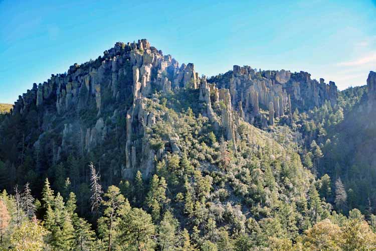
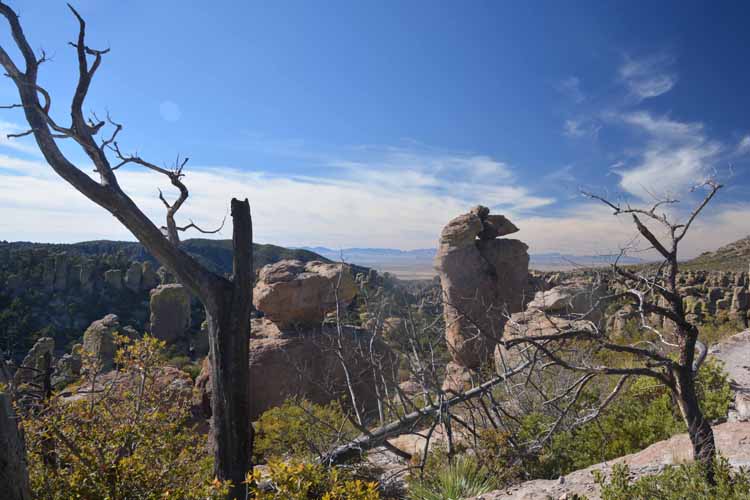
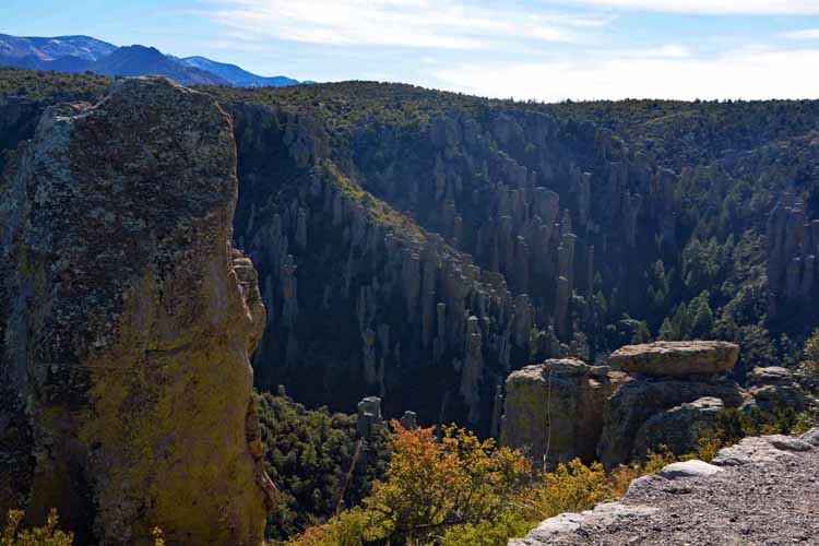
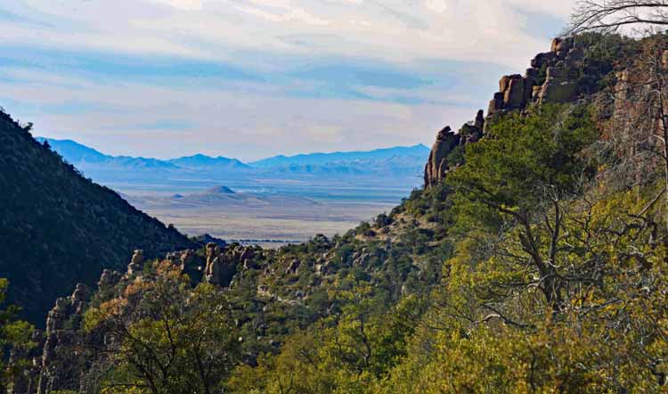
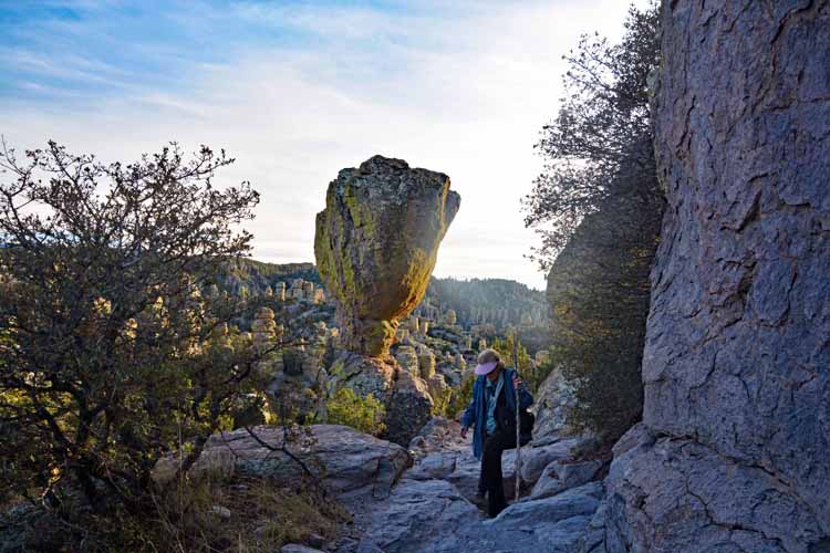
In 1934 a dedication ceremony took place here at what is called Speaker's Rock at the Massai Point, a plateau that offers vast panoramic views of the rhyolite hoodoos that grace the hillside as well as the distant mountain ranges that provide a calming backdrop while hiking the trails.

The ceremony took place when the Chiricahua control shifted from the U.S. Forest Service to the National Park Service. More than 6000 people attended the party along with notable speakers, a marching band and tons of beans, beef, bread and coffee.

Today, the plateau offers the same views although the vegetation that was cleared out for the ceremony as now regrown.

The Massai Point Nature Trail is a .4-mile loop at an elevation of 6,870 ft (2,094 meters). Part of it is paved, therefore wheelchair accessible, but a larger portion is rocky and with steps.

hoodoos
hoodoos
hoodoos and tree
many rocks
hoodoos
rock formations
hoodoos
the trail
trail
hoodoos
trail
hoodoos
many rocks
many rocks
organ pipe formatons
closeup rock
Deer are numerous in the park, especially in the entrance area near the Faraway Ranch and along the Echo Canyon Road.
organ pipe formatons
deer
organ pipe formatons
closeup rock
organ pipe formatons

Thank you for visiting these photo pages.

If you're interested in seeing more, please return to my Main Menu at the bottom of my home page and make your selection.

All images within thewanderingchick.com Web site are copyright protected. They may not be downloaded or otherwise copied.

Please contact me if you think a particular photo or set of photos can be used in your publication.

organ pipe formatons
closeup rock
A Spotted Towhee landed on a branch while we were sitting on the trail having a snack. He must have smelled food in the air, but we knew not to feed him.
bird spotted towhee
One of the best pullouts on the Echo Canyon Road is the Organ Pipe Formation. It's not to be missed as the pillars are directly above, close to the road and soaring straight up to the heavens. They are representative of the meaning of the name Chiricahua: Standing Up Rocks. These last several shots were taken there.
the trail
close up rock
rock formation
organ pipe formatons
balanced rock
organ pipe formatons
rock formation
hoodoos