Vancouver, British Columbia
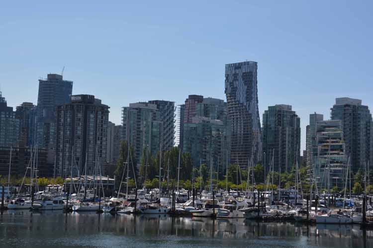
Our last stop on this fabulous trip to Alaska and back was the grand city of Vancouver, on the western coast of British Columbia and the province's most populated city. The City of Glass it's called and if you visit the downtown section, you'll understand why.
Highlights were Stanley Park and Granville Island.
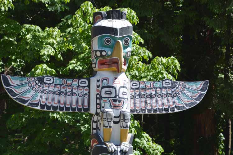
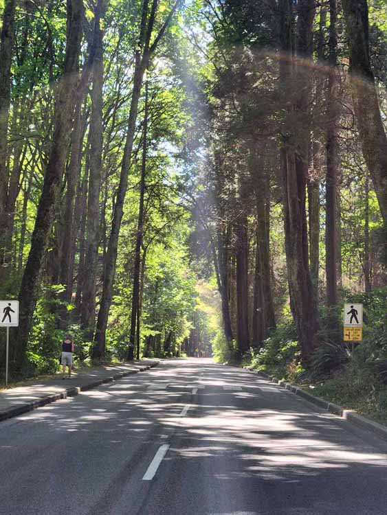
Stanley Park is forested with sections of interest such as the 1000-year-old hollow tree, the 5.5-mile seawall hike/bike path along the coast, the totem poles and the beaches. Stanley Park Drive is a paved well-marked loop and passes all the sights of interest, most of them with dedicated parking lots.
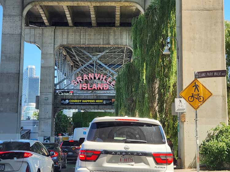
Quite different is Granville Island with its bustling pubic market, outdoor eateries along False Creek and shops galore. As well, it's a takeoff point for boat cruises and smaller boating activities.
An Alaska Road Trip
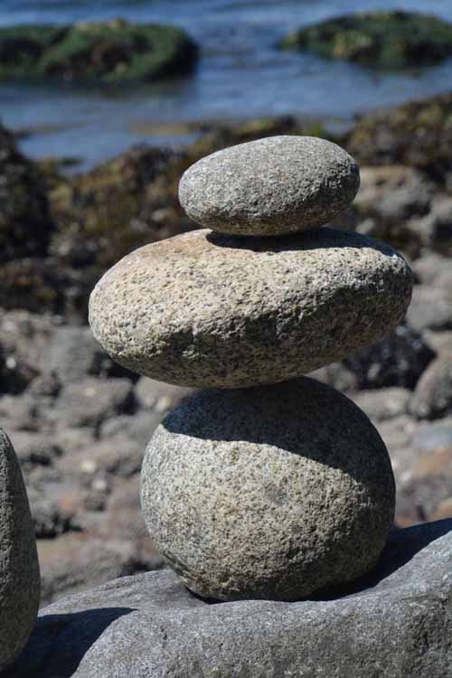
Stanley Park has several little beaches scatteredd around, but the two main ones are Second Beach and Third Beach. These cairns were photograghed on Second Beach.
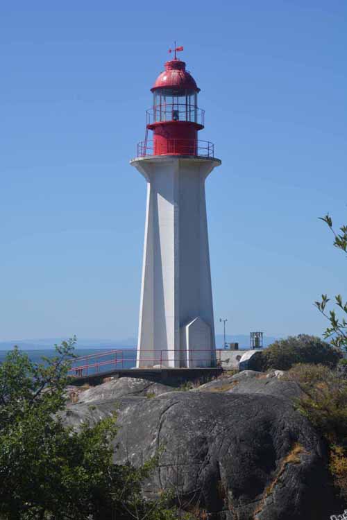
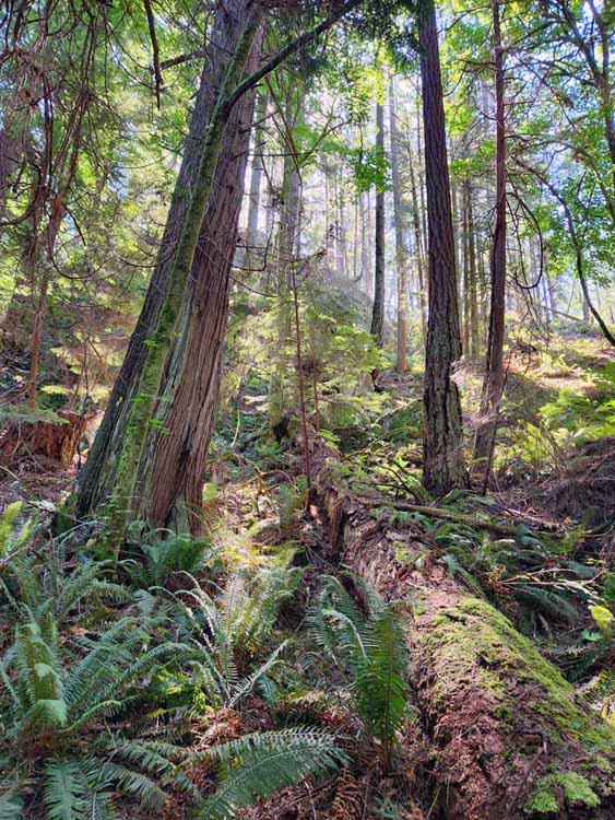
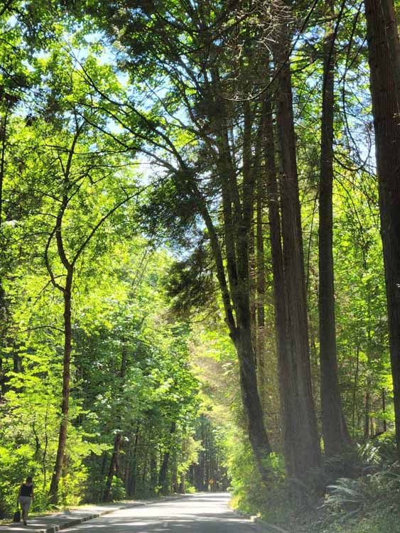
A beautiful walk through an old growth forest in West Vancouver will lead to the Point Atkinson Lighthouse. There are several trails that lead to the lighthouse. It was built in 1912, replacing a wooden one that was built in 1875.
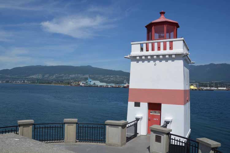
Brockton Point Lighthouse sits at the tip of the mos easterly part of Stanley Park and was established in 1890. However, in 1914 it was rebuilt to today's design. It was inactivated in 2008.
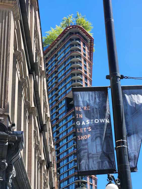
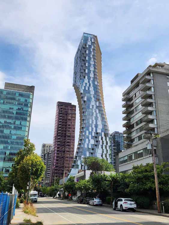
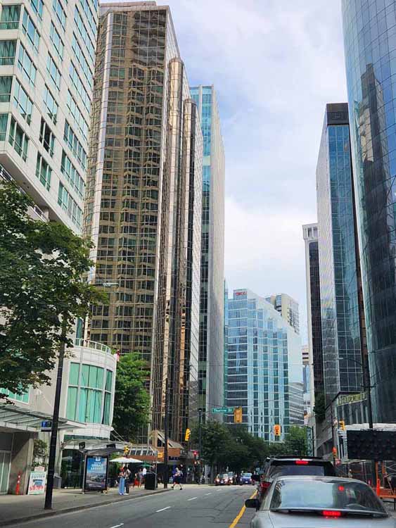
Vancouver's downtown section is in direct contrast to Gastown with its tall semi-modern glass buildings.
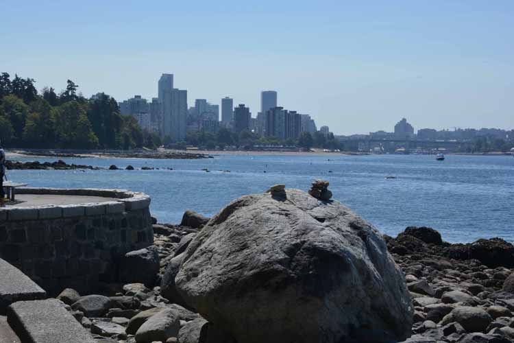
Stanley Park is a wonderful way to spend a leisurely day. It's spread out enough that people aren't bumping into each other. At times it may feel like you're one of few in the park, save the 5,5-mile hike/bike trail that seems to be a favorite. It follows the curves of the calm glassy waters of English Bay, Coal Harbour and Burrard Inlet, which surround it. Stanley Park is the largest city park in Canada, sitting on a peninsula west of downtown. One of few eating establishments in the park is the Teahouse Restaurant with its fine-dining ambiance.
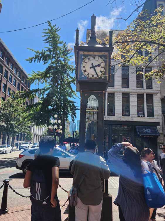
Gastown is Vancouver's first neighborhood, evident by its cobblestone streets and old buildings, so different from the glass buldings of modern Vancouver. The main attraction in Gastown is this whistling steam clock which was built in 1977. Gastown is also known for its many outdoor eating establishments.
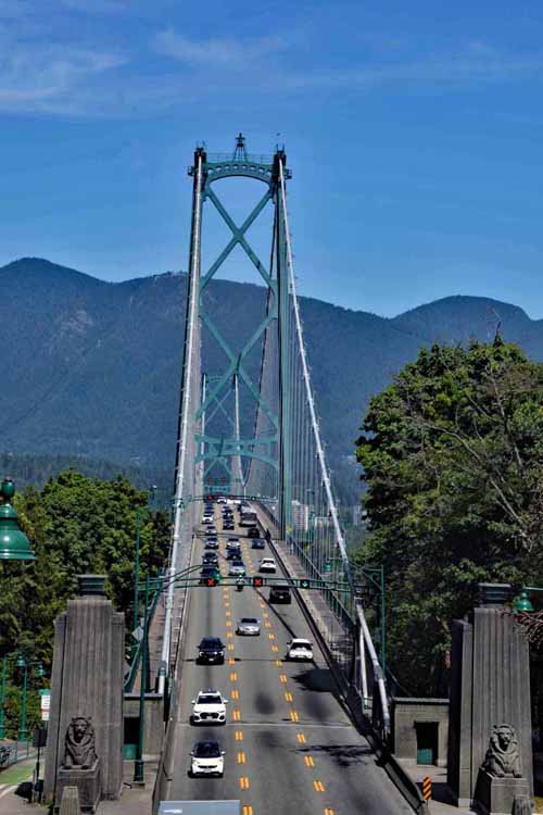
Lions Gate Bridge is a main artery in Vancouver. Spanning the Burrard Inlet, it links main Vancouver to both North and West Vancouver. It opened in 1938 and was originally called the First Narrows Bridge.
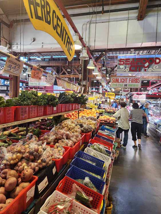
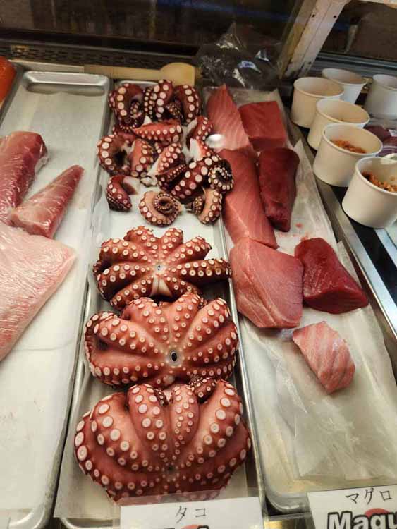
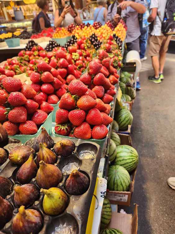
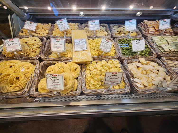
The public market has everything fresh. Seafood, pasta, pastries, fruit (huge strawberries!) and, of course, many eateries for take-out or for eating out on the large deck overlooking False Creek.
Queen Elizabeth Park was named after the Mother Queen Elizabeth during their visit to Vancouver in 1939. At the time, King George VI and the Mother Queen were King and Queen of Canada.
Granville Island can easily be an all-day affair. Between the busy and crowded public market and the shops and galleries, we were hoppin' and shoppin'. Granville is not an island at all, but rather a peninsula that juts out into False Creek. Before the 1950s it was an island, but landfill was put in to make room for more development. It gets its name Granville from the bridge that crosses overhead.
Some very unique trees are planted in the park, and because there was no one there to ask at the time, I'm unable to identify them. But am working on it.
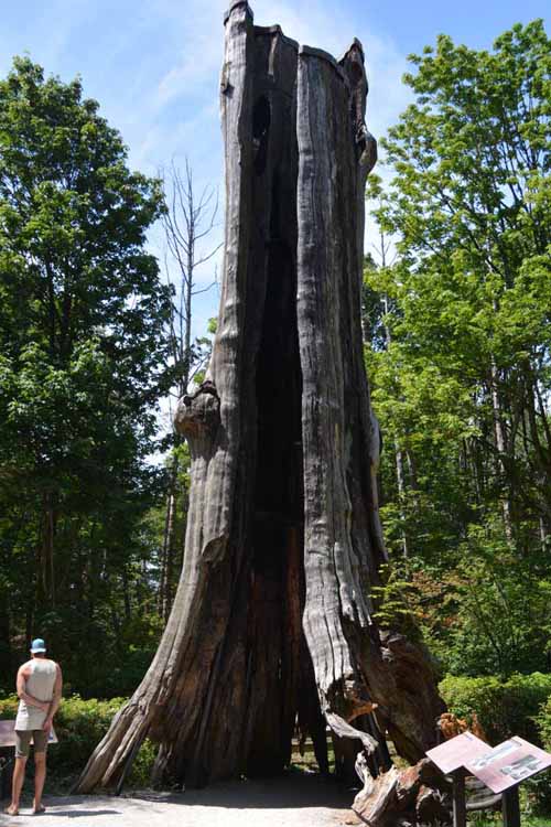
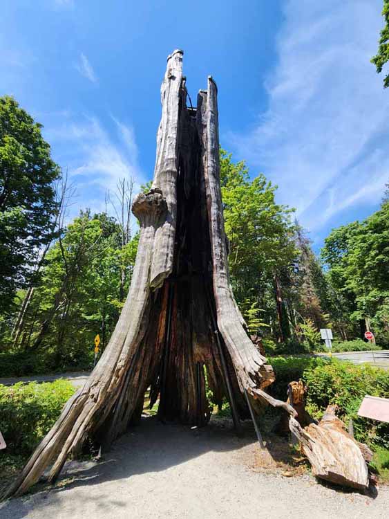
One of the most amazing sights in Stanley Park is this 1,000-year-old red cedar, hollowed out in time by age, typical of such trees. Even though it's hollowed out it continues to grow. Its circumference is 50 feet, and it has survived windstorms that have blown down thousands of other trees over time in the park. Also called The Big Tree, it serves as a monument to the forest of trees of its kind.
Mounts and beams have been placed inside the tree to support and stabilize it.
Stanley Park Drive
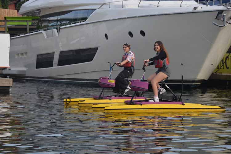
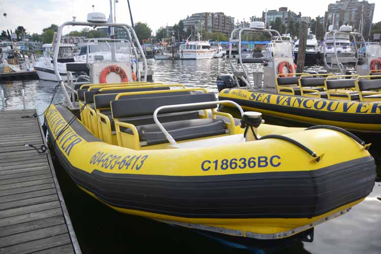
Here's the "boat" we were in, six of us counting the "captain."
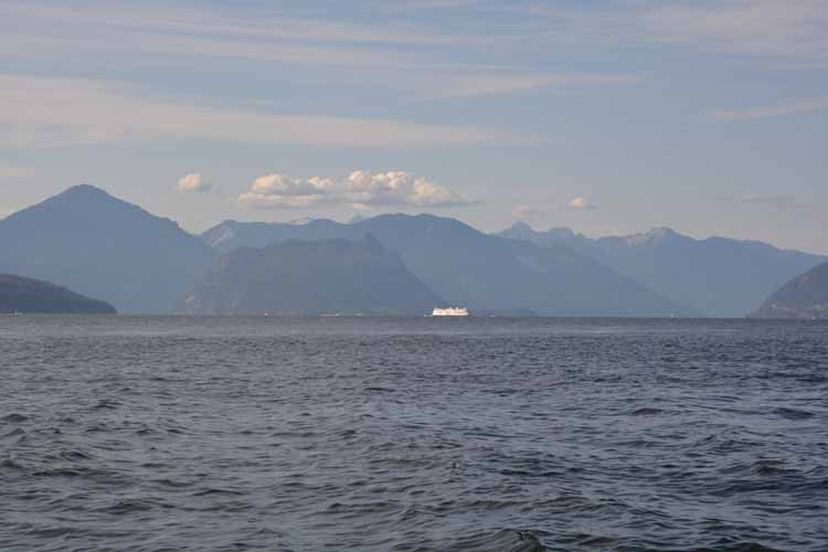
Howe Sound, north of Vancouver
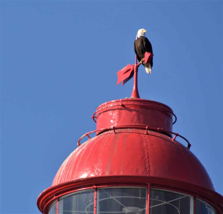
Another view of PointAtkinson Lighthouse, this one from the waters of Burrard Inlet. Note the eagle on top.
Someone with a witty sense of humor came up with the idea of painting these 70-foot silos to look like people. Once a dull gray eye sore, today they are one of the most photographed things on Granville Island. Of the six, three are facing False Creek, and the other three face the concrete plant.
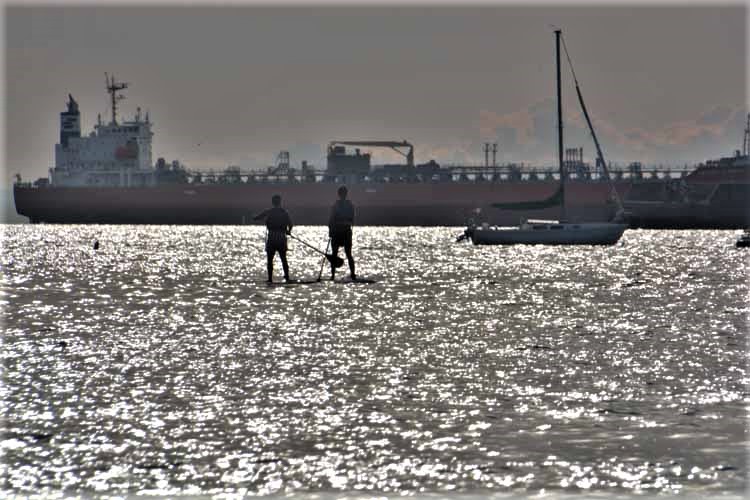
Our reason for going to Grancille Island in the first place was because we had a boat tour later in the day. We decided to go early and check it out, and it was the best decision we made that day. Our boat tour took us way out into English Bay nearly to Howe Sound north toward Horseshoe Bay. We had a great "captain" and narrator, one in the same. The cruise was a little less than 2 hours.
Mt. Baker in Washington towers over the Vancouver skyline from English Bay.
The park sits on Little Mountain which is not only the the highest point in the city proper, but is also geographically very near the center of the city.
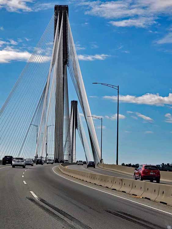
Port Mann Bridge crosses the Fraser River in Surrey, B.C.
Note the water taxis that scoot around False Creek. False Creek is the waterway, a small inlet, that separates downtown and the West End from the rest of Vancouver. It was so named by a surveyor named George Henry Richards who mistakenly thought he was in a creek rather than being in Burrard Inlet. Once he discovered his mistake, he named what turned out to be just a creek "False Creek."
This page is the last of the Alaska road trip. But here are options for other pages:
Even though the Alaska trip ended for me. I dropped my travel partner off at Seattle's airport, stayed the night with a friend on Whidbey Island, then met a group of friends in Skagit County, Washinton for a reunion. From there I hightailed it to Bayfield, Wisconsin, to meet friends for a kayaking trip.
If you'd like to see photos of Whidbey Island, Skagit County (at tulip time) or Bayfield, Wisc. please click the appropriate link. Another link wil direct you from one to the other. .
Previous page: Alaska road trip to Haines and Skagway
See pictures of Vancouver from previous trips
Return to the Alaska Road Trip home page
Exit
can-bc-vancouver-stanley park.jpg)
can-bc-vancouver-queen elizabeth park.jpg)
can-bc-vancouver-queen elizabeth park.jpg)
can-bc-vancouver-queen elizabeth park.jpg)
can-bc-vancouver-queen elizabeth park.jpg)
can-bc-vancouver-queen elizabeth park.jpg)
-vancouver skyline from granville island.jpg)
can-bc-vancouver-white cliff lighthouse.jpg)
.jpg)
-can-bc-vancouver-granville island.jpg)
-can-bc-vancouver skline and mount baker from english bay-c.jpg)
-granville island.jpg)